May 18, 2019 — Argus Peak sits to the west of Great Falls Basin, an area that's been on my radar for a while because of the technical Great Falls Basin Canyon. I was also hoping to explore the basin itself, but without a destination, I had never been particularly excited (typical me!). The fact that a fairly prominent peak could be my destination gave me the motivation I needed.
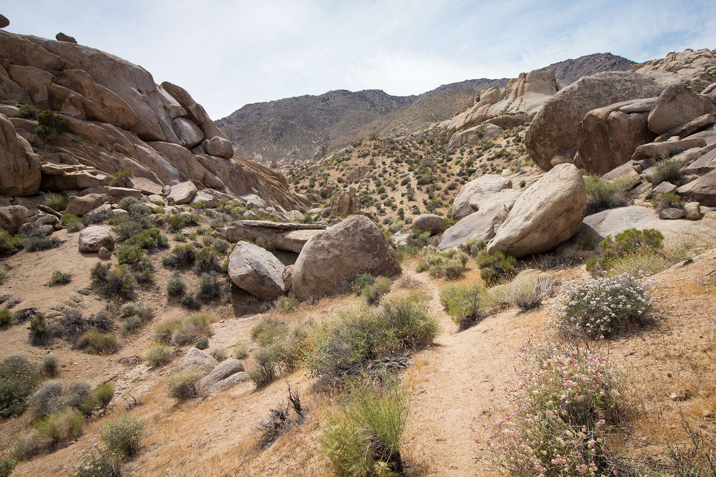
I started from the Great Falls parking lot (where there's more broken glass than I thought possible). To reach the trailhead, turn off from the paved road here (35.83263, -117.33775). From the trailhead I headed up a well-laid trail on the slope to the south of the falls leading to a saddle. From the saddle, I noted Argus Peak in the distance, a vast web of rocks, springs, and canyons separating me from the summit slopes. I was excited, despite my sudden fear of rattlesnake encounters (it's May, after all), of which ultimately there were none.
From the saddle, I dropped down a thin social trail to the head of Great Falls Basin Canyon, then continued through a lush section of trees and brush before locating the specific canyon I thought might serve as a viable route. Animal trails took me from here for the most part, avoiding the brush and cliffs. However, while the existence of wild burros meant well-defined animal trails, it also meant I'd get at least one aggressive beast honking at me, which is never a prticularly great sound. It happened three times on my trip.
Anyway, I was able to navigate the entire basin with only a couple of easy Class 2 sections. It was really pleasant, and quite remote. My goal was to get to a ridge I saw on my topo map that protruded the farthest from Argus Peak, assuming this would be the least steep option. Although it led to a false summit south of Argus Peak rather than the peak itself, I thought the additional ridgeline could add a nice touch to the day. The protruding ridge I chose worked out really well, though it was in fact quite steep. I did my best to avoid rock outcroppings and sections of brush, but massive boulders were unavoidable toward the top, resulting in some Class 3 moves as I neared the ridgeline. The rest of the way to the summit went more easily, with some interesting foliage and nice views toward Owens Peak in the distance. Argus Peak's summit could either be where an old "Argus Peak" sign is positioned, or a Class 4 boulder just to the west (which was acutally a fun little couple of moves).
From the summit, I followed some cairns (what I took to be the standard route?) heading northeast. I decided I wasn't going back the same way I had come up since the boulders were pretty tedious and would be worse going down. The ridge I chose to head down was sandy and steeper than my ascent, but it was excellent for a descent, and actually kind of fun to slip down. It led down to a lush area called Deep Canyon Spring, where I then I worked around the base of the protruding ridgeline I ascended earlier and met back with my initial route through Great Falls Basin. Though I initially thought I'd want to explore another section of the basin, I opted to just take same route I did on the way in, since I think I got lucky with my choices and didn't want to risk an aggravating bushwhack.
Please consider helping me out if you find my site useful. I'm not sponsored, so all site fees are out-of-pocket and my time preparing these trip reports is unpaid. You can also hire me as a web developer. I really appreciate it!


If you find my site helpful, please help me replace my many broken cameras, fund my website fees (hosting, APIs, security), or just support my countless hours of work. I pay for all expenses myself, and all trip reports I post are unpaid and unsponsored, so any support is really appreciated!
If using PayPal, please select their option for "Sending to a friend" so they don't take out fees, thank you.
My site is free to use, but consider sending me a few bucks to help keep it running. Thanks in advance!