I provide a free route map, but you can also download a hike/drive GPX to assist you and to help support my site. Before sharing my GPX tracks with others, please remember my site is a free resource and I'm charging nominal fees to offset my substantial costs.
GPX track added to your cart.
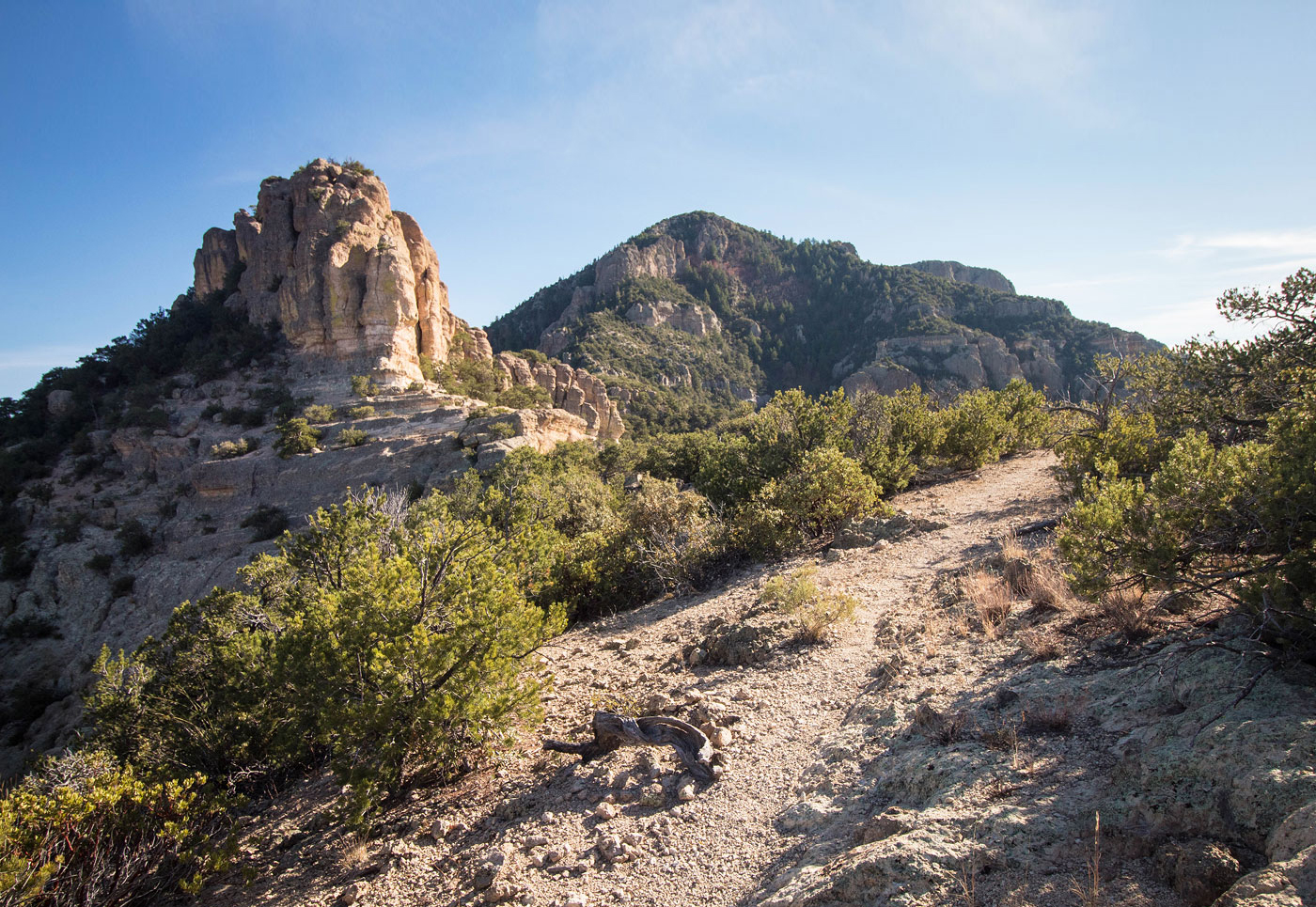
Nov 18, 2019 — Bassett Peak, the high point of the Galiuro Wilderness in AZ, has a couple of approach trails, but the Ash Creek Trail from the east seemed the most heavily trafficked. I've definitely been on a fair number of Arizona "trails" that have degraded to the point of making a hike miserable, so I opted to go for the trail more traveled. The trail, while partially deteriorating, was in overall great shape.
I was able to get my car almost to the official trailhead, but was stopped by a steep hill into a bouldery wash, hency my start point being farther back. Better vehicles could knock off a couple of round-trip hiking miles. I followed the road to the trailhead and then continued on the road for miles up Ash Creek, where it was certainly not in driveable condition. The road eventually turned into a trail after crossing a few streams (dry for me this time of year) and continued through pretty forest where brush sometimes required the occasional smack. The trail finally began to ascend on switchbacks up to the northern ridge of Bassett Peak. The peak finally came into view, still a fair distance away. Once on the north ridge, the trail continues past an old trail sign and some minor switchbacks, and then keeps just west of the ridge crest to avoid the rocky cliffs. A few final switchbacks lead to Bassett Peak's west slopes, just below the summit. A couple of the switchbacks were starting to erode a bit in sandy areas, unfortunately. The trail starts to descend to the south, so as soon as this happens, leave the trail and locate a social trail that continues to the summit. The views are really nice and have a super remote Southern Arizona feel.
Please consider helping me out if you find my site useful. I'm not sponsored, so all site fees are out-of-pocket and my time preparing these trip reports is unpaid. You can also hire me as a web developer. I really appreciate it!


If you find my site helpful, please help me replace my many broken cameras, fund my website fees (hosting, APIs, security), or just support my countless hours of work. I pay for all expenses myself, and all trip reports I post are unpaid and unsponsored, so any support is really appreciated!
If using PayPal, please select their option for "Sending to a friend" so they don't take out fees, thank you.
My site is free to use, but consider sending me a few bucks to help keep it running. Thanks in advance!