I provide a free route map, but you can also download a hike/drive GPX to assist you and to help support my site. Before sharing my GPX tracks with others, please remember my site is a free resource and I'm charging nominal fees to offset my substantial costs.
GPX track added to your cart.
Sep 15, 2023 — UT State Route 65 crosses Big Mountain Pass, which played a crucial role in the journeys of early pioneers. Now it's used as a viewpoint of SLC and a historic meetup spot for various trails. Shawn and I were happy to see the start of some fall foliage, though the hint of autumn was a contradiction to the day's heat. Our goal today was to link a few peaks along the ridgeline: Big Mountain, Swallow Rocks, and Lookout Peak. I'd hiked to Lookout Peak via Killyon Canyon a few years ago, but via a loop to the peak's east, whereas this hike uses a trail system to the west. Today we used a combination of the Great Western Trail, the Lookout Peak Trail, the Mormon Pioneer Original Route Trail, as well as a combination of off-trail and short stretches on other trails.
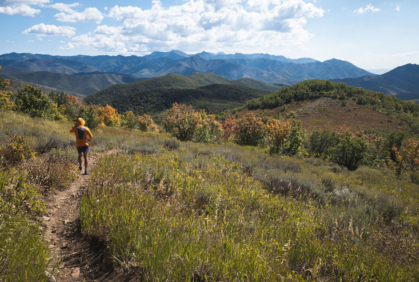
Starting from the pass, the trail begins on the west side of the road, opposite a sizable parking area, clearly marked as part of the Great Western Trail. Shawn vowed to make a silly pose during every photo, but after remembering how many photos I take on a hike, he quickly gave up. After a pretty steep start to the hike, the trail continued more casually around a lump before reaching the southern ridge of Big Mountain. Here the trail continues more gradually, meandering through meadows and forests. The views are panoramic and quite nice for how little effort we'd put in so far. The trail skirts just below Big Mountain's open slope and soon we reached the northern ridgeline of Big Mountain. Here we left the trail briefly to hike along an ATV trail to get to the high point.
The hike is pretty uneventful from Big Mountain to the base of Swallow Rocks, our next summit. It's basically just a walk along the ATV trail that undulates a bit, but at least the views are nice and it gave us time to gossip and catch up. A sign commanding mountain bikers to stay on-trail didn't apply to us pesky foot-people, so we left the Great Western Trail and ascended toward Swallow Rocks from here. You could avoid the peak by continuing along the trail, which we'd merge with again after the summit. The ascent was tame enough, only some tiny spurts of brush on the way. The peak is named for a few columns of rock which nicely punctuate the otherwise standard grassy slopes.
Continuing south from Swallow Rocks, the slope was a bit steep, though a social trail led us down most of the way. We continued along the Great Western Trail until it left the ridge and headed elsewhere, so we deviated and followed the Brink Trail, which continued along the crest. Ahead we could see Lookout Peak, composed of twin lumps of similar height. Although a bit overgrown, the trail was easy to follow and only left us with burrs in our socks. The Brink Trail continues around the eastern slope of Lookout Peak and ultimately merges with the Lookout Peak Trail. It would definitely have been more pleasant, if longer, to reach the peak via the offiical trail system. We didn't do this, instead chosing to ascend directly to the peak. Our off-trail options were to head through the forest or up a brushy slope. In both of our experience hiking in Utah, the forest tends to be a less heinous bushwhacking option.
Through the forest, Shawn tripped over a branch and onto another branch and then onto the forest floor. It was quite the display and I laughed forever, naturally. Shortly after I stumbled onto a bees' nest and proceceeded to shriek from the multiple stings I received. Shawn may have laughed harder than I had, kharma rightfully served. There was a sustianed section where the brush was head-high, but not too horrible to pass through. We navigated along a stretch of meadows, through another forested section, and then ascended more meadows to the saddle separating the twin lumps of Lookout Peak. From here it was just a matter of hiking down along the Lookout Peak Trail and enjoying its expansive views until meeting the junction with the Killyon Canyon Trail and the Birch Spring Trail. We took Birch Spring Trail, which led east down into Affleck Park. This is a fancy-pants park that is blocked to the public unless you have a camping reservation.
The last stretch of our hike would follow the "Original Trail", a historic route used by the Donner Reed Party Trail and Mormon Pioneer Trail. It took us out of Affleck Park and up the drainage that Utah SR-65 switchbacks up. The result is that the trail paralled the sounds of the highway as it ascends, and by being within a forested drainage it's a less pretty and interesting part of the day. We reach the Big Mountain Pass parking area, which was bustling.
Please consider helping me out if you find my site useful. I'm not sponsored, so all site fees are out-of-pocket and my time preparing these trip reports is unpaid. You can also hire me as a web developer. I really appreciate it!


If you find my site helpful, please help me replace my many broken cameras, fund my website fees (hosting, APIs, security), or just support my countless hours of work. I pay for all expenses myself, and all trip reports I post are unpaid and unsponsored, so any support is really appreciated!
If using PayPal, please select their option for "Sending to a friend" so they don't take out fees, thank you.
My site is free to use, but consider sending me a few bucks to help keep it running. Thanks in advance!