I provide a free route map, but you can also download a hike/drive GPX to assist you and to help support my site. Before sharing my GPX tracks with others, please remember my site is a free resource and I'm charging nominal fees to offset my substantial costs.
GPX track added to your cart.
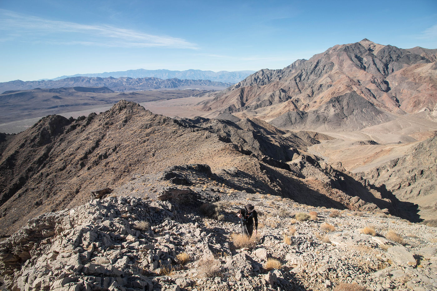
Jan 05, 2021 — This hike heads up to the high point of the BLM-designated Funeral Mountains Wilderness. There are many options to gain this summit, but Marko and I based our route on Bob Burd's. I added additional dotted lines marking likely easier routes, but you're likely to encounter at least one Class 3 move whatever way you decide to approach the peak. I definitely don't recommend approaching via our descent (we went clockwise on the attached map), because the descent is a 600-foot scree slope.
We parked at the Slabby Acres campsite and headed north toward the farthest finger leading down from Funeral Mountains Wilderness High Point (FMWHP). We avoided some craggy stuff at its base and were able to gain the ridge using a steep slope. Once on the ridge, it's obvious the direction to go because there aren't any other off-shoots. However, about halfway up the peak we encountered some rocky terrain that lasted a few hundred feet. It included some fun scrambling with at least two Class 3 sections. At the end of the rocky section is where you'll see as ascent gully that I labeled "Likely Easier" on the map. We liked the ridge overall, but it's probably not the most efficient way up FMWHP. As we continued along the ridge, we came across another Class 3 section and then a steep push to the false summit. It looks more daunting from below, but ultimately ended up being a Class 2 slope. We continued on very mellow terrain from the false summit to the true summit. A bit of Class 2 up the slope to the summit area followed by more Class 2 along a short ridge led to the high point of FMWHP. We took in the views of the high Sierra in the distance and Pyramid Peak to the northwest.
We briefly considered heading back the way we came, but previous trip reports seem to show going down the east side on a crap-ton of scree being a viable option. Some Class 2/2+ down-climbing on loose crap brought us to a somewhat eroded social trail. This took us directly down the scree slope and into a drainage. The Class 2 boulder-hoppy drainage led us into the open desert and back to the trailhead.
Please consider helping me out if you find my site useful. I'm not sponsored, so all site fees are out-of-pocket and my time preparing these trip reports is unpaid. You can also hire me as a web developer. I really appreciate it!


If you find my site helpful, please help me replace my many broken cameras, fund my website fees (hosting, APIs, security), or just support my countless hours of work. I pay for all expenses myself, and all trip reports I post are unpaid and unsponsored, so any support is really appreciated!
If using PayPal, please select their option for "Sending to a friend" so they don't take out fees, thank you.
My site is free to use, but consider sending me a few bucks to help keep it running. Thanks in advance!