I provide a free route map, but you can also download a hike/drive GPX to assist you and to help support my site. Before sharing my GPX tracks with others, please remember my site is a free resource and I'm charging nominal fees to offset my substantial costs.
GPX track added to your cart.
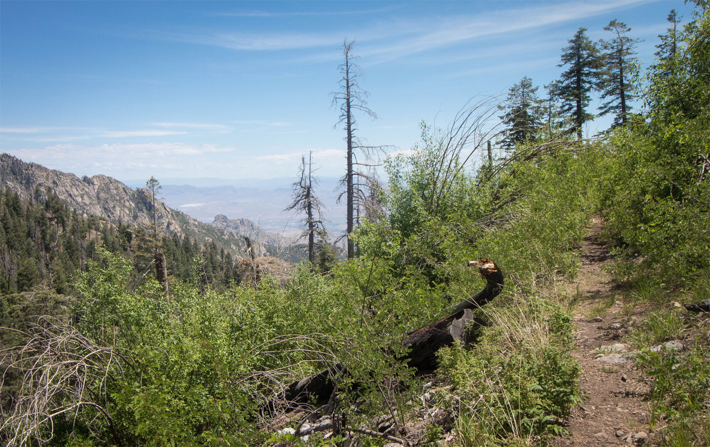
Jun 01, 2020 — Heliograph Peak is another Arizona 10,000 foot peak just south of Mount Graham. Matt and I decided we'd attempt the loop route, which includes following a trail to the summit and then heads down on a dirt road back to the trailhead. We knew it might be a bit of a bushwhack, but it ended up being a bit more than we were excited for. Regardless, I thought the trail was pretty enough to warrant the brush, though Matt might disagree with me.
The Shannon Camground was closed due to COVID, so the official trailhead was accessible only by walk-in. We parked at a small parking area just off the main road, I suppose what would be the official trailhead for the Heliograph Peak standard road walk. We headed past the Shannon Campground gate and to the back of the Shannon Campground where we located a trailhead kiosk and followed the Arcadia Trail. At first the trail was a great and inviting stroll with really amazing views to the east. Then we got some brush and eventually we lost the trail completely. The bushhacking wasn't bad, but our hopes were dashed since we were excited to be on a nice trail at the beginning. Eventually we found the trail again (I marked the crap area on my map attached) and followed it south as it followed along a stunning ridgeline. Most maps we looked at (including the official one posted at the trailhead) made the trail appear to continue south along the ridge and up to the summit, but to our surprise, there was no trail at all, but a cairned and well-defined enough trail continued directly west instead. We were baffled, but followed it anyway. The brush encroached enough to be annoying, but not enough for us to consider it awful. However, when the trail was 100 feet from the forest road, we left the trail and just got onto the road rather than suffer on a basically no longer existing trail - it just wasn't worth the extra effort. I marked this spot in pink on my attached map. The dirt road took us to the summit lookout tower, where we enjoyed some mediocre views before heading back down on the road.
I don't know that I'd recommend the trail at this point except for the first quarter mile or so.
Please consider helping me out if you find my site useful. I'm not sponsored, so all site fees are out-of-pocket and my time preparing these trip reports is unpaid. You can also hire me as a web developer. I really appreciate it!


If you find my site helpful, please help me replace my many broken cameras, fund my website fees (hosting, APIs, security), or just support my countless hours of work. I pay for all expenses myself, and all trip reports I post are unpaid and unsponsored, so any support is really appreciated!
If using PayPal, please select their option for "Sending to a friend" so they don't take out fees, thank you.
My site is free to use, but consider sending me a few bucks to help keep it running. Thanks in advance!