I provide a free route map, but you can also download a hike/drive GPX to assist you and to help support my site. Before sharing my GPX tracks with others, please remember my site is a free resource and I'm charging nominal fees to offset my substantial costs.
GPX track added to your cart.
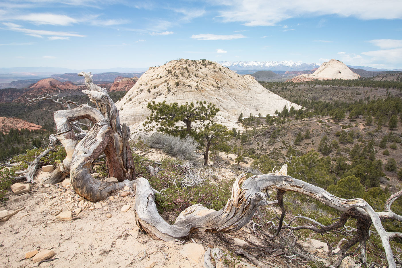
Apr 20, 2019 — I've passed by Northgate Peaks East and Northgate Peaks West a bunch of times on the way into other parts of the backcountry, but they felt too small to plan a trip specifically for them, so I wanted to include them in a route leading deeper into this interesting region of the park. My route here includes Northgate Peaks East and West, Red Cone, Jumbled Knoll, and Carl's Peak. I initially wanted to make it a loop, but intense bushwhacking got me to drop the loop idea in order to get back to town in time for a shower before the gym closed. Unless you're serious about bagging random Zion peaks, I'd recommend you turn back after doing Red Cone, which I would definitely recommend. Jumbled Knoll wasn't particularly interesting and Carl's Peak is just a bunch of undesirable bushwhacking with views inferior compared to the rest of the day.
I followed the Wildcat Trail to the Northgate Peaks Trail and broke off from the trail at an arbitrary point to the east of Northgate Peaks West, dropped into the wide gully, and then ascended the north ridge. There's a section of Class 3 by a small pine tree, just east of the ridgeline, and the views are great, including a nice sense for my route for the day. I returned to the Northgate Peaks Trail and followed it to the lookout point, where a large group was taking photos. I headed east down an unexpectedly clear social trail which led straight up to Northgate Peaks East, significantly easier than expected (barely Class 2).
I returned to the base of the peak and headed southwest, sticking to the western base of North Gurdian Angel to avoid brush and encountered a lovely slickrock drainage with water flowing. This drainage led to the base of Red Cone, which I ascended via on one of likely many Class 2 slope options on dirty slickrock and brush, then working up a small Class 3 section through the slickrock domes. On the descent, I was able to find an easier option, so I left both of my route options on the map attached. The views from Red Cone were really wonderful. It was a strange view of North Guardian Angel from this angle, and more interestingly, I could see into the cascades leading out of The Subway below. I descended from Red Cone, and I'm sure you could find any number of ways down, and found a way through brush and nonsense to the summit of Jumbled Knoll, located to the west. I'm not sure if I was on the true high point, but there was the remnants of a cairn and the other two potential high points weren't intriguing enough to go explore.
I headed back the way I came off Jumbled Knoll, then continued toward Little Creek, which I intended to follow up and around to the north side of Carl's Peak. There was so much brush that I immediately gave up and instead ascended a hill to the west, working on animal trails to the north side of Carl's Peak via the high ground rather than the creek. A sandy wash led to the base, and Class 2 led to a small Class 3 move at the summit. I noted Little Creek draining from the north. It looked awful. And it was. After Carl's Peak, I started up Little Creek and after a short time of bushwhacking and boulder-hopping, and rather than continue north (the creek's head would have landed me right back on the Wildcat Trail, close to the trailhead), I ascended to the east to a saddle and back down into the slickrock drainage to the west of North Guardian Angel. From here, I retraced my steps back to the trailhead. I'm sure this shortcut saved me a ton of time, despite adding a bit more mileage. Unless you're a masochist greater than myself, avoid Little Creek when there's water flowing.
Please consider helping me out if you find my site useful. I'm not sponsored, so all site fees are out-of-pocket and my time preparing these trip reports is unpaid. You can also hire me as a web developer. I really appreciate it!


If you find my site helpful, please help me replace my many broken cameras, fund my website fees (hosting, APIs, security), or just support my countless hours of work. I pay for all expenses myself, and all trip reports I post are unpaid and unsponsored, so any support is really appreciated!
If using PayPal, please select their option for "Sending to a friend" so they don't take out fees, thank you.
My site is free to use, but consider sending me a few bucks to help keep it running. Thanks in advance!