May 17, 2019 — Owens Peak is a striking mountain, rising up from the green/brown hills surrounding it, and I immediately wanted to hike it as soon as I got to the area. However, I wanted to plan a route that would bag a couple of the nearby peaks to Owens Peak: Jenkins Mountain and Morris Peak. I had a detour to the summit of North Jenkins as well, but more about that mishap later.
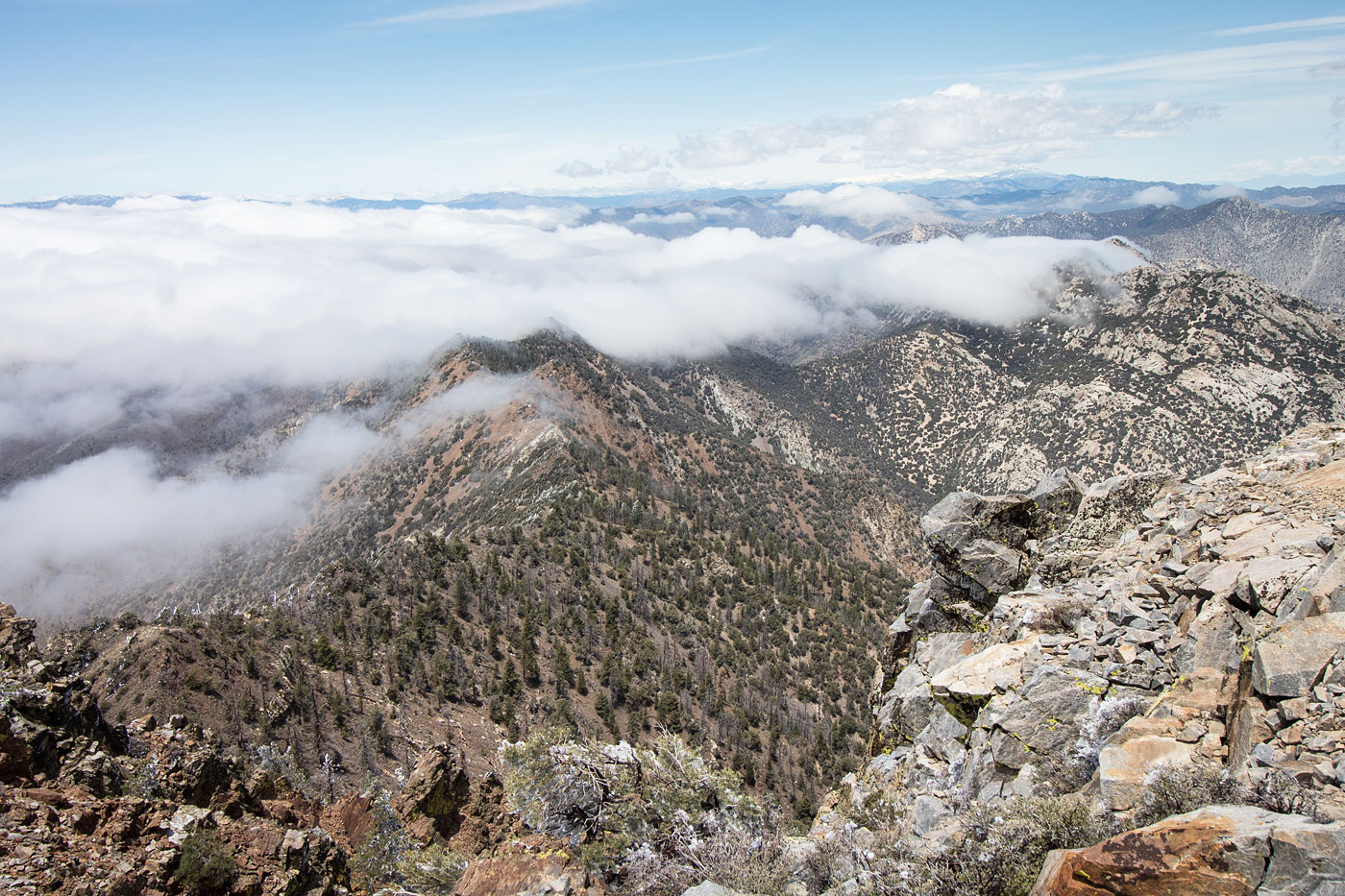
I parked my car well before the Owens Peak Trailhead, assuming I'd be descending a ridgeline to complete my loop and didn't see the point in driving farther than necessary. I walked along the road to the official trailhead. The Owens Peak Trail follows an old dirt road for a time before narrowing into a nice trail that gets progressively more steep. I checked out some pictographs along the way, a great little detour recommended by Adam Walker. The Owens Peak Trail gets a bit convoluted as it gets higher up. Keeping to the drainage meant I was scrambling up a large black talus field, which was fun and I recommend it if you prefer scrambling to steep hiking. However, the social trail just right of the talus field eventually curves to the right and heads up a granite slab, facilitating access to Owens Peak's south ridge. I luckily didn't miss the turn-off, despite the fun I was having on the talus. I continued up the ridge to Owens Peak, where I was granted three minutes of views before the fog rolled in and wouldn't let up. Happy I got at least a little sunlight, I worked down Owens' southwest ridge, where cairns marked most of the route, but it's pretty straightforward Class 2 the whole way down. The fog was kind of a nice touch.
At the saddle of Mount Jenkins and Owens Peak, I met up with the Pacific Crest Trail. I briefly debated heading up along the ridgeline rather than following the trail, but I couldn't see what was up there due to fog and the rare instance of a trail existing to make a route easier sort of made my mind up for me. Along the PCT, I passed a person who saw me the day before on the PCT as I made my way to Scodie Mountain and they were very confused, so I clarified how I ended up in front of them again.
A few miles of trail hiking gave me FOMO about the potential for fun along the ridge, so I noted North Jenkins and decided to link it with Mount Jenkins. I ascended a spur ridge to get to North Jenkins (Class 2+), where I got some pretty great views of Owens Peak before attempting the ridgeline. I was only a few hundred feet from Mount Jenkins before I got shut down by cliffs. Now I understood why most people seem to not do the traverse, despite how pretty it could potentially be. Maybe more research would have cleared this up for me. Note: I did not include the traverse or its Class 4/5 stats in my trip report, nor on the map. Take about 600 feet of vertical gain off my stats if you skip North Jenkins.
Back on the PCT, I headed to Mount Jenkins via the standard east ridge, where a Class 2+ move led to the summit block. I still had plenty of time to go to Morris Peak, despite my ridgeline mishap. The PCT led me to the saddle of Mount Jenkins and Morris Peak, where a social trail led steeply to Morris Peak's summit. From here, I backtracked a bit and took a ridgeline heading east back down to my car.
Please consider helping me out if you find my site useful. I'm not sponsored, so all site fees are out-of-pocket and my time preparing these trip reports is unpaid. You can also hire me as a web developer. I really appreciate it!


If you find my site helpful, please help me replace my many broken cameras, fund my website fees (hosting, APIs, security), or just support my countless hours of work. I pay for all expenses myself, and all trip reports I post are unpaid and unsponsored, so any support is really appreciated!
If using PayPal, please select their option for "Sending to a friend" so they don't take out fees, thank you.
My site is free to use, but consider sending me a few bucks to help keep it running. Thanks in advance!