I provide a free route map, but you can also download a hike/drive GPX to assist you and to help support my site. Before sharing my GPX tracks with others, please remember my site is a free resource and I'm charging nominal fees to offset my substantial costs.
GPX track added to your cart.
Aug 16, 2023 — I did a combination of two hikes within Mesa Verde National Park, the Point Lookout Trail and the Prater Ridge Trail. Mesa Verde is known for its preservation of dwellings from the Ancestral Pueblo people, and I recommend taking one of the tours when visiting the park. These two hikes just reaches a couple of pretty viewpoints using well-maintained trails, no ruins to be found. The hikes are so close together and so short that I grouped them into one little write-up.
I started off with the Point Lookout Trail (parking: 37.30709, -108.42019). This mellow trail switchbacks a bunch of times before reaching Point Lookout's mesatop, then continues north to a nice overlook toward the San Juan Mountains and the primary Mesa Verde National Park access road. The high point of Point Lookout also happens to be here.
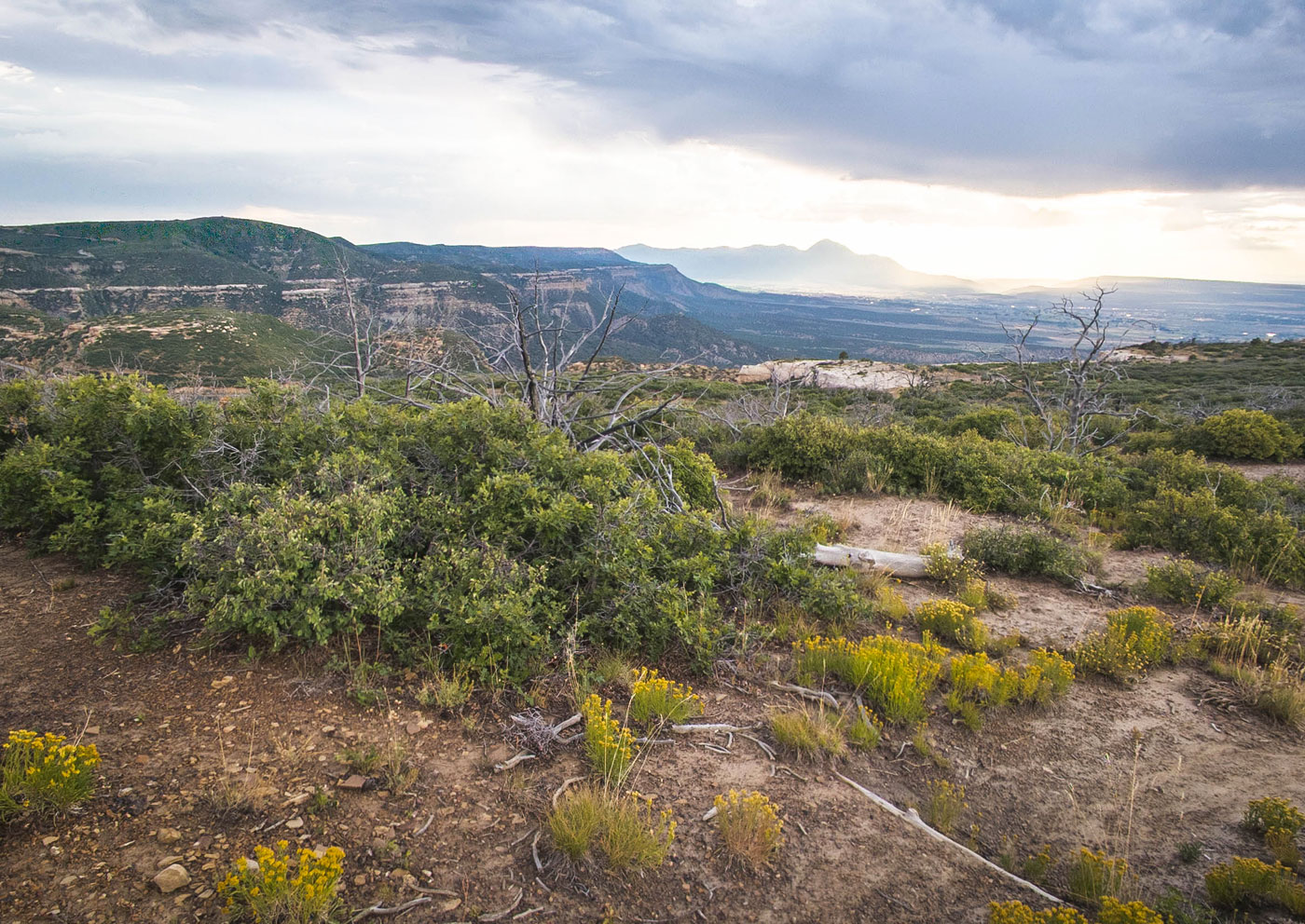
The Prater Ridge Trailhead is located closer to Mesa Top Ruins Road (parking: 37.29667, -108.41819). This mesa separates Prater Canyon and Morefield Canyon. There's a longer trail system around the perimeter of Prater Ridge, composing the south loop and north loop, both labeled well. I would only be reaching the high point of Prater Ridge today, not doing the full loop. A slowly ascending hike leads from the trailhead up to a couple of switchbacks to overcome a small cliff band and gain the rim. Following the rim for a short time, there are some great views toward the San Juan Mountains in the distance. I reached the junction of the south and north loop, taking the north loop. The meandering hike continues up to the high point, where I looked down into Montezuma Valley and enjoyed the sunset. I'm sure the remainder of the loop is nice, but with fading daylight I decided to just turn back now that I'd reached the high point.
Please consider helping me out if you find my site useful. I'm not sponsored, so all site fees are out-of-pocket and my time preparing these trip reports is unpaid. You can also hire me as a web developer. I really appreciate it!


If you find my site helpful, please help me replace my many broken cameras, fund my website fees (hosting, APIs, security), or just support my countless hours of work. I pay for all expenses myself, and all trip reports I post are unpaid and unsponsored, so any support is really appreciated!
If using PayPal, please select their option for "Sending to a friend" so they don't take out fees, thank you.
My site is free to use, but consider sending me a few bucks to help keep it running. Thanks in advance!