I provide a free route map, but you can also download a hike/drive GPX to assist you and to help support my site. Before sharing my GPX tracks with others, please remember my site is a free resource and I'm charging nominal fees to offset my substantial costs.
GPX track added to your cart.
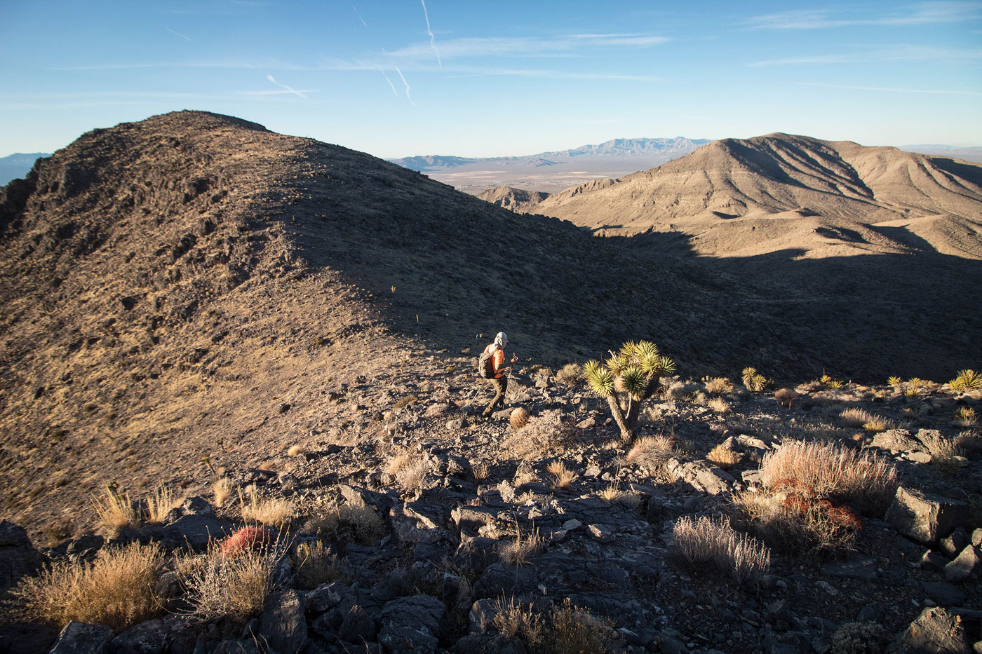
Jan 10, 2020 — Honestly I probably wouldn't recommend this hike. It really just follows a general ridgeline of big dirt lumps in southern Nevada. There is a highlight ridgeline with some fun Class 3, but overall it's a fairly long day without the gorgeous desert scenery I've grown to love in the Mojave Desert. The route has a lot of animal trails and otherwise minimally rocky terrain, so it could work nicely as a trail run. Additionally, we were able to contrive a loop out of the route, and I always love a loop hike.
Adam, Frances, and I parked at the high point along the somewhat rough dirt road leading out of Goodsprings, NV. We headed southwest up to Peak 4957 (someone signed the register calling it Shagged Peak, to fit the theme of Ragged and Jagged Peaks). The ascent had some Class 2, but otherwise was a slope. The morning light was nice, but the rest of the day was really bright and didn't make for great photos. We continued west along a nice sloping ridgeline over to Ragged Peak, where the slope became steep, low Class 2, and led to the summit. From her we headed north down to the saddle of Ragged Peak and Jagged Peak, which required a fairly long descent. We crossed over the western reach of the dirt road we drove in on, and continued up the biggest vertical ascent of the day toward Jagged Peak. We unexpectedy chose what's probably the most difficult route to ascend the peak. About a third of the way up to Jagged Peak, the terrain became more rocky and topped out on the southern ridgeline: a fairly long Class 2/3 (with a section of Class 3+) jagged route. We were happy to see some change to the otherwise boring landscape, but you could stick to the peak's eastern base and find another route up to ascend the peak in less time, but honestly the scrambling was the only part of the hike I thought was interesting. The Class 3+ section met us about halfway across the ridge, where a steep drop on loose rock with fair exposure was required (unless you want to take a long detour to bypass it) to continue. The aforementioned section is the only thing I'll make a special note of, since the rest was straightforward enough and much of it can be avoided by keeping just east of the ridgeline on typical loose terrain.
Jagged Peak had similar views to the rest of the day: brown and lumpy. We continued east down the steep slope and along a mellow ridgeline to Peak 5318, which Adam adorably deemed Haggard Peak to stick with the rest of the peaks' naming theme. The southeast face of Haggard Peak is a cliff, so we continued north and found a Class 2 weakness, which we headed down on a loose slope and continued to the dirt road below. We followed this dirt road to just north of the car, then left the road to reach the car, completing the loop.
Please consider helping me out if you find my site useful. I'm not sponsored, so all site fees are out-of-pocket and my time preparing these trip reports is unpaid. You can also hire me as a web developer. I really appreciate it!


If you find my site helpful, please help me replace my many broken cameras, fund my website fees (hosting, APIs, security), or just support my countless hours of work. I pay for all expenses myself, and all trip reports I post are unpaid and unsponsored, so any support is really appreciated!
If using PayPal, please select their option for "Sending to a friend" so they don't take out fees, thank you.
My site is free to use, but consider sending me a few bucks to help keep it running. Thanks in advance!