Sep 06, 2019 — The Thunder Mountain Trail is primarily a mountain biking trail located in Red Canyon (within Dixie National Forest). The trail has two trailheads, likely mostly done as a point-to-point, but I didn't have a shuttle and therefore had to chose a trailhead. Since I wanted some exercise, I chose to start from the lower of the two (north trailhead) for some vertical gain and just return the way I came. The trail doesn't really have a destination, and I noted a point on a map called Peak 8429, an unnamed high point just off the Thunder Mountain Trail. I hope it's not too presumptuous to name this unnamed point as Thunder Mountain, since there doesn't seem to be a named Thunder Mountain nearby, and I don't know what other high point the Thunder Mountain Trail would be named after. Anyway, I decided to make this point my destination for this hike.
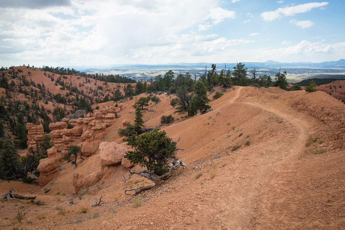
I set out along the Thunder Mountain Trail, heading south through a mellow canyon. The trail then hit a junction and started east, where the beautiful hoodoos that Red Canyon is known for lined the canyon walls, and the trail started making switchbacks typical for a mountain bike trail up the red slopes and onto a ridge. There was a pretty section as I continued east where the ridge became narrow and the views to either side were really wonderful. The trail dropped south into another canyon, and then continued south and gained some elevation to get to the tallest ridge in the area. The views of the hoodoo forest to the north were sporadic, but great. I made it just south of Peak 8429 (Thunder Mountain), and started considering options to get up to the hoodoo-guarded summit. I noted a sign labeled "White Point", and followed it on a social trail to a dead-end, the ridge too jagged and cumbly. I continued along the Thunder Mountain Trail for a short bit until I made it to a large and obvious pair of hoodoos on the side of the trail. I chose to leave the trail here, heading north into a drainage. I followed the drainage up some light Class 2 to the summit. The steepest part is the descent from the trail into the drainage, and if you're on anything sketchy or crumbly, there's another way. The views were limited on the summit, but I was happy to have a non-arbitrary turn-around point.
Please consider helping me out if you find my site useful. I'm not sponsored, so all site fees are out-of-pocket and my time preparing these trip reports is unpaid. You can also hire me as a web developer. I really appreciate it!


If you find my site helpful, please help me replace my many broken cameras, fund my website fees (hosting, APIs, security), or just support my countless hours of work. I pay for all expenses myself, and all trip reports I post are unpaid and unsponsored, so any support is really appreciated!
If using PayPal, please select their option for "Sending to a friend" so they don't take out fees, thank you.
My site is free to use, but consider sending me a few bucks to help keep it running. Thanks in advance!