I provide a free route map, but you can also download a hike/drive GPX to assist you and to help support my site. Before sharing my GPX tracks with others, please remember my site is a free resource and I'm charging nominal fees to offset my substantial costs.
GPX track added to your cart.
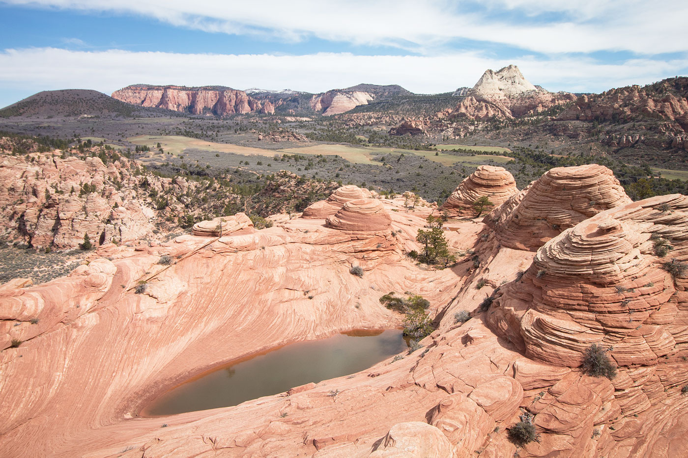
Apr 14, 2019 — A surprisingly fun route, the traverse of Tinaja Knoll, Cave Knoll, and Spendlove Knoll has some incredible slickrock and hoodoos. Start from a dirt pulloff southwest of Tinaja Knoll, the highpoint of which is difficult to identify because of all the hoodoos along the ridge, and follow a dirt road into a wash. The wash leads to the base of Tinaja Knoll's south slope. We found a Class 2 route up into the hoodoos, making our way to the high point as we navigated around lots of pretty hoodoos. Just below the summit was a gorgeous tinaja, for which the peak was named. We dropped down on the east side of the ridge to avoid cliffs, working down a section of Class 3 slab before getting back onto the ridge. This lightly forested ridge, known as Hoodoo Ridge, linked us to the base of Cave Knoll, where waves of slickrock led us to the Class 2 summit. To the north, we noted Spendlove Knoll, which looked like a particularly boring hill, but realizing the route to descend would take us most of the way up anyway, decided to go for it. Along the route from Cave Knoll, we passed likely the most gorgeous hoodoo landscape I've ever seen. It's a bit of an interesting Class 2+ maze to go around and over these hoodoos, which eventually leads to where the sandstone splendor meets brown dirt, the base of Spendlove Knoll. We saw a social trail leading down to the northwest, and assumed this was the standard route people take to get to Cave Knoll. Instead, we bushwhacked along ample animal trails to the summit of Spendlove Knoll, where we then continued over its north side to the road.
This route is best done as a traverse, but unfortunately despite having two cars, Yoshi and I didn't have the foresight to set up a shuttle *eyeroll*, so instead we ran back to our cars via the road. The views were nice along the road. Mileage/stats assume you do it as a shuttle (+3.1 miles if you walk back on the road like we did).
Please consider helping me out if you find my site useful. I'm not sponsored, so all site fees are out-of-pocket and my time preparing these trip reports is unpaid. You can also hire me as a web developer. I really appreciate it!


If you find my site helpful, please help me replace my many broken cameras, fund my website fees (hosting, APIs, security), or just support my countless hours of work. I pay for all expenses myself, and all trip reports I post are unpaid and unsponsored, so any support is really appreciated!
If using PayPal, please select their option for "Sending to a friend" so they don't take out fees, thank you.
My site is free to use, but consider sending me a few bucks to help keep it running. Thanks in advance!