I provide a free route map, but you can also download a hike/drive GPX to assist you and to help support my site. Before sharing my GPX tracks with others, please remember my site is a free resource and I'm charging nominal fees to offset my substantial costs.
GPX track added to your cart.
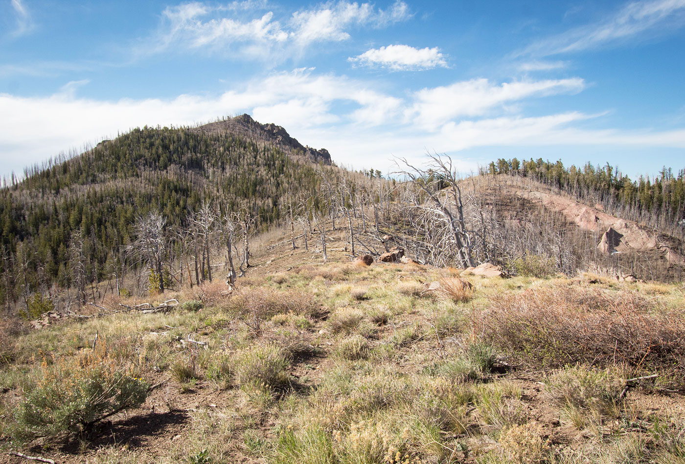
May 16, 2022 — Adams Head is one of the taller peaks in the southern Sevier Plateau. Surprisingly, a well-maintained trail leads the entire way to the summit, complete with a sign. Reaching the trailhead is doable by any vehicle with at least some clearance due to some small ruts in the approach drive. Chris and I met up for a week of Utah adventuring and Adams Head served as a nice start to the trip.
We parked just south of the trailhead in a pull-off and began to hike through the old burn area that seems to be regularly cleared. The trail ascends to the northern ridge of Adams Head, where some cool hoodoo formations to the north and nice overlooks to the west almost immediately come into view. The trail then follows the ridge crest to the summit. Along the way the views improve and the hoodoos along the side of the mountain slopes become more dramatic. We passed a junction with the Hunt Trail a half mile or so from the summit, but this trail seemed a bit more overgrown than the Adams Head Trail and while we initially planned to take it to explore the area to the south, we were deterred by the high potential for deadfall.
The summit of Adams Head had excellent views to the surrounding landscape and was a nice perch for getting the vibe of these mountains. We returned the way we came.
Please consider helping me out if you find my site useful. I'm not sponsored, so all site fees are out-of-pocket and my time preparing these trip reports is unpaid. You can also hire me as a web developer. I really appreciate it!


If you find my site helpful, please help me replace my many broken cameras, fund my website fees (hosting, APIs, security), or just support my countless hours of work. I pay for all expenses myself, and all trip reports I post are unpaid and unsponsored, so any support is really appreciated!
If using PayPal, please select their option for "Sending to a friend" so they don't take out fees, thank you.
My site is free to use, but consider sending me a few bucks to help keep it running. Thanks in advance!