

I left the road and headed up a drainage toward Arch Mountain South, seen ahead.
Optional Class 3 dryfall obstacle.
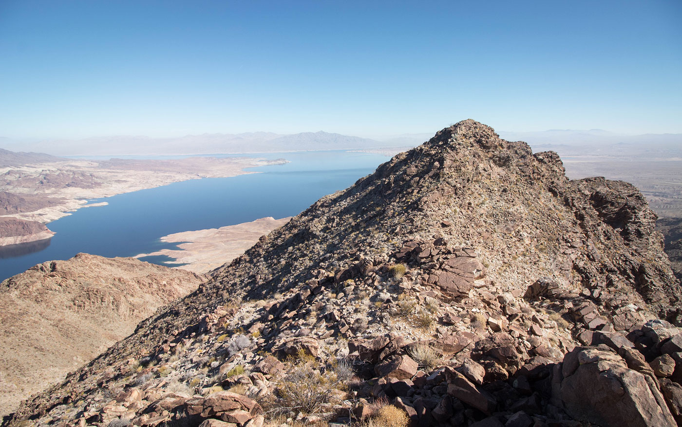
Along the ridge leading to Arch Mountain South.
Arch Mountain South's Class 2 summit block.
Continuing north, Arch Mountain High Point visible center.
View back toward Arch Mountain South.
Arch Mountain High Point ahead.
View back toward Arch Mountain South.
Approaching a Class 2 loose slope to reach Arch Mountain High Point.
View back from the top of the Class 2 slope.
Arch Mountain High Point ahead.
Arch Mountain High Point, view back along the ridge.
Colorado River. Muddy Mountains visible top right. Charleston Peak top left.
Lake Mead's eastern reaches.
Continuing north toward Black Benchmark.
View back to Arch Mountain High Point.
Black Benchmark ahead, Arch Mountain visible top right.
Looking back toward a significant bump along the ridge from Arch Mountain High Point.
You can see the Class 3/4 loose ridgeline on the left. I decided to drop to the right into the barely Class 2 drainage instead. Both routes would lead to the saddle in the center of this photo.
Close-up toward the drainage route I chose to take. The Class 3/4 ridge is out of frame on the left.
Heading up to the western saddle of Arch Mountain.
View back toward Black Benchmark (top left) from the western saddle of Arch Mountain. You can see the scary ridge in the center.
Class 2 up to Arch Mountain. I ascended this slope and then kept to the left of the ridge crest.
Final ridgeline to the summit of Arch Mountain.
Close-up toward the drainage I descended from Black Mountain. You can see the Class 3/4 ridgeline top right.
Lake Mead leading into the narrow canyon that was unfortunately obscured by cliffs.
Lake Mead's eastern reaches.
I backtracked to Arch Mountain High Point and then continued down its Class 2 approach slope and located this spur ridge to descend. It might be easier to use the gully on the right. There are also lots of other options for descending off the ridge, but this one felt pretty efficient.
The road is hidden, but located in the center of this photo. My goal was to head through the lumpy desert to get there.
View back toward Arch Mountain High Point just before reaching the road.
Hire me or show me some love!
Hire/refer me as a web developer or send me a few bucks if you find my site useful. I’m not sponsored, so all fees are out-of-pocket and my time preparing trip reports is unpaid. I really appreciate it!