

After passing the underpass, we headed down this wide wash.
The trail to Arizona Hot Spring heads to the left. On the right is the drainage we'd be ascending from after returning via White Rock Canyon.
A bit of ascending to a minor saddle viewpoint.
Viewpoint before descending a drainage into Arizona Hot Spring Canyon below.
Lower within the drainage, the canyon seen ahead.
View back up the drainage.
Entering the canyon below.
Looking back the way we came. If you'd taken the alternative Class 3 drainage option, this is where the two routes merge.
Some light scrambling in a mostly open wash.
Narrows within the canyon.
View back toward the narrows after the canyon opened up again.
Continuing to descend.
Another shot back at some imposing walls.
Another short section of narrows.
View back up the canyon.
Approaching the final set of narrows that houses the hot spring.
Short scramble to enter the narrows.
View back at the short scramble.
A hairpin turn just before the hot spring (left).
Arizona Hot Spring's upper pool.
Arizona Hot Spring.
View back through the slot.
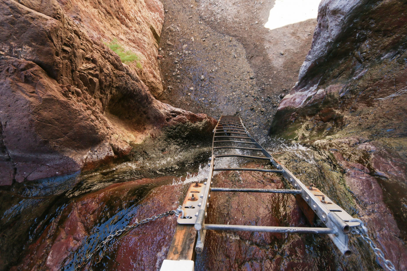
At the end of the spring, where a ladder leads down a waterfall.
Shot of the ladder from below.
Just for memory's sake, here's the old ladder that used to be in place.
Continuing down the canyon.
Some pretty features and colorful walls.
Junction with the bypass route to get to White Rock Canyon on the right. Left leads to the Colorado River.
Colorado River.
Ascending the bypass route.
The trail leads along the bank of the Colorado River.
View back.
Class 2 scramble.
Continuing along the Colorado River.
View back.
Approaching White Rock Canyon.
Starting up White Rock Canyon.
Wider, taller narrows than Arizona Hot Spring Canyon.
Lots of hairpin turns within the canyon.
A short open section a bit before halfway up.
Lots more narrows to come.
View back within White Rock Canyon.
The canyon begins to fade as we ascend to its head.
View back into White Rock Canyon before merging with the wash we started in on.
Hire me or show me some love!
Hire/refer me as a web developer or send me a few bucks if you find my site useful. I’m not sponsored, so all fees are out-of-pocket and my time preparing trip reports is unpaid. I really appreciate it!