I provide a free route map, but you can also download a hike/drive GPX to assist you and to help support my site. Before sharing my GPX tracks with others, please remember my site is a free resource and I'm charging nominal fees to offset my substantial costs.
GPX track added to your cart.
Jan 09, 2021 — The Bare Mountains are located just east of Beatty, NV, but really seem to only get attention as people view it from their cars on the way to Death Valley. Being next door to the National Park, it's hard to justify spending time in the Bare Mountains, but they're overall a nice range. I was happy to snag all the major peaks in one big loop so I don't have to come back. To reach the trailhead (Secret Pass), first navigate here (36.89122, -116.75121) and follow good dirt roads to Secret Pass. Any car could make it.
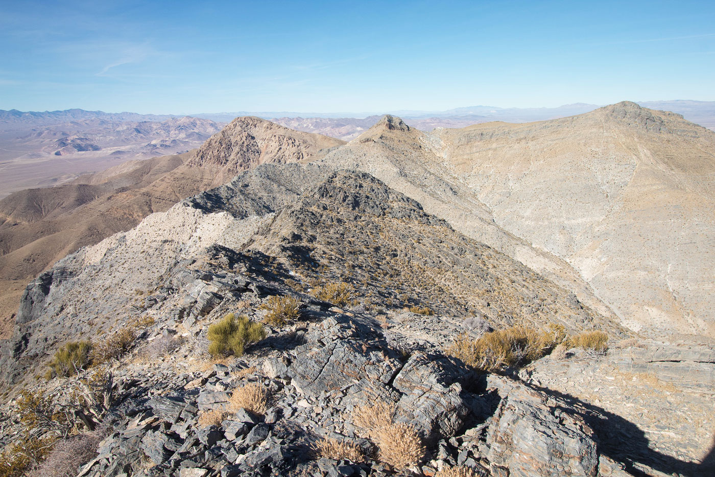
Meiklejohn Peak hovered to the east, but first I headed west toward Peak 5860. Although it's just a bump along the ridge and not even tall enough to be a true "peak", heading up its northeast face seemed like the most efficient way to get up to the ridgeline. Getting there involved hiking along a dirt road past a human-built tower of some sort and continuing up Peak 5860's intimidating-looking face. Although the limestone slabs look like a serious endeavor, the route can easily be kept Class 2, with just a bunch of crawling up the steep, but fortunately not loose, slope that's riddled with big limestone slabs. The route would be more difficult if you keep to the high point of the slope, but I stayed just left where it was mostly just grassy. Once on Peak 5860, I took in the views of the route to come. The ridgeline continued west, up and over Razorback Ridge (Class 2) and then dropped down to the base of some bump where the ridge I was on bisected the primary ridge that separated Bare Mountain Peak from Bare Mountain. You could ascend this bump, but I decided to follow an animal trail on its north slope, where the side-hilling was easy. I continued north to Bare Mountain Peak. This involved losing some vertical gain that would be re-ascended on the way back.
Bare Mountain Peak was a nice summit, and Bare Mountain to the south seemed quite far away. I started back past the bump I avoided earlier, but on its south side this time, again using animal trails to side-hill. The ridge continued along pleasant terrain for a long time. I did encounter some Class 2 and some minor route-finding on the way up to Barely Peak, but it's not enough to say more about it. Eventually I found myself at the base of Bare Mountain, where I dropped my pack and headed up. When the ridgeline becomes craggy, I recommend keeping to the left (east) and follow a social trail along talus/scree, completely avoiding any scrambling along the ridge crest. There was some Class 2 at the summit block, and althought I didn't exclaim with glee at the standard desert scenery below, the view to the relatively colorful ridgeline I had just traversed was nice. I dropped back to the base of Bare Mountain and descended what seems to be the standard gully most people use to gain the summit. It's somewhat steep and barely Class 2. As I neared the bottom of the drainage, I hopped over a minor ridge to the north and and was introduced to some brush. I wasn't expecting brush for some reason, but it only got worse as I traversed to the north through the desert on the way back to my car. Expect lots of little fuzzies in your socks and some scratched ankles. About halfway through the open desert, I stumbled on a road which I followed until it curved to the left, leaving it so I could continue to a saddle at the base of Peak 5860. From the saddle, I dropped down and side-hilled back to my car using the path of least resistance that I could find through the shrubs.
Meiklejohn Peak was next on the agenda. I headed up the road from Secret Pass toward the peak for a little bit (the road gets rocky quickly and ends shortly after) and continued into the obvious drainage. There are any number of routes up the peak from here, all Class 2 and steep. Just pick your way through the rocky terrain and keep gaining elevation. The views from Meiklejohn Peak felt similar to pretty much everything else I saw throughout the day.
Please consider helping me out if you find my site useful. I'm not sponsored, so all site fees are out-of-pocket and my time preparing these trip reports is unpaid. You can also hire me as a web developer. I really appreciate it!


If you find my site helpful, please help me replace my many broken cameras, fund my website fees (hosting, APIs, security), or just support my countless hours of work. I pay for all expenses myself, and all trip reports I post are unpaid and unsponsored, so any support is really appreciated!
If using PayPal, please select their option for "Sending to a friend" so they don't take out fees, thank you.
My site is free to use, but consider sending me a few bucks to help keep it running. Thanks in advance!