

Starting along the Ute Creek Trail.
View back at the Ute Creek Trailhead.
View back again after hiking through some meadows at the start of the trail.
The trail starts into the forest.
And through more meadows before entering the canyon formed by Ute Creek.
Ascending Ute Creek.
Along Ute Creek.
Entering the Lost Creek Wilderness.
View back along Ute Creek.
The Ute Creek Trail enters a sparsely-forested section.
The Ute Creek Trail continues to ascend back into the forest.
View back the way I came.
Along the Ute Creek Trail, which heads through the forest at a moderately steep grade.
A few switchbacks within the forest, but it's not a particularly interesting couple of miles.
The tundra and cool rocks of Bison Peak's southern ridge comes into view.
View back along the Ute Creek Trail.
At the junction with the Brookside - McCurdy Trail. I headed east along this trail. You can see Bison Peak (or at least one of its rock outcrops) in the distance.
Along the Brookside - McCurdy Trail.
A hint at the rock outcrops to come.
Switchbacks up above treeline and onto the tundra above.
View back. The trail ascended from the forest on the right in this photo.
After a few switchbacks, the Brookside - McCurdy Trail emerged onto tundra and continued east. This is a view north toward Bison Peak, where I left the trail and headed north.
Close-up at the cool rocks. Bison Peak is on the left.
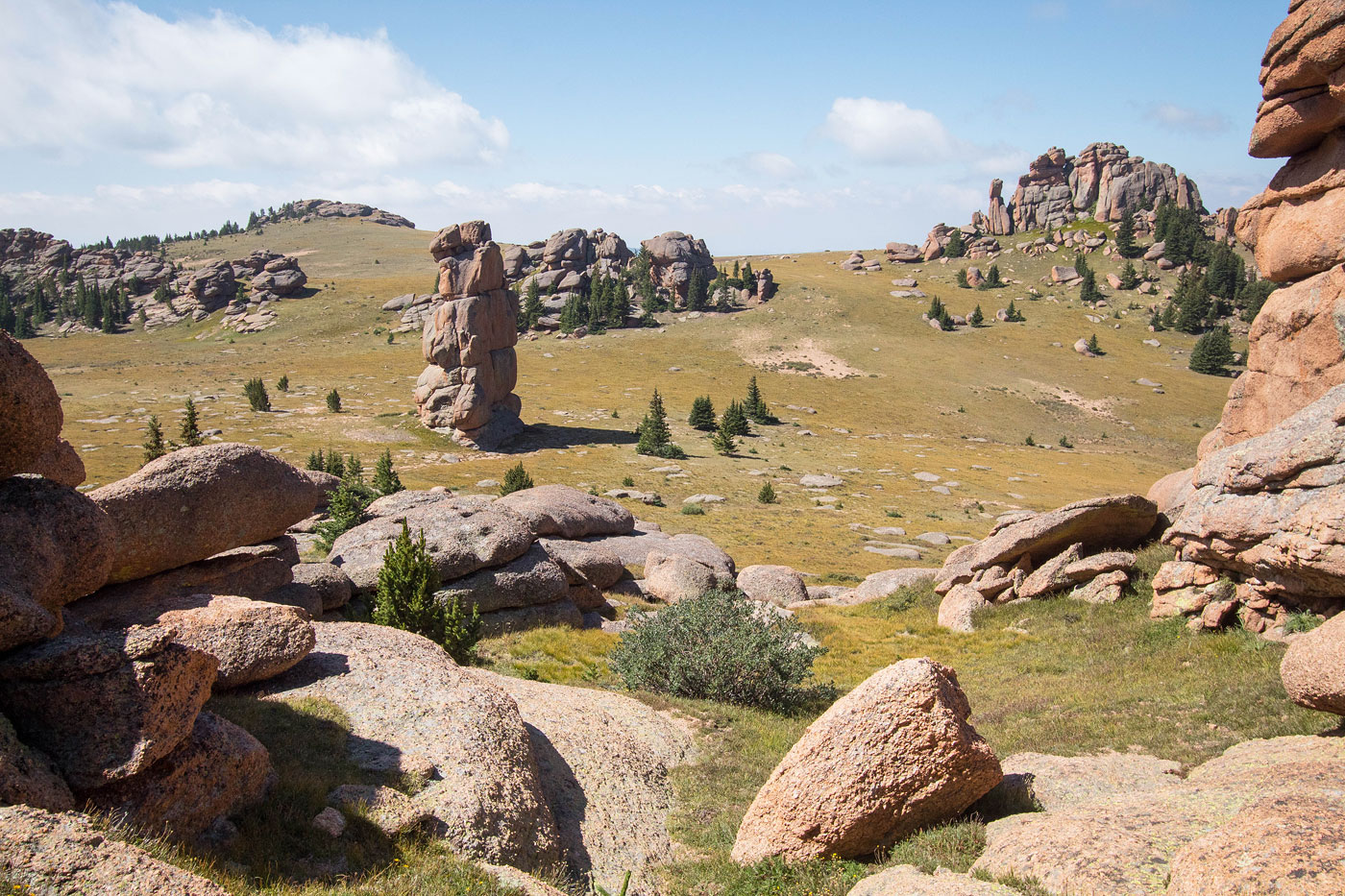
Bison Monolith.
View back the way I came (center), Bison Monolith on the left.
Another shot back toward the Bison Monolith. My route came from the tundra in the center of this photo.
Ascending the gorgeous landscape. I recommend staying to the left of the upcoming cluster of rock towers.
View back.
View back.
Keep left of these cool towers.
View back from on the west side of the aforementioned towers. Bison Monolith visible center.
Higher up, view back. Behind me is a steep rock outcrop. I followed its base until I could navigate to the summit without any scrambling.
A social trail emerged, leading through the rock outcrops and up to the summit of Bison Peak.
View back from just below Bison Peak. McCurdy Mountain visible top left.
McCurdy from the summit of Bison Peak.
View back down the way I came, from the tundra in the center of this photo. As you can see you can avoid all scrambling by just following the tundra and avoiding the rock towers.
View west.
View north.
Additional photo of some cool fog near Bison Monolith.
More cool fog.
Hire me or show me some love!
Hire/refer me as a web developer or send me a few bucks if you find my site useful. I’m not sponsored, so all fees are out-of-pocket and my time preparing trip reports is unpaid. I really appreciate it!