

At the trailhead, view east where you can see the peaks of this route.
Looking back toward the trailhead as I ascend to Black Canyon Wilderness High Point.
Black Canyon Wilderness High Point ahead.
Black Canyon Wilderness High Point summit, view back the way I came toward the trailhead.
Black Canyon Wilderness High Point, view toward Peak 2660. I used the loose-looking slope left bottom in this photo to descend.
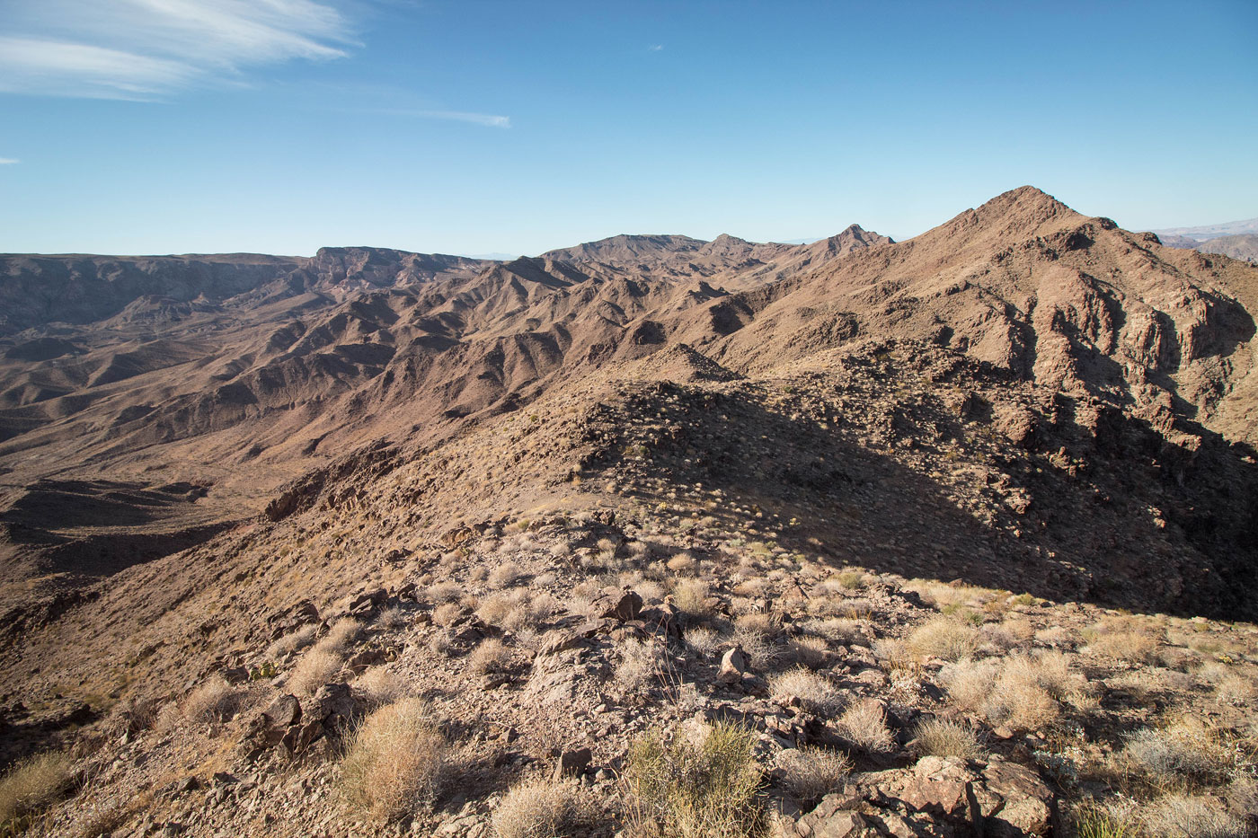
Continuing to Peak 2660, top. You can see the Class 2+ cliff band obstacle to the right of the summit that I used to gain the ridge.
View back toward Black Canyon Wilderness High Point.
On the ridge, heading up to Pea 2660.
Awful stuff to gain Peak 2660's summit.
Heading along the ridge from Peak 2660 to Peak 2570.
Peak 2570 ahead, a bunch of cliffy stuff making the traverse a little more interesting.
Looking back toward Peak 2660 (top center) and Black Canyon Wilderness High Point top left).
Easy Class 3 obstacle along the ridgeline to Peak 2570.
Close-up toward the Colorado River. Mount Wilson visible top right, Fortification Hill top left. Muddies on the distant left.
View back from near the summit of Peak 2570 toward Peak 2660 and Black Canyon Wilderness High Point. Trailhead visible left of center.
Summit of Peak 2570 ahead.
Close-up toward Peak 2402, my next objective. You can also see the canyon I'd use to get to it, and the ridge in the center I used to gain its summit. The pink line on the attached map outlines the nice-looking drainage to the right of the ridge I took.
Looking back up at Peak 2570 on awful rock.
Within the drainage that would lead to the wash/canyon.
Within the wash.
Wash narrows into a canyon.
Some obstacles as I descend the canyon.
A dryfall stopped me. I couldn't find a way around it.
I ascended the ridge to Peak 2402, here.
Looking back at my progress up the ridge. To the left in this photo is the alternative, likely easier ascent option outlined in pink on my map.
Class 2/3 scrambling on my ridge ascent choice.
On the final summit ridge to Peak 2402. The pink link on my map would end up here also.
Peak 2402 ahead.
View back along the ridge from Peak 2402. Black Canyon Wilderness High Point visible left of center, the trailhead left of that. Peak 2570 where I came from is visible right of center.
Continuing along the ridge to Peak 2300, center.
Barely Class 2 slope to Peak 2300.
View back as I ascent Peak 2300.
Peak 2300, view south.
Back at the saddle of Peak 2402 and Peak 2300, view toward Burro Wash Road, somewhere in the center.
Minor obstacles to bypass as I descend from the saddle.
I traversed the desert, up and over a couple of hills.
View back toward the saddle I came down from, center.
Burro Wash Road visible ahead.
Along Burro Wash Road.
Looking back as I ascend to the rim where my car is.
Back at my car, view toward Peak 2775.
Looking back toward Black Canyon Wilderness High Point and the trailhead (center) as I head up to Peak 2775.
Peak 2775 ahead.
Close-up toward the peaks I did earlier in the day.
Ran into Adam on the summit of Peak 2775!
Hire me or show me some love!
Hire/refer me as a web developer or send me a few bucks if you find my site useful. I’m not sponsored, so all fees are out-of-pocket and my time preparing trip reports is unpaid. I really appreciate it!