I provide a free route map, but you can also download a hike/drive GPX to assist you and to help support my site. Before sharing my GPX tracks with others, please remember my site is a free resource and I'm charging nominal fees to offset my substantial costs.
GPX track added to your cart.
Oct 25, 2019 — Blushing Bride Canyon is a nice non-technical canyon that allows for access to the lower sections of Lower Maidenwater Canyon as a loop. The two combined made for a nice half day excursion. If you have two cars with good clearance and the ability to drive in deep sand, you can cut out over two miles of road walking from the stats I've listed.
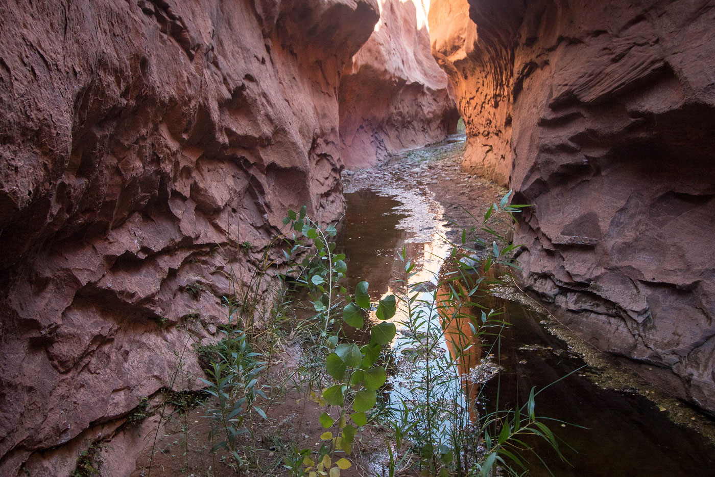
We parked at the start of the dirt/sand road and followed it east on foot to the head of Blushing Bride Canyon. A long rappel would drop you into the head, but we didn't bring a rope and instead meandered along the northern rim of the canyon until we found a Class 2+ downclimb onto some pretty slickrock slabs that led down to the canyon floor. From here, a series of Class 3 downclimbs and other fun obstacles led through Blushing Bride Canyon. I recommend bringing some webbing, or at least a buddy for partner assists, to use as a handline in case you need it. The fun narrow sections of Blushing Bridge Canyon ended with a squeeze behind a big boulder that would have proved difficult to descend if not for this little cave slide. Shortly after, the canyon opened up into a brushy wash, and while not prickly, it required a bit of tedious bushwhacking to get through. We took a little detour to see a really cool ampitheater-like feature about halfway through the wash. Eventually, we got to a marshy downclimb into some absolutely foul-looking water within the watercourse. Instead, we backtracked and followed the canyon rim to avoid the marsh, and then dropped back into Blushing Bridge Canyon at the confluence with Lower Maidenwater Canyon. Note that there is also a Class 4 sandstone slab just to the right of the marsh if you want to escape the canyon here.
Once at the confluence of the two canyons, we headed up Lower Maidenwater Canyon, passing lots of gorgeous cliff faces, narrows, and foliage. Toward the end, the canyon got really narrow and had smooth, pretty sandstone walls. There was also a dryfall with a bypass on the right. There was a fork toward the end of Lower Maidenwater Canyon once nearing the road (UT 276), both apparently viable options to escape. We chose the right fork and continued under a man-made drainage tunnel to ascend up to the road, which we then followed back to the car.
Please consider helping me out if you find my site useful. I'm not sponsored, so all site fees are out-of-pocket and my time preparing these trip reports is unpaid. You can also hire me as a web developer. I really appreciate it!


If you find my site helpful, please help me replace my many broken cameras, fund my website fees (hosting, APIs, security), or just support my countless hours of work. I pay for all expenses myself, and all trip reports I post are unpaid and unsponsored, so any support is really appreciated!
If using PayPal, please select their option for "Sending to a friend" so they don't take out fees, thank you.
My site is free to use, but consider sending me a few bucks to help keep it running. Thanks in advance!