Jul 06, 2019 — Boundary Canyon is gorgeous little canyon, but the approach/exit is long enough to warrant waiting to only do the canyon while flowing. I'd suspect Boundary Canyon dry would be significantly less fun. That being said, the section of Kolob Creek during the exit is incredible and despite the brevity of Bouncary Canyon itself, this route has no shortness of beauty. This route uses the MIA exit, a steep exit route that seems to be tossed around the Internet like it's some absurdly difficult feat you don't speak of until you have to do it. Granted, it is steep and sometimes loose and sketchy, but it shouldn't stop you from wanting to do Boundary Canyon and exploring this gorgeous area.
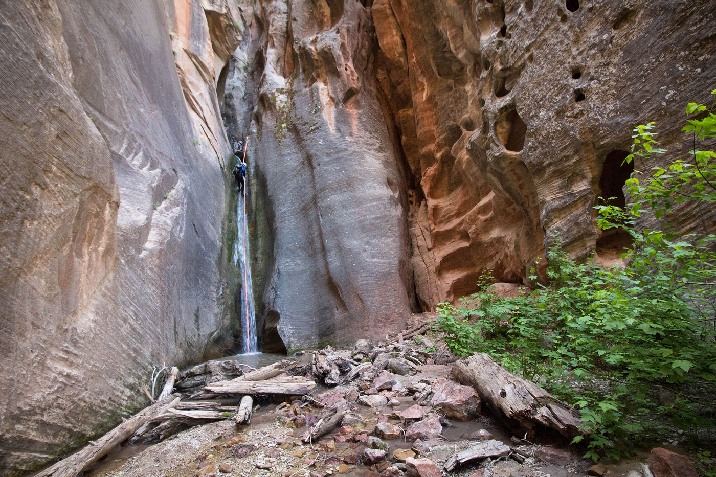
Starting from the West Rim Trailhead, we followed a forest road to a bump where a cairn marked a very old road that led to a brushy route to the head of Boundary Canyon. There seem to be at least three options to get down there. Ours was fine. I can't speak of any others. A few lovely rappels led us through Boundary's little waterfalls and winding narrow slots. None were particularly difficult, but it was a bit cold in there. Wetsuit recommended even in July when we did it. A final rappel landed us into a brushy drainage. This drainage continued to Kolob Creek, an incredible narrow canyon that I was not expecting. It rivals the Virgin River Narrows in beauty, but without the water park crowds. Aboslutely stunning. We followed the creek downstream through a couple of darker, narrower sections, and located the MIA exit on the right, the first area so far without sheer cliff walls on both sides.
Two of us broke off from the group and went up the MIA exit. It's fairly well-traveled and cairned sometimes. The two of us were able to navigate to the rim without a map. The route starts steeply up a dirty slope, then drops into a canyon, where there are a couple of easy Class 3 moves. The route then left the drainage and up another slope, leading to a sandy saddle that looks west toward the rim. We dropped down to the southwest for about a hundred feet and then continued west up the drainage. I recommend paying close attention to diverging social trails. I added a couple of cairns for somewhat difficult to follow spots, but who knows if they'll still be there. It only gets steeper from here, with heavily-eroded sandy sections that requiring using roots and vegetation to climb. Eventually, the steep slope mellows out just before the crux, a Class 3 (wet during our visit) crumbling bit of muddy rock that leads to the rim. From the rim, a massive web of forest roads takes you in all directions, so I highly recommend having a satellite map ready. I altered my attached map to remove all our mistakes, leaving the fastest approach I thought possible.
Please consider helping me out if you find my site useful. I'm not sponsored, so all site fees are out-of-pocket and my time preparing these trip reports is unpaid. You can also hire me as a web developer. I really appreciate it!


If you find my site helpful, please help me replace my many broken cameras, fund my website fees (hosting, APIs, security), or just support my countless hours of work. I pay for all expenses myself, and all trip reports I post are unpaid and unsponsored, so any support is really appreciated!
If using PayPal, please select their option for "Sending to a friend" so they don't take out fees, thank you.
My site is free to use, but consider sending me a few bucks to help keep it running. Thanks in advance!