

The trail starts along an old road, pavement visible at parts.
The trail passes Switzer Camp, and then ascends to avoid Switzer Creek below, but there are some great views.
My intended loop heads left here, and comes back on the right later in the day. I didn't realize the trail on the right was closed until I was on my way back.
Continuing down into Bear Canyon, Switzer Creek below.
Side-trail to Switzer Falls.
Switzer Falls.
Headed into Bear Canyon.
Mini waterfalls along the trail.
Entering Bear Canyon Campground.
The trail is a bit hard to follow toward the end after Bear Canyon Campground.
After getting to this old thing, the trail becomes much easier to follow as you ascend to the saddle of Mt. Lowe and Brown Mountain.
Some great views on the way up.
Looking down toward Bear Canyon.
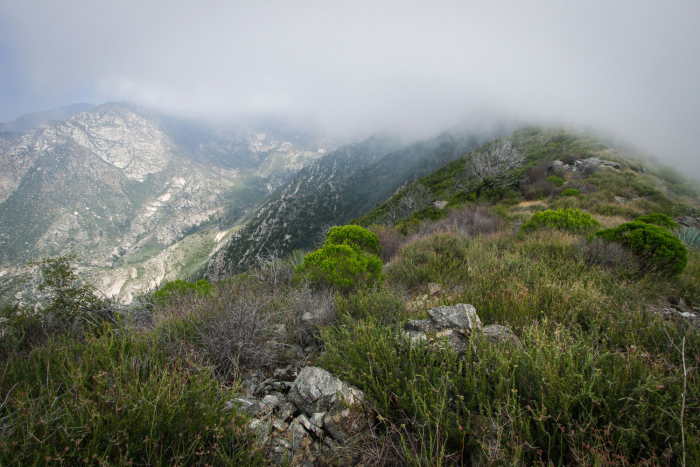
At the fogy saddle. Left is Mt Lowe, right is Brown Mountain (route pictured).
Along the steep ridge, headed toward the summit. There are multiple false peaks.
Mini-scramble. Low class 2.
Approaching one of the summits where I got a break from the fog for a minute.
Continuing along the ridge.
Brown Mountain summit.
Heading down, but the trail is a bit obscure. The ridge is obvious, though, so you can't get lost. The peak a little ahead is the final min-summit of brown Mountain before the final descent.
Looking back toward the main peak.
Looking back the way I came.
Steep section to get to the official trail leading down (you can see the tail on the right of the next hill (Little Brown Mountain).
Heading down the official trail toward Oakwilde Campground.
At Oakwilde, the trail intersects with the Gabrielino Trail. I headed north to complete the loop.
About here, I was greeted by a Trail Closed sign. Crap. There was no way I could go all the way back, so I pressed on.
The Gabrielino Trail sticks close to the canyon wall on a fairly narrow ledge, the creek ten to forty feet below at points.
Looking back the way I came.
The Gabrielino Trail leaves one canyon and enters a much more confined one. The fun stopped here for a little bit...
Much of the trail is completely overgrown and there are dozens of fallen trees. It's a bit hard to follow the route, and I got pretty scratched up.
But it is definitely still gorgeous the whole way.
A lot of the trail looks like this.
Finally, the ascent out of the overgrown canyon.
Looking back toward the canyon I came through.
Below on the right is the canyon the San Gabrielino Trail comes through.
Brown Mountain. You can see all the little sub-peaks.
The loop completes at the junction form earlier in the day. Head back up to the trailhead.
Hire me or show me some love!
Hire/refer me as a web developer or send me a few bucks if you find my site useful. I’m not sponsored, so all fees are out-of-pocket and my time preparing trip reports is unpaid. I really appreciate it!