Hike Calico Hills South, Red Book Point, Calico, Tank, Red Cap Traverse Red Rock Canyon National Conservation Area, NV


Starting up along the well-traveled trail from the Red Spring picnic area.
We randomly decided to head up the side of Calico Hills South at some point.
Looking back toward the Red Spring picnic area.
Calico Hills South summit over there.
One down, four to go! This one was the easiest.
Heading just below the ridge along the north side of Calico Hills South.
We en countered lots of obstacles. Chances are you won't find the same ones, but this is an example of the kind of stuff we found pretty regularly.
We ended up on the west side of Calico Hills South somehow, just below the ridge. You can see the Red Rocks scenic drive down there.
Jon coming down a chimney, yet another type of fun obstacle.
A random mini canyon along the way.
Looking down into the mini canyon we found somewhere along Calico Hills South's north end.
Will we get cliffed out if we go down from the north ridge of Calico Hills South this way? We gave it a go. Somehow there was a route. you can see Calico Peak in the distance here.
On the way up to Red Book Point. You can see the way we came down Calico Hills South's north end just above Jon's head in this photo.
Route-finding up Red Book Point. I thought this was the most fun part of the day. You can see the high point of Calico Hills South's north ridge on the left.
Red Book Point summit looking toward Calico and Tank (the two yellow-capped peaks).
Looking back from the Red Book Point summit toward Calico Hills South.
Another fun obstacle which took some Class 3+ chimney moves. Likely avoidable with some route-finding. Plus, who knows, you might end up going a totally different way.
Almost down from Red Book Point.
On the way up to the saddle between Calico and Tank, Red Book Point back there.
Almost to the Calico and Tank saddle. You can see people up there because the saddle is also the end of the very popular Calico Tanks Trail.
From the saddle (end of Calico Tanks Trail) looking down toward Red Book Point.
Heading up Calico Peak, Tank Peak on the right.
Calico Peak summit ahead.
There was a pretty Tank at the top of Calico Peak.
Calico Peak summit, looking back toward Red Book Point and even farther, Calico Hills South.
After summiting Calico Peak, we came back to the saddle and went up Tank Peak. Calico Peak is behind Jon.
Tank Peak summit looking toward Red Cap (the obvious red capped peak), Turtlehead Peak on the top right.
Looking back at Tank (left) and Calico (right). The saddle (end of Calico Tanks Trail) is that notch between the two. You can see the Calico Tanks Trail on the right down there.
A random dried up tank on the way up to Red Cap Peak.
Red Cap Peak ahead.
Heading up to Red Cap Peak.
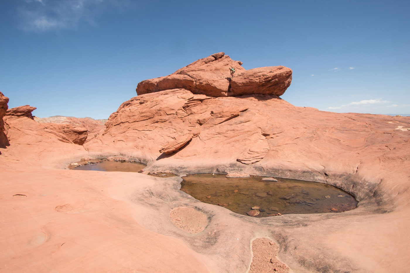
A flat section with some water pools, Red Cap Peak a climactic last summit. Jon is pictured just above the final Class 3 move of the day.
Looking back at the pools (northwest) just before the summit block.
Red Cap Peak summit. Tank Peak center right, New Peak on the left.
Coming down from Red Cap Peak. Someone had set up a stack of rocks to get down from the steep slab.
We spent a few minutes looking for a gully that might take us down because the northern end of Red Cap was a sheer cliff. We found on on the northeastern side, which went down really smoothly.
Looking up toward the start of our descent gully.
Looking up our gully from the base of Red Cap Peak.
Continuing down Ash Canyon.
Ash Canyon ahead.
Some minor Class 2 boulder scrambles to get down Ash Canyon.
Looking back up Ash Canyon, Tank Peak in the center.
Continuing through open desert for a while to get back to the trailhead.
Hire me or show me some love!
Hire/refer me as a web developer or send me a few bucks if you find my site useful. I’m not sponsored, so all fees are out-of-pocket and my time preparing trip reports is unpaid. I really appreciate it!