

Starting from the Cataract Gulch Trailhead.
Ascending along the Cataract Gulch Trail.
The Cataract Gulch Trail parallels a gorgeous, flowing creek for its majority.
It's often a bit steep and the vegetation encroaches, but it's in great shape.
A switchback as we ascend, reference for the trail steepness.
Passing one of a few little waterfalls along the Cataract Gulch Trail.
Continuing our ascent up the Cataract Gulch Trail.
View back, Sunshine Peak seen in the distance.
Another gorgeous waterfall.
A creek crossing above the waterfall.
Ascending above tree line into a weird landscape of lumpy tundra and rocky talus.
Shot back down Cataract Gulch as the trail grade becomes more tame.
Ascending toward Cataract Lake.
View back.
Whiley continued to Cataract Lake (as per the race requirement). I left the trail to go reach a couple of 13ers.
I headed off the Cataract Gulch Trail toward the gully seen center, keeping to the left side of it.
Some light brush, all pretty much avoidable. I stumbled on an animal trail on the left side of the gully.
Ascending along a solid animal trail.
View back, Cataract Lake seen left. I came up from the center/right somewhere.
Animal trail leading almost the whole way to the ridgeline above.
Onward to Cataract Peak.
First I took a social trail on the right, leading up the peak's southern slope.
It was steep and loose, but the trail was defined enough that it wasn't difficult.
View back at the steep slope and social trail. Tundra Top seen top left.
Cataract Peak summit, view down into Cataract Gulch.
I decided to drop off the west side of Cataract Peak. It's a comparable route to the southern slope.
Onward to Tundra Top, seen ahead.
Class 2 on the way up.
View back toward Cataract Peak as I make my way up to Tundra Top. You can see the ascent on the peak's southern slope (center), a light trail etched into the face.
Tundra Top summit, view south.
I continued along the ridgeline from Tundra Top. Carson Peak seen ahead.
View back along the ridge, which begins to get more rugged. Whiley rejoined me here.
Carson Peak seen ahead, but a rough section of ridge at the saddle adds Class 3 into the mix. You could drop to the right on the slopes, but that would require substantial vertical loss and regain.
View back at the Class 3 ridge. It's very loose and would be dangerous if wet or had snow.
Past the dangerous section of ridge, Class 2 for a bit to avoid the Carson Peak ridge crest ruggedness.
Then tundra to the summit.
Nearing Carson Peak summit, view back toward Tundra Top (left) and Cataract Peak (right).
Onward to Bent Peak, seen left of center. Lots of tundra to walk to get there.
Bent Peak ahead.
Close-up of Bent Peak. We kept right of the talus and ascended on its south side.
View back toward Carson Peak.
Bent Peak summit, view toward Carson Ghost Town (far left). Coney Benchmark seen top center.
Descending to Carson Pass on an old road.
We had to take a quick detour to Carson Ghost Town for Whiley's race, but I didn't include this (or its stats) on my trip report. This is Carson, but you won't see it along the hike outlined here.
View back toward Bent Peak as we head up to Coney Benchmark.
A junction with the Colorado Trail. We opted to take the trail, though the road leads up as well.
Along the Colorado Trail, view back.
Approaching Coney Benchmark. The Colorado Trail wraps around the summit, so we left the trail briefly.
Coney Benchmark summit, view toward Redcloud and Sunshine.
View back toward Coney Benchmark as we rejoin the Colorado Trail.
Along the Colorado Trail, next up is Peak 13256, seen center.
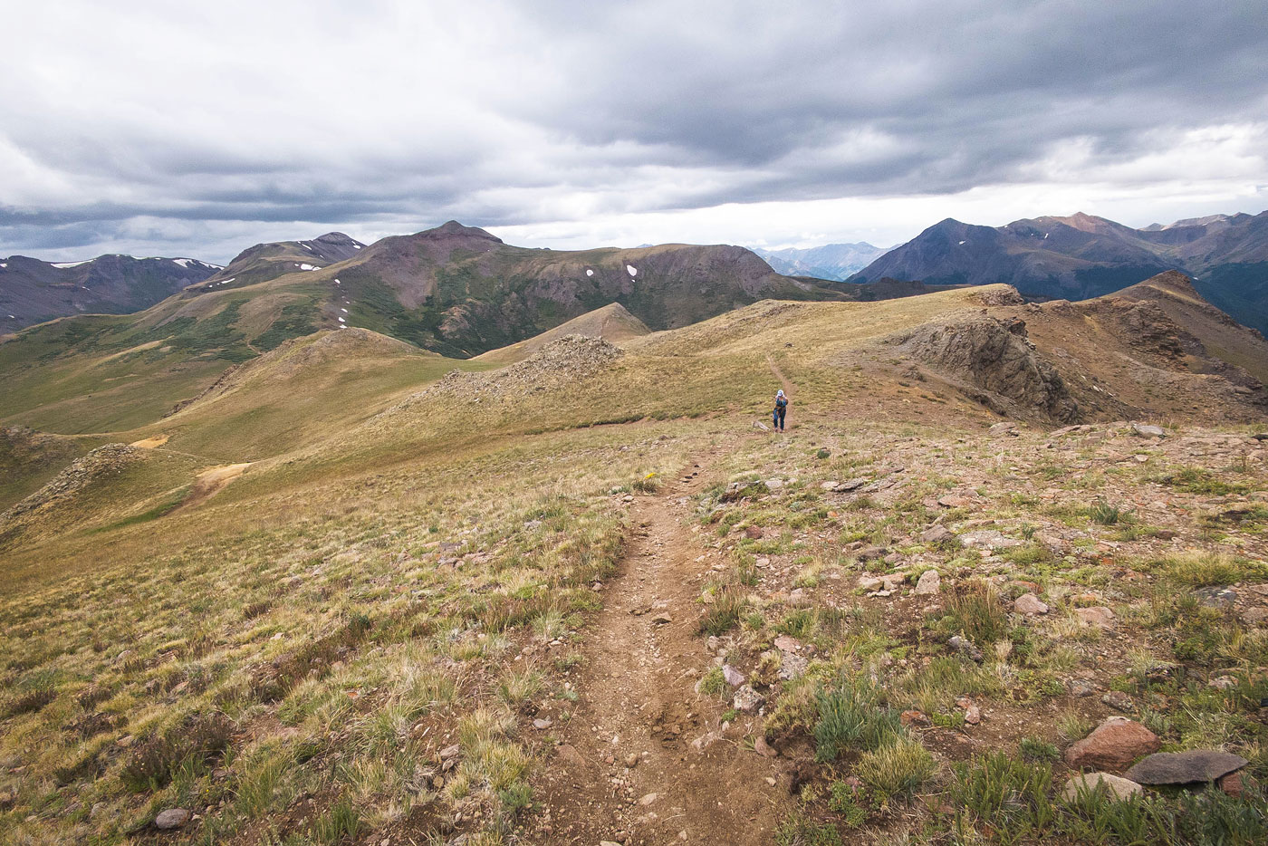
View back as we stroll along gorgeous tundra.
Off-trail briefly to reach Peak 13256.
Peak 13256, view back along the ridgeline. Coney Benchmark seen on the left.
Onward along the Colorado Trail, unranked Peak 13138 seen ahead.
View back toward Peak 13256.
Along the Colorado Trail after a quick detour to get Peak 13138.
Close-up at the gorgeous tundra to come. Lake San Cristobal seen on the left.
Gorgeous rim walk along the Colorado Trail.
View back.
We descended through a herd of sheep.
And then left the Colorado Trail to head directly to the saddle where we could pick up the Camp Trail #476.
Junction with the Camp Trail.
View back toward the ridge walk we just completed.
Descending along the Camp Trail.
View back toward the cool cliffs along the rim as we descend along the Camp Trail.
The Camp Trail enters tree line.
Descending the Camp Trail. Our rim traverse is seen above on the left.
We started losing too much light for photos, but the Camp Trail was mostly just a pretty forest walk with occasional views.
Hire me or show me some love!
Hire/refer me as a web developer or send me a few bucks if you find my site useful. I’m not sponsored, so all fees are out-of-pocket and my time preparing trip reports is unpaid. I really appreciate it!