

From our parking spot, heading up the eastern major drainage to gain Copper Mountain's south ridge.
Looking back at our progress up the drainage.
Along Copper Mountain's south ridge, Copper Mountain visible top right. Copper Mountain - West Peak visible left.
Looking back as we continue along the ridge.
Class 3+ move along the ridge. Solid holds, but worth mentioning it's here.
Cholla forest on the way to Copper Mountain.
Fun navigation along the ridge to Copper Mountain.
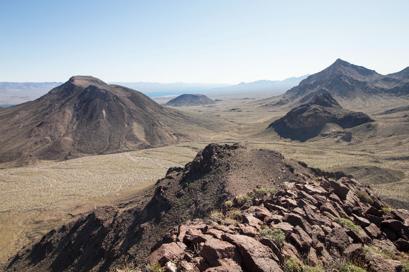
We kept just left of the ridge crest for the majority of the last half mile to the summit of Copper Mountain.
View back along the south ridge where we ascended.
Making our way up Copper Mountain.
An arch along the crest.
Copper Mountain ahead.
Copper Mountain summit, view back along the ridge. The cars are somewhere left of center in the desert.
Copper Mountain summit, view toward Salt and Pepper Mountain.
Copper Mountain - West Peak is next, visible on the right.
Copper Mountain - West Peak ahead.
View back toward Copper Mountain.
Hiking along the ridge, heading north. Salt and Pepper Mountain visible top right.
View back toward Copper Mountain - West Peak (right somewhere), and Copper Mountain (left).
Peak 3205 ahead (right). Class 2 with one Class 3 move down the north ridge of Copper Mountain - West Peak to the saddle below.
Class 3 move.
View back toward Copper Mountain - West Peak.
Onward to a false summit of Peak 3205.
View back. Copper Mountain visible right of center.
Peak 3205 comes into view, the pointy guy on the right.
Approaching Peak 3205.
Nearing the base of Peak 3205. Keep left of the summit cliff and wrap to its north side.
Glass 2 gully on the north side.
Class 2+ move to gain the summit.
Peak 3205 summit, view north. Copper Mountain visible center.
Backtracked a little, now to find a way down the east side of Peak 3205.
Steep descent, but nothing too scrambly or dangerous. Dupont Mountain visible on the left.
View back up at the Class 2 descent.
Entering a pleasant drainage that led to the base of Dupont Mountain.
View back toward Peak 3205, up there on the top right somewhere.
At the base of Dupont Mountain. Class 2 to the saddle above.
Heading up Dupont Mountain.
View back toward Copper Mountain (top left) and Copper Mountain - West Peak (top center).
Just past some old mine remains, this Class 3 scramble led to just below the summit.
Dupont Mountain, view south. Copper Mountain top right, Salt and Pepper Mountain on the left. We descended from Dupont to the saddle in the center bottom of this photo, then dropped left to get over to Salt and Pepper Mountain.
On the way to Salt and Pepper Mountain.
Ascending Salt and Pepper Mountain, view back toward Dupont Mountain.
Class 2 up Salt and Pepper Mountain.
View back again. Dupont Mountain far right. The ridge we descended from to get down from Copper Mountain - West Peak's north ridge is visible far left.
Salt and Pepper Mountain ahead, a bit of a flat rocky walk.
Salt and Pepper Mountain, view toward the Colorado River.
Salt and Pepper Mountain, view toward Talus Mound and Indigo Peak behind it.
Class 3 down from Salt and Pepper Mountain.
View back toward Salt and Pepper Mountain as we ascend a minor Class 2+ sub-peak on the peak's east side.
Descending from the minor sub-peak, Talus Mound next.
On our way up Talus Mound (Class 2), view back toward Salt and Pepper Mountain and its little sub-peak on its east side.
Another shot back as we ascend to the high point of Talus Mound.
Talus Mound, view toward Indigo Peak. I recommend staying on the ridge. It's Class 2, but less steep and loose than descending off the slope.
Ascending Indigo Peak via a grassy ridge.
After ascending Indigo Peak, there was a bit of flat walking to the summit. This is a view back toward Copper Mountain (left) and Salt and Pepper Mountain plus Talus Mound (right).
Indigo Peak.
Class 2 gully to get down from Indigo Peak, followed by a walk through the desert to reach the cars.
Hire me or show me some love!
Hire/refer me as a web developer or send me a few bucks if you find my site useful. I’m not sponsored, so all fees are out-of-pocket and my time preparing trip reports is unpaid. I really appreciate it!