I provide a free route map, but you can also download a hike/drive GPX to assist you and to help support my site. Before sharing my GPX tracks with others, please remember my site is a free resource and I'm charging nominal fees to offset my substantial costs.
GPX track added to your cart.
Jul 29, 2022 — Copper Mountain is the high point of a sub-range of the Jarbidge Mountains. We did this hike as an add-on to our traverse of the high peaks of the Jarbidge Range the next day, and it served as a nice warm-up for this remote area. Any car can reach the trailhead, though it's a long drive and unlikely you'll want to come way out here just for these peaks. Google had no trouble navigating us to the trailhead after we left pavement and headed east here (41.53513, -115.8319). While the road is excellent, it's a very long drive and needing a tow way out here would be disastrous. Also, the only gas is in Jarbidge, NV so make sure you start with a full tank when leaving Elko, NV.
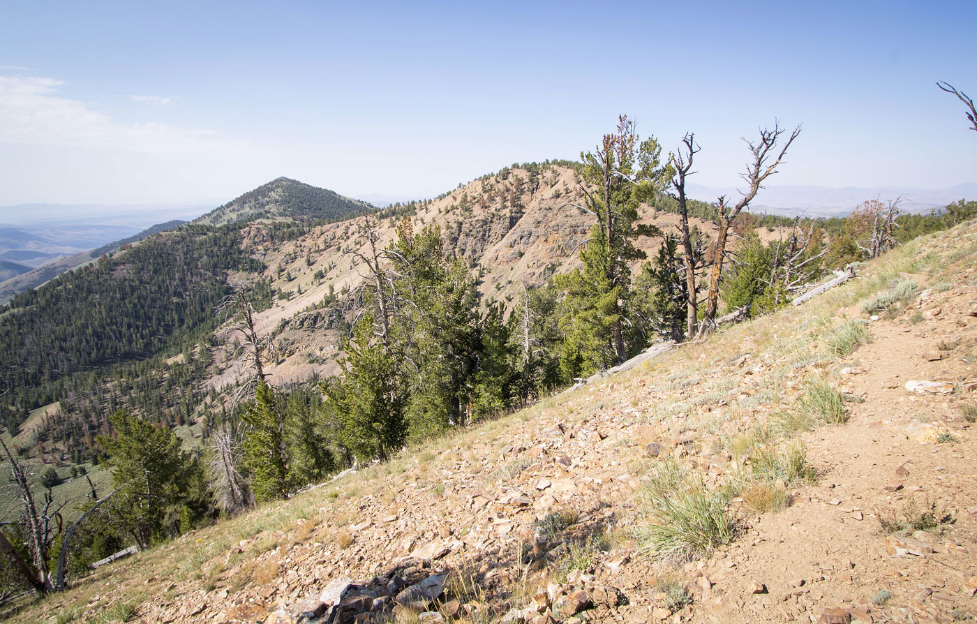
We parked at the turn-off from the graded road and started up a much less good road as it led northwest. If you plan to just do this hike as an out-and-back to Copper Mountain, you can probably get any Crossover another half mile along this road, but we made a loop and so parked where we did. The spur road steepened and just below 9200' it ended. A little trail continued north to gain the ridge crest and then we just headed along the mostly open ridgeline. At times we entered trees, but an excellent animal trail led us through without any bushwhacking. We ascended a small hump and then gradually got up to Peak 9860. This was a minor summit along the way, but gave us a nice view toward Copper Mountain ahead. The route from Peak 9860 was also a nice stroll over open country and through very sparsely-vegetated sagebrush, and the final push to Copper Mountain had some minor talus for the last hundred feet or so.
After inspecting the Jarbidge Mountains traverse from this distance for a while, we started down to our last peak of the traverse, Silver Mountain. After a few hundred feet of talus/scree descending from Copper Mountain, the terrain opened up briefly before introducing some slightly more dense sagebrush. While it wasn't thick, we had to scope a bit ahead to ensure we wouldn't end up in a thicker clump of the potentially annoying plant. With almost no annoyance, we were at the saddle. I recommend just ascending directly to the northeast ridge of Silver Mountain as quickly as possible even though it may look a bit brushy and forested. Ascending to the ridge farther to the west results in thicker forest and more deadfall, while the route displayed on my attached map was almost bushwhack-free. Once along the treeless north ridge of Silver Mountain, we made quick work to its summit.
We backtracked to the saddle of the two peaks and spent a minute trying to locate what appeared on a topo map as the Copper Mountain Trail, our ticket for getting back to the car. Fortunately the trail was still in good shape for the most part as it wound in and out of the arroyos of the eastern slope. It could have been a grueling side-hill of bushwhacking, and possible may become so in a few years as the trail deteriorates further. We had a little bit of trouble a handful of times when the trail seemed to disappear, but it was only hard to follow in these instances because some of the brush has become overgrown. The trail itself was in good shape and I'd say in total we bushwhacked for an accumulated 500 feet or so. The Copper Mountain Trail eventually reached an old mining road. This road passed some old remains of a cabin before ascending back to the car, completing the loop. Ultimately I thought Silver Mountain was a nice add-on, rather than just doing Copper Mountain and heading back the same way.
Please consider helping me out if you find my site useful. I'm not sponsored, so all site fees are out-of-pocket and my time preparing these trip reports is unpaid. You can also hire me as a web developer. I really appreciate it!


If you find my site helpful, please help me replace my many broken cameras, fund my website fees (hosting, APIs, security), or just support my countless hours of work. I pay for all expenses myself, and all trip reports I post are unpaid and unsponsored, so any support is really appreciated!
If using PayPal, please select their option for "Sending to a friend" so they don't take out fees, thank you.
My site is free to use, but consider sending me a few bucks to help keep it running. Thanks in advance!