

Starting from the Courthouse Trailhead.
The trail climbs steeply through the forest.
A switchback in the trail to illustrate the steepness.
Ascending along the Courthouse Trail.
View back, Precipice Peak poking through the trees.
A junction. Leave the Courthouse Trail to head toward the summit, straight ahead in this photo.
Flatter forested walking for a bit.
An overlook toward Courthouse Mountain's bulk above.
The trail switchbacks for a bit through a small meadow.
Ascending toward pretty pinnacles along the steep slope.
Courthouse Mountain seen ahead, while hiking up the switchbacks.
View back, more peaks of the Cimarrons seen in the distance.
An overlook north. Chimney Rock seen left of center.
The trail steepens and becomes very eroded.
Ascending away from the grassy slope and up to the volcanic portion of the hike.
View back down the first Class 2 portion, just after leaving the trees.
A wider shot back. I came up from the center. Precipice Peak seen on the right.
The trail re-materializes for portions. The route leads toward the large stacked boulders right of center.
Approaching the large boulders, and the social trail keeps right of them.
Ascending on steeper Class 2/2+.
View back, Chimney Rock seen top left.
Gorgeous views as I ascend Courthouse Mountain. The trail generally keeps to the tundra when available, but there are short sections of talus hopping.
Final hundred feet to the summit, extremely eroded and now forming a pretty deep trench.
View back down just below the summit block.
Courthouse Mountain summit block just ahead (Class 2/2+), view north. Chimney Rock seen right.
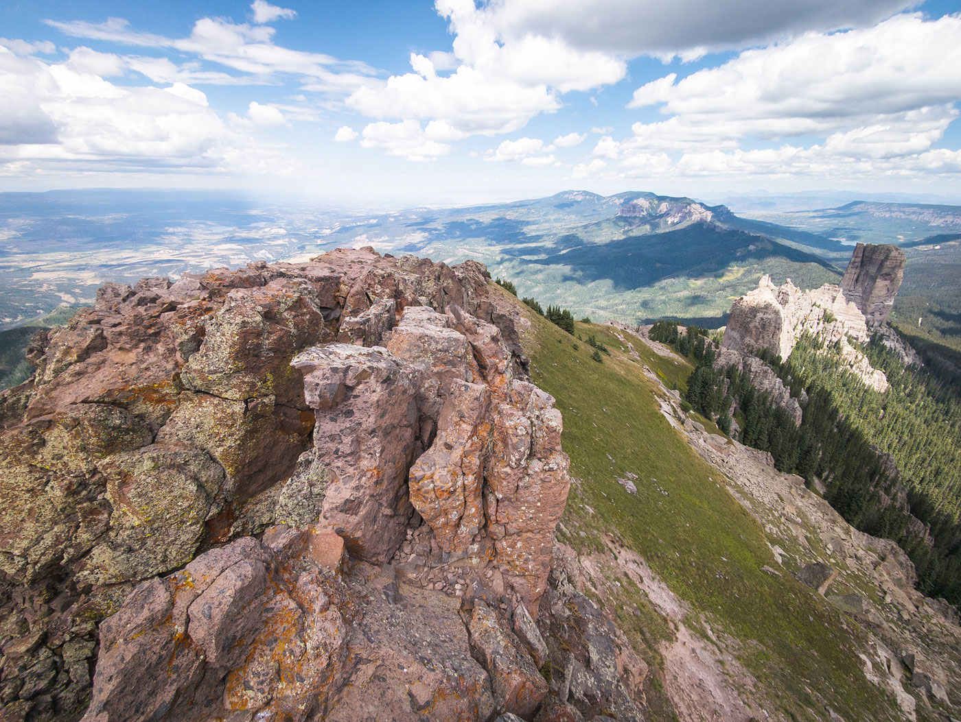
Courthouse Mountain summit, view toward Wetterhorn Basin. Dunsinane Mountain and Precipice Peak on the left, Coxcomb Peak center.
Close-up toward Chimney Rock.
Hire me or show me some love!
Hire/refer me as a web developer or send me a few bucks if you find my site useful. I’m not sponsored, so all fees are out-of-pocket and my time preparing trip reports is unpaid. I really appreciate it!