I provide a free route map, but you can also download a hike/drive GPX to assist you and to help support my site. Before sharing my GPX tracks with others, please remember my site is a free resource and I'm charging nominal fees to offset my substantial costs.
GPX track added to your cart.
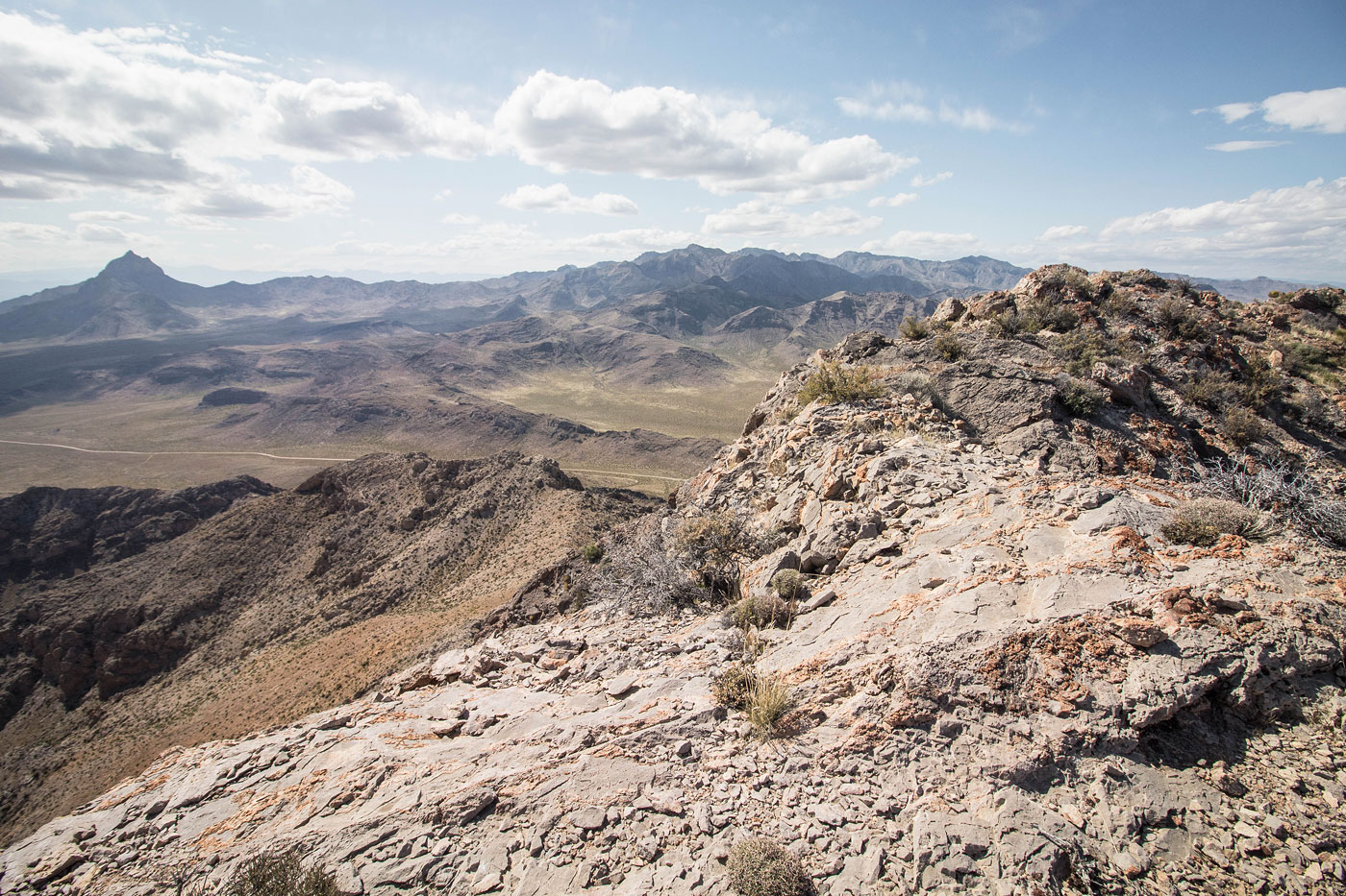
Apr 05, 2020 — The road leading out to Davidson Peak was surprisingly good; likely any car going slowly could make it. From the trailhead, I followed the less than ideal dirt road (high clearance could have made it a bit farther) to the base of the meandering east ridge of Davidson Peak. I followed this ridge on Class 2 terrain basically along the crest for the entire route up to the summit. About halfway up, the ridge does get rocky, so I stayed just left of the crest, then pulled a couple of Class 2+ moves to gain the ridge again. Alternatively, you could hug the cliff base (south side) and ascend when the rocks disappear. Two thirds of the way up, a really steep nice slickrock slab was a fun surprise. An avoidable sort-of knife edge summit ridge offered amazing views of Moapa Peak and Mormon Peak.
After Davidson Peak, I ascended Little Davidson Peak, just east of Davidson Peak. It was too short to write up an entire extra report for it, but it's worth doing if you're in the area. Basically just drive up the nice road until you get to the south ridge. A significant cliff band will prevent an easy scramble, so hug the cliffs on the north side of the peak until you get to a Class 2 baby scramble, and then make a hairpin turn and re-ascend to the summit.
Please consider helping me out if you find my site useful. I'm not sponsored, so all site fees are out-of-pocket and my time preparing these trip reports is unpaid. You can also hire me as a web developer. I really appreciate it!


If you find my site helpful, please help me replace my many broken cameras, fund my website fees (hosting, APIs, security), or just support my countless hours of work. I pay for all expenses myself, and all trip reports I post are unpaid and unsponsored, so any support is really appreciated!
If using PayPal, please select their option for "Sending to a friend" so they don't take out fees, thank you.
My site is free to use, but consider sending me a few bucks to help keep it running. Thanks in advance!