

Starting along the Shelf Lake Trail.
Along the Shelf Lake Trail - that's Argentine Peak in the center.
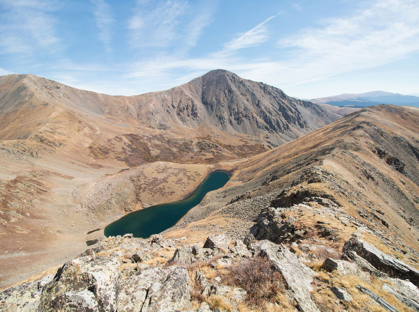
Looking back along the Shelf Lake Trail, Square Top Mountain on the left.
Shelf Lake.
Heading up the slope toward Decatur Mountain, looking down toward Shelf Lake. Argentine Peak left, Square Top Mountain right.
Along the ridge to Decatur Mountain.
Looking toward Geneva Peak (center) and Revenue Mountain (right), with some small lakes below them down there.
Almost at Decatur Mountain summit, looking back toward Shelf Lake.
From Decatur Mountain summit looking toward the ridge - Revenue Mountain is next, Geneva Peak far back left.
Close-up of the ridge.
Looking north toward Grays Peak (left), and the crazy-colored Peru Creek below.
Almost at the summit of Revenue Mountain, looking back toward Decatur Mountain.
Revenue Mountain summit looking southwest toward the ridge to come.
Heading down from Silver Mountain (just a bump along the ridge), Santa Fe Peak (right) and Geneva Peak (left).
Heading up to Santa Fe Peak.
Along Santa Fe Peak's summit ridge, looking back toward the Geneva Creek Mine (right bottom), and Silver Mountain (left).
Santa Fe Peak up there somewhere.
Looking back.
Short section along a dirt road to Santa Fe Peak's summit.
Looking back along the ridgeline, Grays and Torreys in the distance.
Continuing onward to Sullivan Mountain (the bump ahead), and Geneva Peak on the far right.
Looking back on the way to Sullivan Mountain toward Santa Fe Peak.
Looking south toward Geneva Peak from Sullivan Mountain, a small lake on the left.
Close-up of the social trail up Geneva Peak.
Along the route up Geneva Peak, looking back laong the ridge.
Geneva Peak, looking toward Landslide Peak and the ridgeline I'll be going down.
Close-up of the little lake at the end of the Geneva Creek dirt road. Maybe you can find a way down from here toward the lake and follow the road back. I chose to follow the ridgeline instead.
Headed down the grassy ridgeline from Landslide Peak.
Looking back toward Landslide/Geneva, Santa Fe in the distance.
Entering the treeline.
The bushwhacking is minimal - the trees are fairly spread out, making this an easy off-trail descent.
Just happened to end up at a log bridge someone put here, leading to a campground on the side of the road.
Following the road back to the Shelf Lake Trailhead.
Hire me or show me some love!
Hire/refer me as a web developer or send me a few bucks if you find my site useful. I’m not sponsored, so all fees are out-of-pocket and my time preparing trip reports is unpaid. I really appreciate it!