

Starting down Lonesome Wash as I attempt to find a path of least resistance up and over a hump.
Along the ridge over a hump, Peak 1963 visible on the far right. A more interesting-looking peak that I didn't do in the center.
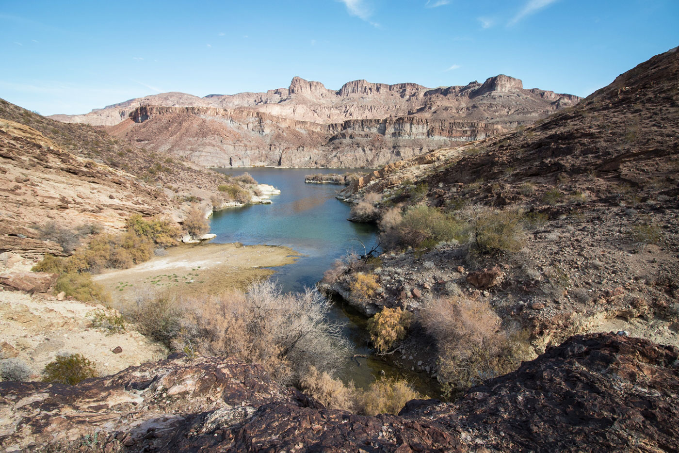
Looking back toward the Colorado River and Lonesome Wash before I descend from the hump into the wash south of Peak 1963.
About to descend the hump to the wash visible below. I then went to toward the center of this photo in that drainage west of Peak 1963.
Within the drainage west of Peak 1963.
At the saddle to the northwest of Peak 1963, headed up and around to its summit.
Class 2+ to the summit.
Peak 1963 summit, looking east.
Peak 1963 summit, looking south.
Peak 1963 summit looking north toward the narrows I'll be heading into.
Close-up of the narrows before entering.
Some really interesting sections of this wash leading down to Fenlon Bend Cove.
The wash opens up a couple of times, with great views of the surrounding cliffs.
A dryfall with a detour to the left.
Eventually, the wash opens up and you walk down to Fenlon Bend Cove.
View south from Fenlon Bend Cove into the drainage I decided to head toward.
Fenlon Bend Cove from above.
Heading south. Squaw Peaks East and West visible there. I didn't attempt to climb them.
Mini side canyon with some brightly colored rock and a nice view of the Colorado River.
Along the rim headed toward Chalk Cliffs.
Some of the really interesting landscape just north of Chalk Cliffs. You can see the Chalk Cliffs Overlook on the right.
A short section of narrows serving as a Class 3 obstacle.
Approaching Chalk Cliffs Overlook.
Class 2 to get to the Chalk Cliffs Overlook.
Chalk Cliffs Overlook, view northeast. You can see the cliffs the spot is named after below.
Chalk Cliffs Overlook, view south.
Chalk Cliffs Overlook, view northwest toward the landscape I just traversed.
Chalk Cliffs Overlook, looking west. Peak 1963 visible center.
Heading down from Chalk Cliffs Overlook toward a cove. I went over the hill in the center of this photo in order to get into Lonesome Wash on the other side.
Entering Lonesome Wash.
Some interesting features within Lonesome Wash.
Hire me or show me some love!
Hire/refer me as a web developer or send me a few bucks if you find my site useful. I’m not sponsored, so all fees are out-of-pocket and my time preparing trip reports is unpaid. I really appreciate it!