

View southwest toward Forlorn-Lonesome Peak (top left).
Forlorn-Lonesome Peak top right.
Along the ridge to Forlorn-Lonesome Peak - the ridge ahead is tempting, but cliffs out. Drop to the right on Class 2 and avoid it by hugging the cliff base visible on the right.
Past the cliff, view toward Forlorn-Lonesome Peak, the high point in the center of this photo.
View back along the ridge. Peeper Benchmark visible top center, Forlorn Hope Peak top right.
Cliffs barring access to Forlorn-Lonesome Peak. I dropped down to the right and found a Class 2 slope to the summit around the cliff base.
Forlorn-Lonesome Peak summit, view down at the slope I ascended. I came from around the left of the cliffs in the center of this photo.
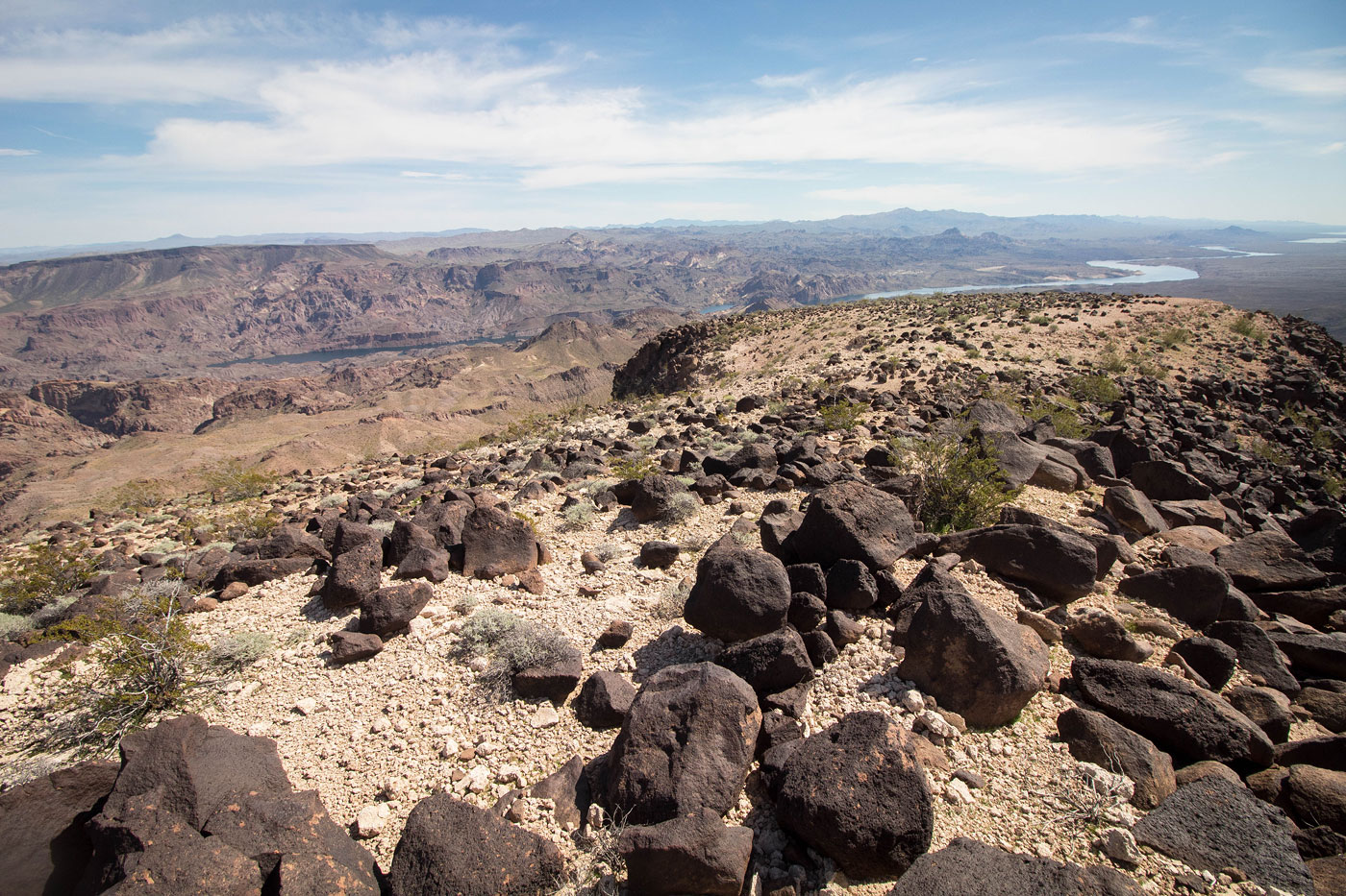
Forlorn-Lonesome Peak summit, view toward Lonesome Wash to the east, where I'll be dropping into shortly. Withdrawn Peak visible top right of center, and Malpais Flattop Mesa visible above it.
I backtracked and dropped into the drainage to the north of Forlorn-Lonesome Peak in order to get into North Lonesome Wash.
North Lonesome Wash.
View back toward Forlorn-Lonesome Peak, within North Lonesome Wash.
Cholla cacti forest. Withdrawn Peak visible top center.
At a minor saddle to the west of Withdrawn Peak. I headed up the west ridge.
Class 2 talus as I ascend to Withdrawn Peak.
Class 2 scree. There was a sweet spot to get around the cliffy crap on the left of the overhanging orange rock visible on the right in this photo.
Withdrawn Peak ahead.
Withdrawn Peak summit.
Withdrawn Peak summit, view back into North Lonesome Wash. Forlorn Hope Peak visible top right. I'll be heading along the ridgeline to get there.
After dropping off Withdrawn Peak, heading along the ridgeline. First up is Peak 2840, visible top right. Forlorn Hope Peak top left.
Looking back toward Withdrawn Peak (center).
Continuing along the ridgeline.
Entering a cholla cacti forest.
Looking back toward Withdrawn Peak (top center).
Higher up, view back toward Withdrawn Peak.
Summit of Peak 2840. Forlorn Hope Peak visible top left.
Class 3 optional section on Peak 2840's descent. Avoidable by backtracking and working around the cliffs.
Looking back toward Peak 2840 (top left) and Withdrawn Peak (top right).
Lots of cliffs blocking Forlorn Hope Peak.
I found a weakness (right) and used that to get up.
Class 2/2+ weakness.
Looking back toward Peak 2840 (left).
Forlorn Hope Peak ahead.
Forlorn Hope Peak, Peeper Benchmark visible top right.
Forlorn Hope Peak, view north. Railroad Peaks visible top left.
Looking back at a Class 2 section when descending from Forlorn Hope Peak.
Close-up into North Lonesome Wash.
Peeper Benchmark ahead.
Ridgeline to Peeper Benchmark.
Peeper Benchmark summit, looking back. Forlorn Hope Peak top left, Forlorn-Lonesome Peak top right.
Peeper Benchmark, view north.
Heading back through the desert toward my car.
Hire me or show me some love!
Hire/refer me as a web developer or send me a few bucks if you find my site useful. I’m not sponsored, so all fees are out-of-pocket and my time preparing trip reports is unpaid. I really appreciate it!