

Starting up the Kraft Mountain Loop Trail.
Kraft Mountain Loop Trail, entering Gateway Canyon. Turtlehead Peak visible center.
Some gorgeous scenery in Gateway Canyon.
Gateway Canyon opens up and heads further northwest. Turtlehead Peak seen center left.
Working up Upper Gateway Canyon.
Some really cool rock formations within Upper Gateway Canyon. I loved that Lower Gateway was all sandstone and Upper Gateway was limestone.
The gully of choice to ascend to Grey Cap Peak seen on the right. My second time ascending Grey Cap, I followed the ridge visible in this photo.
The standard gully route. I went up to the saddle in the middle of this photo.
Looking back at the saddle I came up, Turtlehead Peak visible behind it.
Working around the south slopes of Grey Cap Peak.
Continuing around the south side of Grey Cap Peak.
A nice notch along the way with great views.
Working up Class 2+ to Grey Cap Peak. The route-finding isn't too hard, but does require keeping your brain on.
Almost at the summit of Grey Cap Peak, looking back the way I came.
Almost on Grey Cap Peak.
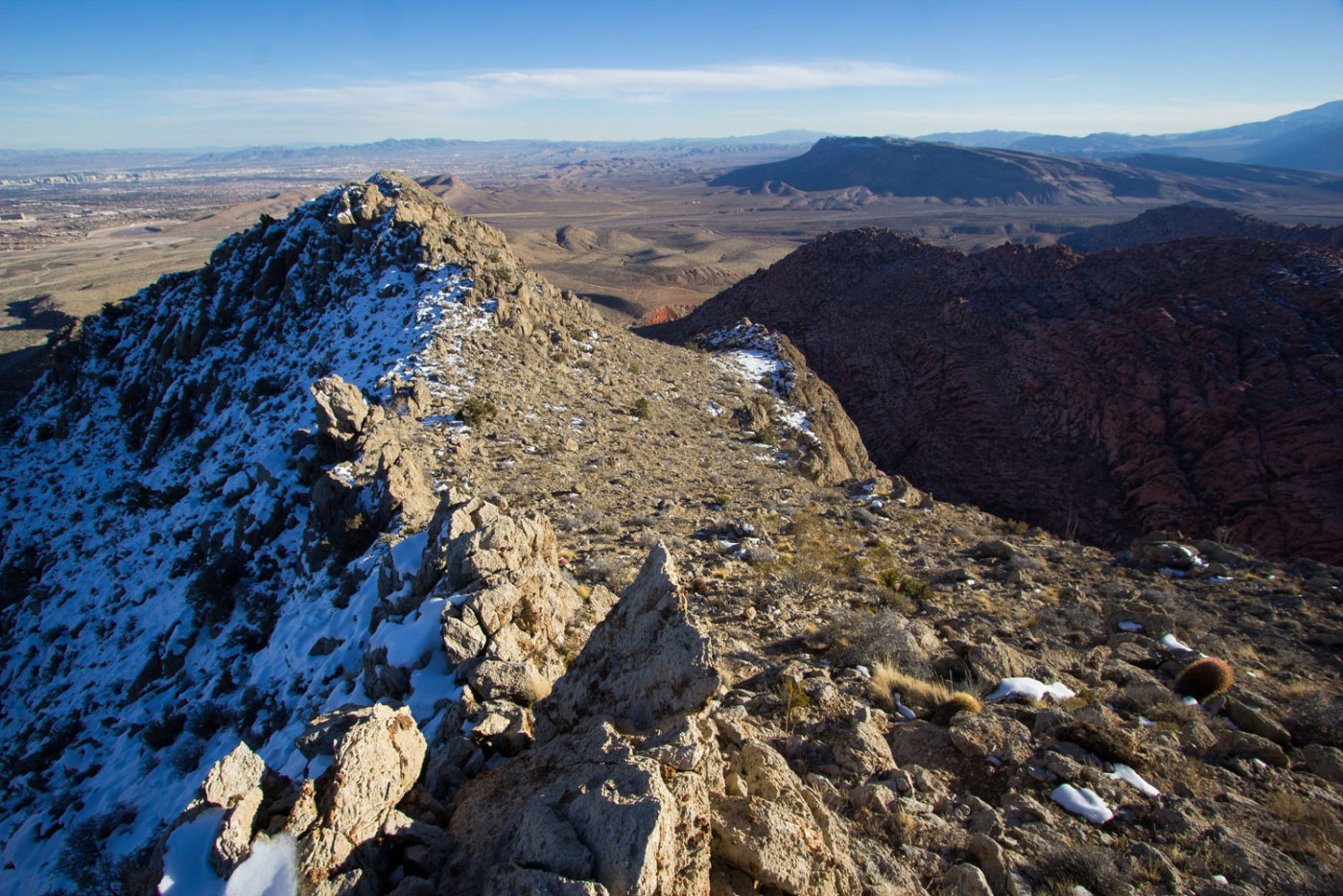
Gray Cap Peak summit, view east at the ridge I'd continue on.
Gray Cap Peak summit, view west toward Turtlehead Peak.
Along the narrow ridgeline.
A minor knife-edge along the ridge from Grey Cap Peak.
Avoiding a sketchy section along the ridge, Goat Bed Peak visible center.
Looking back toward the ridge that I left temporarily.
Yes, suddenly there is no more snow. I know. I took a stupid descent my first time summiting Grey Cap, and I wanted to do the whole route again, this time using the entire ridgeline. See map for more info. So yes, all pictures from here on are from March 23, 2018 on my second time doing Grey Cap, properly mapping the route.
Continuing along the ridge, view back toward Turtlehead Peak.
Working along toward the end of the ridge after summitting Goat Bed Peak.
Looking back toward Goat Bed Peak.
Approaching the Class 3 down climb we chose along the ridge.
Looking back up the Class 3 stuff we took on the way down from the ridge.
Class 2 stuff to get back to the Kraft Mountain Loop Trail.
Approaching the Kraft Mountain Loop Trail.
Looking back at the ridge traverse.
Hire me or show me some love!
Hire/refer me as a web developer or send me a few bucks if you find my site useful. I’m not sponsored, so all fees are out-of-pocket and my time preparing trip reports is unpaid. I really appreciate it!