I provide a free route map, but you can also download a hike/drive GPX to assist you and to help support my site. Before sharing my GPX tracks with others, please remember my site is a free resource and I'm charging nominal fees to offset my substantial costs.
GPX track added to your cart.
Apr 12, 2023 — Guatay Mountain is a minor summit located near Cuyamaca Rancho State Park, but despite being a relatively small peak it has great views of the surrounding hills due to its steeply sloped ridgeline. The trailhead is poorly labeled and does not have an official parking lot. I left my car at the large Pine Creek Trailhead lot and walked back along the road to reach the start of the Guatay Mountain Trail. It started off a little overgrown, concerning initially, but shortly after became much better.
The first half mile or so of the hike parallels Old Highway 80, only a small creekbed separating the trail from the busy mountain road. Despite the lovely water sounds coming from below, it was hard to ignore the passing cars. Fortunately this portion is short-lived, and the trail bends south and heads much more steeply toward the east ridge of Guatay Mountain. The trail is heavily eroded in this section, and I found myself doing some cute parkour-attempt moves to avoid a deep crevice formed by water erosion.
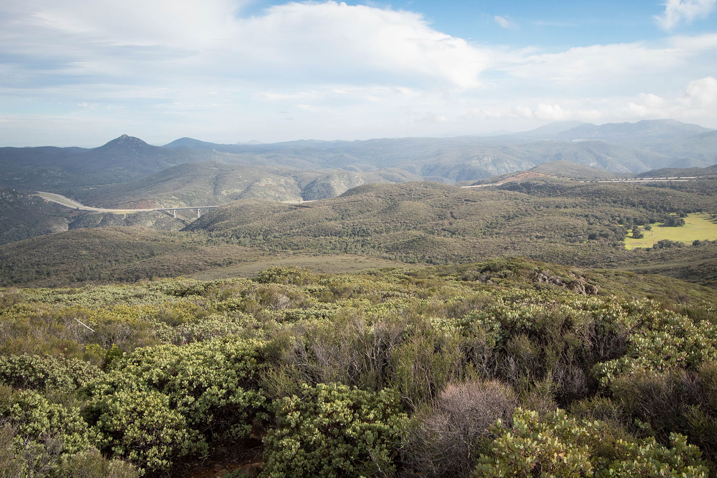
The east ridge of Guatay Mountain almost immediately introduced some great views, the large bridge on I-8 that passes over Pine Valley a neat sight from afar. The Guatay Mountain Trail dropped a hundred feet or so, and then ascended up and over another hump along the ridge crest. I found the trail in great shape, and the ridgeline views were surprisingly lovely and not obscured by the low chaparral foliage. Soon I found myself at the base of Guatay Mountain and hiking up an unexpectedly steep, loose trail for a few hundred feet that has somehow avoided intense erosion. Past here the trail tamed out and wandered up toward the high point, a bit of rockiness along the way to the summit. The last quarter mile has a couple of spots where locating the trail is a teeny bit more difficult at times, but they're short-lived sections. I could see Cuyamaca Peak to the north, Corte Madera to the south, and other nearby peaks like Long Valley Peak.
Please consider helping me out if you find my site useful. I'm not sponsored, so all site fees are out-of-pocket and my time preparing these trip reports is unpaid. You can also hire me as a web developer. I really appreciate it!


If you find my site helpful, please help me replace my many broken cameras, fund my website fees (hosting, APIs, security), or just support my countless hours of work. I pay for all expenses myself, and all trip reports I post are unpaid and unsponsored, so any support is really appreciated!
If using PayPal, please select their option for "Sending to a friend" so they don't take out fees, thank you.
My site is free to use, but consider sending me a few bucks to help keep it running. Thanks in advance!