

Waterpocket Fold seen in the distance as we leave the cars.
Dropping into an initial drainage.
Navigating the open desert, against the grain of the drainages.
View back toward the trailhead, center.
Little cliff bands and other obstacles along the way.
View back at our progress, the cars somewhere in the center. The Henry Mountains are seen above.
A final ascent to the rim above.
Happy Dog Canyon far left across Halls Creek.
Class 2/3 descending on loose terrain.
Steep ledges, view north up Halls Creek.
Class 3 section.
A wide ledge blocking direct access down. A slickrock slope assists farther south.
Entering Halls Creek.
Some brushy hiking as we near the junction with Millers Creek.
Ascending the north slope of Happy Dog Canyon.
View back down as we ascend, the cliff we came down seen center.
View south into Happy Dog Canyon, Halls Creek seen top center.
Happy Dog Canyon's upper reaches seen left of center. We continued to the ridge center.
Along a rib on the ridgeline, Millers Creek seen below.
Crazy view down into Millers Creek.
My friends seen below on some striped sandstone, a more difficult way up to the head of Happy Dog Canyon.
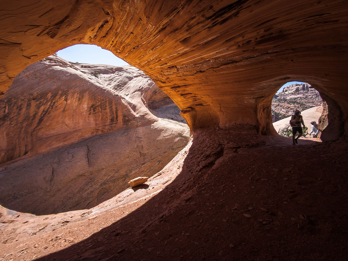
The grotto/arch center.
Within the grotto.
Class 2+ to the notch, the absolute head of Happy Dog Canyon.
First few obstacles within the canyon.
Partner assists at times.
Rappel 1.
View back at Rap 1.
More fun obstacles.
Many waist-deep potholes, some escapes requiring some work.
Partner assist out of a pothole.
Some light stemming through narrow sections.
View back up-canyon.
Happy dog Canyon opens up a bit.
More narrow stemming, a short section.
Looking back at nuisance Rap 2.
Some little obstacles as we approach Rap 3.
Rap 3.
View back up at Rap 3.
Rap 4, only the first half needed a rope.
More potholes.
And then we got into the stemming. I didn't take many photos because it was just high-stemming through poorly-lit narrows, but it was a significant stretch.
Deep within Happy Dog Canyon.
Shawn serving as a meat anchor for a bigger drop within the narrows.
Gorgeous features within this deeper section.
Happy Dog Canyon opens up for a break.
Happy Dog Canyon continues on for a short time, but we escaped on the left here.
Hire me or show me some love!
Hire/refer me as a web developer or send me a few bucks if you find my site useful. I’m not sponsored, so all fees are out-of-pocket and my time preparing trip reports is unpaid. I really appreciate it!