

Starting from the trailhead, we headed into this wash. Mortero Palms is our first destination.
Some bouldery obstacles within the wash. A social trail leads up along the right side to avoid most of the boulders.
Looking back down the bouldery wash, avoiding most of it on a social trail.
It wasn't a long hike to reach the palms.
Mortero Palms.
One of the "morteros" for which the grove is named after. Apparently natives created these to grind nuts and whatnot.
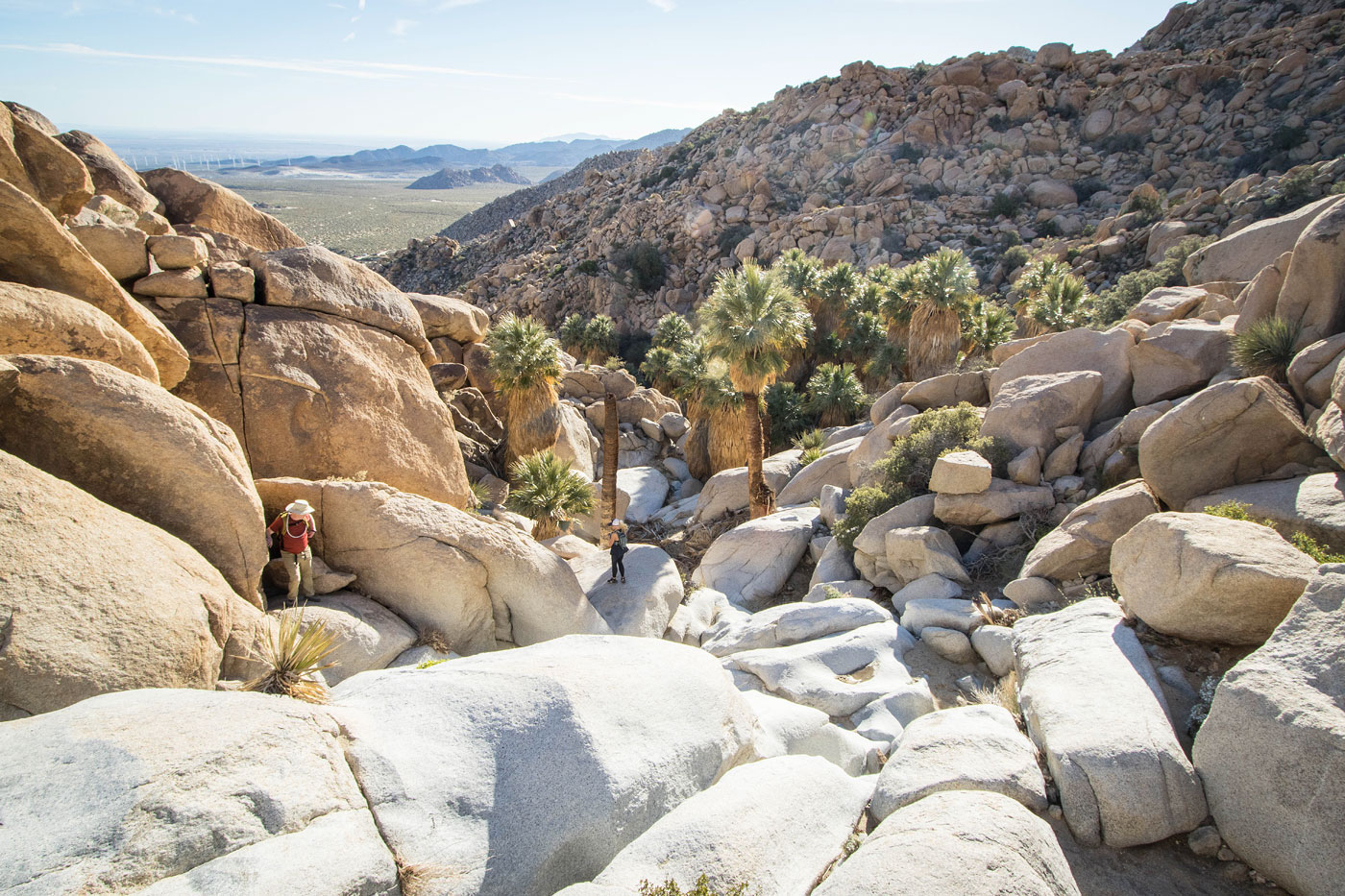
Ascending past Mortero Palms. This short section ahead was a trickier section, Class 2/3.
View back down the Class 2/3 into Mortero Palms.
Continuing through the wash on our way to get onto the Goat Canyon Trestle Trail.
View back into the drainage we came out of.
Now on the Goat Canyon Trestle Trail.
View back along the trail.
The trail ascends away from the drainage (seen left) and then drops down into it.
View back. Had we not located the trail, we would have been ascending in the drainage seen below.
Within the draninage for a short time.
The trail heads out of the drainage again and ascends steeply up this slope. You can see other hikers on their way up.
View back into the drainage.
Alternatively, if you stay in the drainage you get some fun scrambling, seen in this photo and the following one.
Alternative to the trail if you stay within the drainage.
Along the Goat Canyon Trestle Trail, view back.
Ascending to the saddle above.
At the saddle, view down into the drainage we'd descend into to reach the trestle. We'd be back to this spot later in order to ascend to Jacumba Mountain.
Still along the trail, view back as we head down to Goat Canyon Trestle.
The wash narrows into a canyon for a short time.
Fun scrambling within the drainage.
The railroad track comes into view in the distance, though not the trestle we came to see just yet. I recommend keeping to the right as you descend to avoid excessive boulder-hopping.
View back at the boulder-hopping you'd have to deal with if you don't stick to the social trail.
Continuing to descend toward the trestle.
Finally, it came into view!
Class 3 descent to get closer.
Goat Canyon Trestle (photo from 2015).
After viewing the Goat Canyon Trestle, we returned to the saddle mentioned earlier and started south, seen here. The goal was to reach the ridgeline above and take it to Jacumba Mountain.
Higher up on the slope.
Class 2 toward the top of the slope.
View back. The saddle we came up from is seen left, the trailhead is top right.
Now on the ridgeline, a view toward Jacumba Mountain.
Some cool rock features as we head along the lumpy ridgeline.
View back at the colorful ridgeline.
Now on the standard route to Jacumba Mountain using its northern ridgeline.
View back as we head up to Jacumba Mountain.
There's a faint social trail.
Jacumba Mountain ahead.
Really tame slope higher up below the summit.
Shot back along the northern ridge of Jacumba Mountain.
The summit comes into view.
Class 2 summit block of Jacumba Mountain.
Jacumba Mountain summit, view southeast.
After backtracking from the summit, we descended north. Seen here is Whiley along our descent ridge of choice. It was mostly clear of brush and only sometimes had boulders. I don't think there's any real "best" slope option to reach the peak.
Descending into the drainage below, where we picked up the Goat Canyon Trestle Trail again.
Hire me or show me some love!
Hire/refer me as a web developer or send me a few bucks if you find my site useful. I’m not sponsored, so all fees are out-of-pocket and my time preparing trip reports is unpaid. I really appreciate it!