

After hiking along the Continental Divide Trail, passing over Loch Lomond Road, and continuing up through the trees, I got some views of James Peak (center) and Mount Bancroft.
Above treeline, heading toward James Peak.
Close-up toward Loch Lomond below.
Looking back toward where I came.
Heading through tundra up to James Peak.
Along the James Peak Trail.
Looking back. The Loch Lomond road is within the trees on the right.
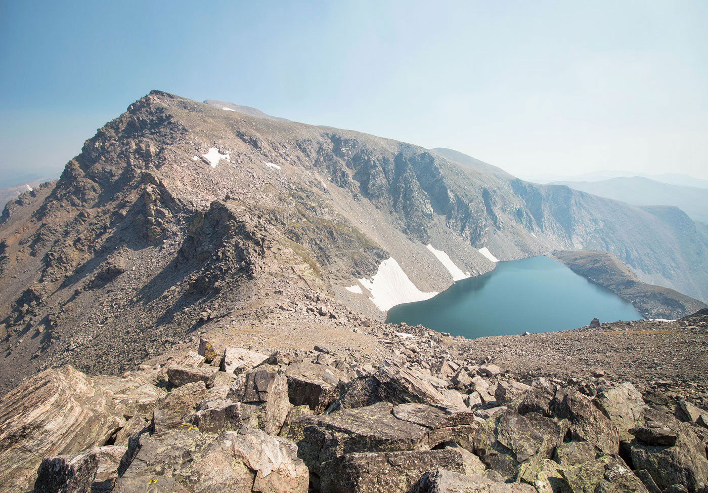
Ice Lake peeking through below Mount Bancroft. James Peak out of frame on the right.
Looking back along the James Peak Trail, Loch Lomond visible below.
James Peak ahead.
Looking back just below James Peak's summit.
James Peak summit, view north toward the Indian Peaks Wilderness. Lots of fire haze, unfortunately.
Continuing south toward the traverse to come.
Ice Lake on the left, Mount Bancroft on the top right, and the Class 2 traverse ahead. The route keeps to the left on the talus (it's more rocky on the right) down to the rocky outcrop in the center.
Just to the right of the rocky outcrop, continuing to the right on talus.
Avoiding the rocky outcrop on Class 2, hugging the cliff. Mount Bncroft visible on the right.
Heading up the slope, looking back toward James Peak (left) and Ice Lake.
Continuing up the ridge to Mount Bancroft (center). Parry Peak is visible top right.
Looking back again.
Approaching Mount Bancroft.
Mount Bancroft summit, view back toward James Peak.
Parry Peak ahead. Eva and Flora visible on the left.
Nearing the Parry Peak summit, view back toward Mount Bancroft and James Peak.
Heading down from Parry Peak, continuing to Mount Eva.
At the saddle of Parry Peak and Mount Eva.
Mount Eva summit, view back toward Parry Peak and Mount Bancroft. James Peak is poking up between them.
Mount Eva summit detritus, view south toward Mount Flora.
After a long tundra stroll, a steep push up to Mount Flora's false summit.
Almost at Mount Flora's false summit, view back along the ridgeline I traversed.
Continuing on tundra to Mount Flora's true summit.
Mounta Flora summit ahead, Ethel Lake below. The route I would take follows the Continental Divide Trail from the summit, leading along the ridge visible in this photo.
Starting down from Mount Flora's summit, view back along the ridge.
I picked up the Continental Divide Trail and followed it along the ridge. I will be down in those trees seen top left after descending from the ridge. The Continental Divide Trail basically follows the treeline on the left.
Looking back toward Mount Flora, Ethel Lake poking out on the right.
Along the Continental Divide Trail, a fairly long walk down the ridge.
The ridge becomes filled with talus and the trail becomes hard to follow at times, but cairns help in staying on track.
The Continental Divide Trail curves left when nearing the base of the ridge and heads down toward Bill Moore Lake. Mount Flora is visible on the left.
You can see the dirt road leading to Bill Moore Lake on the right. The Continental Divide Trail crosses it.
Crossing the road.
Still along the Continental Divide Trail, view looking back toward the ridge I descended from Mount Flora. The trail leads out of frame on the top left when coming down. Mount Flora visible on the right.
Continental Divide Trail gains a little elevation as it hugs the slopes.
Looking back.
Meadowy walk along the Continental Divide Trail.
Looking back, the ridge I came down from Mount Flora visible on the left.
Continental Divide Trail heads through the trees after a nice long meadowy walk.
Some final views toward James Peak as I descend down to my car.
Hire me or show me some love!
Hire/refer me as a web developer or send me a few bucks if you find my site useful. I’m not sponsored, so all fees are out-of-pocket and my time preparing trip reports is unpaid. I really appreciate it!