

View back down the road after leaving my car, which is in the trees on the left somewhere. Sultan Mountain visible in the distance.
Shortly after the previous photo, I left the road, heading up this grassy slope.
View back down the grassy slope as I ascend to Kendall Benchmark.
Steep tundra ascent.
The route leads to this grassy bowl, just below Kendall Benchmark (left). I ascended to the dirt road above (sort of visible in the center of this photo). Plenty of people drive up here.
I ascended from the grassy bowl in the center, crossed over this dirt road, and took the east ridge of Kendall Benchmark.
Class 2 up Kendall Benchmark's east ridge.
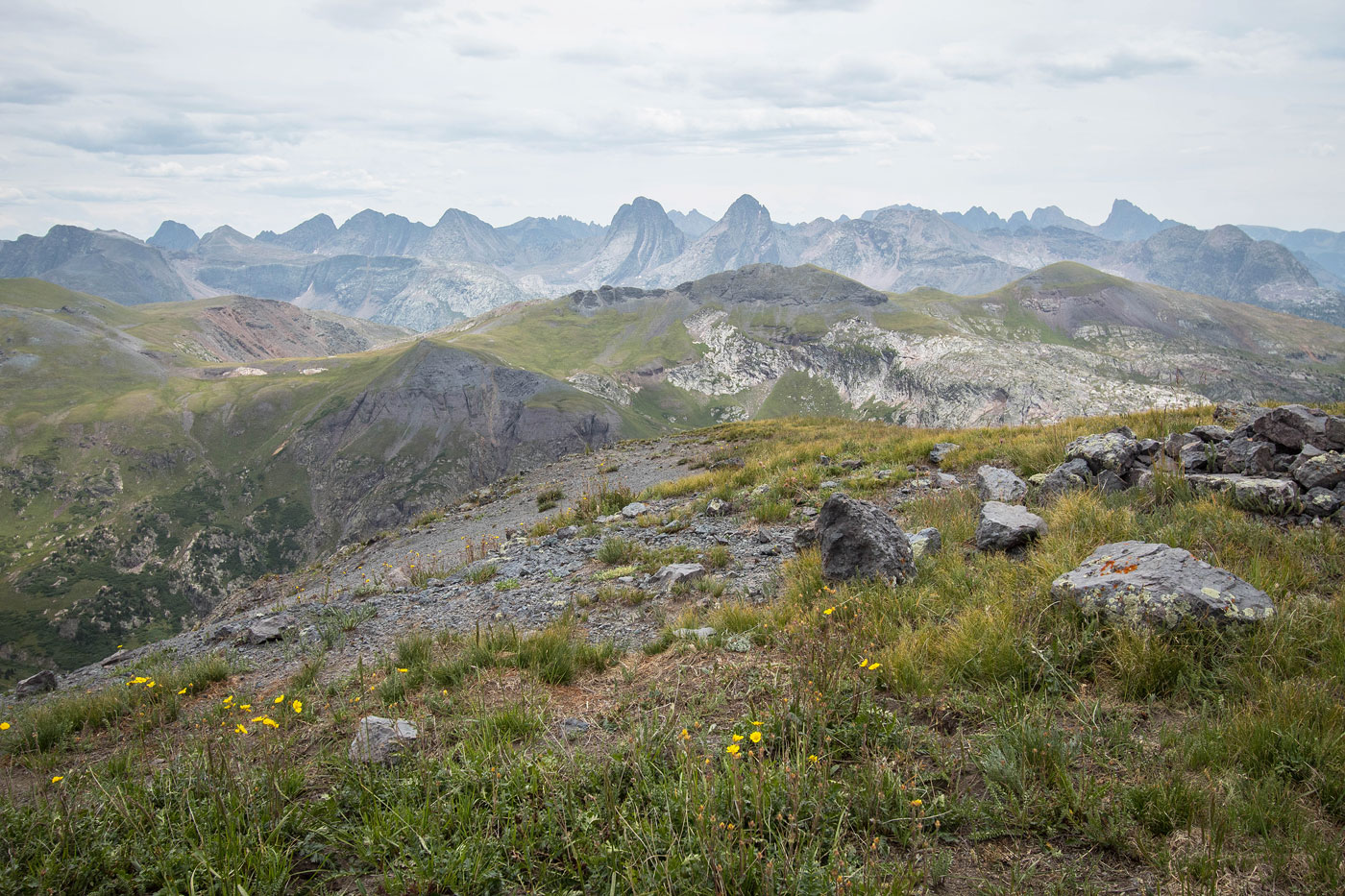
Kendall Benchmark summit, view west.
Wide shot southwest toward Twilights (center) and Sultan Mountain (right).
Kendall Benchmark summit, view southwest toward Snowdon Peak, The Twilights, and Molas Lake.
Kendall Benchmark, view east toward Kendall Mountain (left), my next peak. After Kendall Mountain, I'll be descending its slopes on the right to reach the dirt road in the center of this photo, which will lead to Kendall Peak.
View back toward Kendall Benchmark as I ascend Kendall Mountain's west ridge.
Kendall Mountain ahead on the left. After the peak, I'll be dropping down to the road on the right.
View back at my progress up Kendall Mountain.
Higher up, a social trail leads through the scree, but it's quite steep at a couple of points.
Kendall Mountain ahead.
Kendall Mountain, view north.
Kendall Mountain, view toward Kendall Peak (left). I headed down the grassy slope on the right in order to reach the road below.
After descending the slope, just before reaching the road.
View back along the road toward Kendall Benchmark and the road leading to its summit. I continued ascending the road on my way up to the crap gully.
And there it is, the crap gully. I followed the well-worn social trail past the old mine into the center of this photo.
View back toward the road I ascended. Also, you can see the scary-looking cliffs of Kendall Mountain's east ridge, the reason I dropped so far earlier rather than stick to the ridgeline.
Close-up at the start of the gully. It's very steep and has minimal solid things to grab onto.
Higher up the gully, view back down. Not fun.
On the ridgeline, headed up to Kendall Peak.
Kendall Peak, view west toward Kendall Mountain.
Kendall Peak, view east toward the route to come. Spencer Peak on the left.
Descending to the saddle of Kendall Peak and Spencer Peak. There is a social trail that wraps around the left side (north) of Spencer Peak. The ridge ahead is obviously pretty daunting, so I was happy to take the easier option.
From the saddle, I located a social trail.
However, the social trail was quite eroded at points, resulting in non-trivial hiking to avoid slipping down the loose, steep slope. View back toward Kendall Peak.
On the north side of Spencer Peak, a steep tundra walk followed by easy Class 2 to reach the summit.
Spencer Peak summit ahead on the right. Mountaineer Peak on the left.
Spencer Peak summit, view toward Kendall Peak.
Continuing along the beautiful tundra from Spencer Peak to Mountaineer Peak.
Mountaineer Peak ahead.
Mountaineer Peak, view back toward Spencer Peak.
Mountaineer Peak, view toward Mount Rhoda (left).
Descending to the saddle before Mount Rhoda (left). You can also see the Grenadiers top center, Arrow and Vestal of note.
Small cliff band at the summit of Mount Rhoda, avoidable by wrapping around to the right.
Mount Rhoda, view back toward Mountaineer Peak.
Close-up into Highland Mary Lakes from the summit of Mount Rhoda.
Mount Rhoda summit, view toward Whitehead Peak (left) and Peak 13109 (right).
Ascending to Whitehead Peak.
Whitehead Peak, view back toward Mount Rhoda.
Close-up toward Arrow Peak and Vestal Peak.
Descending Whitehead Mountain, onward to Peak 13109, center.
The final ridgeline to Peak 13109.
Ascending Peak 13109, view back toward Mount Rhoda (left) and Whitehead Peak (right).
A Class 2 wannabe-catwalk just before the summit of Peak 13109.
Peak 13109, view back toward the ridgeline I just traversed.
Close-up toward Kendall Benchmark, the bump in the center and the start of my traverse earlier in the day. You can somewhat see the dirt road leading to its summit.
Peak 13109, view toward the Grenadiers.
Leaving Peak 13109, heading along its southwest slope. I headed toward the grassy slope on the left to get to the Whitehead Trail.
Descending the pleasant grassy slope. The Whitehead Trail is below, visible in the the center of this photo.
On the Whitehead Trail, headed west.
View back toward Peak 13109 along the Whitehead Trail.
Twilight group in the distance.
Another shot back, Peak 13109 top left.
The Whitehead Trail is really gorgeous. It wraps around the west ridge of Peak 13109.
Heading north now along the Whitehead Trail. Kendall Benchmark visible center.
Descending along the Whitehead Trail.
The Whitehead Trail heads through forest for a bit.
End of the Whitehead Trail. I took the dirt roads back to my car.
View of the end of the Whitehead Trail at a Private Property sign and an old mine.
Hiking along the dirt road back to my car.
View back up the dirt road.
Hire me or show me some love!
Hire/refer me as a web developer or send me a few bucks if you find my site useful. I’m not sponsored, so all fees are out-of-pocket and my time preparing trip reports is unpaid. I really appreciate it!