

In case you weren't sure by looking at the sign, this is the trailhead.
Starting along the lovely Overland Lake Trail through the sandy foothills.
The route continues to the slope on the far top right.
Entering the Ruby Mountains Wilderness. The trail continues above the rocky pinnacles on the right.
Switchbacks begin up the slopes.
Looking back before passing over a major ridge.
The trail passes over a ridge and heads west toward the ridgeline ahead. King Peak visible center.
Close-up as the trail enters a green tunnel, King Peak visible top right.
The pretty white peak ahead is an unnamed point above Overland Lake.
View looking back - the trail came from the far right.
Continuing up toward Overland Lake.
Looking back again.
Close-up toward King Peak (left of center), a view at the junction of the Overland Lake Trail and the Ruby Crest Trail
View back, just a pretty area. King Peak is out of frame on the left.
Approaching Overland Lake. The pretty white unnamed point visible above.
Overland Lake.
Continuing on the left side of Overland Lake. The Ruby Crest Trail continues up the green gully right of center on the opposite side of the lake.
Approaching the south side of Overland Lake.
Looking back toward Overland Lake.
Overland Lake as I ascend on the Ruby Crest Trail.
A smaller lake above Overland Lake.
Above the smaller lake, still ascending on the Ruby Crest Trail.
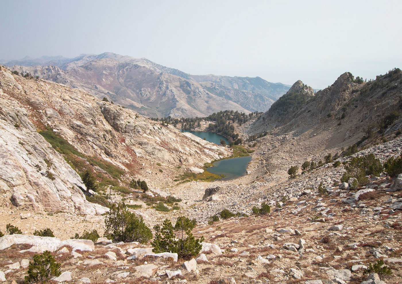
Nearing the ridgeline along the Ruby Crest Trail, looking back toward the two lakes.
I left the Ruby Crest Trail and started heading north. Tipton Peak is visible center. It was a tempting objective, but maybe another day.
Heading north, side-hilling through some low brush that got a teeny bit annoying.
Looking back toward the ridge. The Ruby Crest Trail section I ascended on wrapped around from the left to the saddle in the center.
Peak 10827 summit, King Peak visible ahead.
Looking back from Peak 10827. The ridge where I left the Ruby Crest Trail visible on the right.
Heading down from Peak 10827 toward King Peak.
Looking back toward Peak 10827 as I make my way to King Peak.
King Peak on the right. I recommend sticking as close to the ridge as possible to avoid excessive Class 2 talus-hopping.
Looking back toward Peak 10827 as I near the summit area of King Peak.
Just below the false summit of King Peak, looking toward the true summit.
Class 2+ fun scramble to the true summit.
Looking back from the top of the Class 2+ section, view toward the false summit of King Peak.
Class 3+ move to gain the summit ridge of King Peak.
King Peak summit, view north.
King Peak summit, view back toward the false summit and Peak 10827. Tipton Peak visible in the distance, hazy.
Hire me or show me some love!
Hire/refer me as a web developer or send me a few bucks if you find my site useful. I’m not sponsored, so all fees are out-of-pocket and my time preparing trip reports is unpaid. I really appreciate it!