I provide a free route map, but you can also download a hike/drive GPX to assist you and to help support my site. Before sharing my GPX tracks with others, please remember my site is a free resource and I'm charging nominal fees to offset my substantial costs.
GPX track added to your cart.
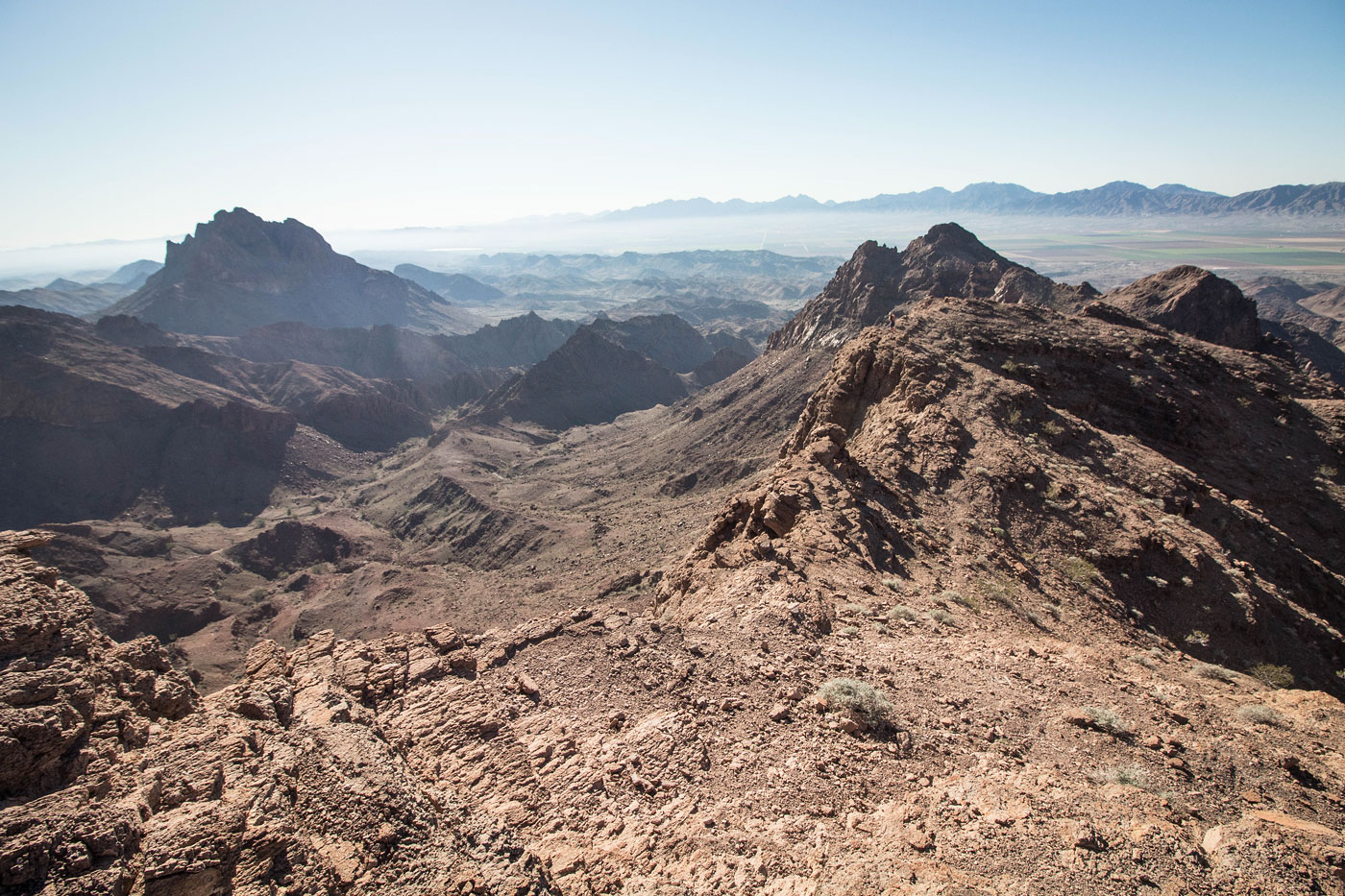
Jan 23, 2020 — After hiking Muggins Peak a couple of years ago, I returned to the Muggins Mountains to do Klothos Temple, Muggins' neighbor. This route ended up being a bit better, in my opinion. While Muggins Peak had a fun section toward the summit after lots of rough scree, Klothos Temple has a nice social trail through some intersting desert wilderness. Klothos Temple is the high point of a stretch of desert prominence called Long Mountain. A guy at the trailhead spent some time explaining to us that back in the day, Muggins was called something completely different, and Klothos was called Long. He was a little upset that people renamed the peaks, and seemed content with confusing us by referring to the peaks as their old names. Anyway, I digress.
Matt and I set out from the trailhead, heading north along the Muggins Peak Loop Trail (an official trail that wraps around Muggins Peak) through a short section of narrows. When the cliffs fell away, we headed northwest up a side wash, and then followed another major drainage north. We started encountering cairns, which led usually on the right side of the drainage to avoid extra rock-hopping. The route led through a short narrow section of canyon before spitting us out at the bottom of a Class 2 not particularly fun slope. We headed to the ridge above. At least two routes worked, but I included the better one (which was also cairned) on my attached map.
From the top of the slope, we headed east along the ridge, and then curved north, following a pretty well-defined social trail. The trail keeps close enough to the rim that the views east toward Muggins Peak are captivating. About halfway along the ridge, there was a single Class 2+ move, and then the route stuck generally to the west of the cliffs, ultimately avoiding crumbly cliffs and a jagged knife-edge. The last few hundred feet followed the base of the knife-edge, whose cliffy walls had Matt (a geologist) excited. Overall, I thought this made for a nice hike with a rarely-encountered trail in a somewhat remote area.
Please consider helping me out if you find my site useful. I'm not sponsored, so all site fees are out-of-pocket and my time preparing these trip reports is unpaid. You can also hire me as a web developer. I really appreciate it!


If you find my site helpful, please help me replace my many broken cameras, fund my website fees (hosting, APIs, security), or just support my countless hours of work. I pay for all expenses myself, and all trip reports I post are unpaid and unsponsored, so any support is really appreciated!
If using PayPal, please select their option for "Sending to a friend" so they don't take out fees, thank you.
My site is free to use, but consider sending me a few bucks to help keep it running. Thanks in advance!