I provide a free route map, but you can also download a hike/drive GPX to assist you and to help support my site. Before sharing my GPX tracks with others, please remember my site is a free resource and I'm charging nominal fees to offset my substantial costs.
GPX track added to your cart.
Jan 24, 2020 — It's been almost 5 years since I last hiked Signal Peak, and either the social trail leading to the summit has been developed more visibly, or my route-finding ability has gotten significantly better (I'd say the former). Also of note, the rocky wash pretending to be a road required to reach the trailhead seems to have deteriorated a fair amount, but most reasonable-clearance vehicles can get to there with decent tires. Our goal was to hit Signal Peak, and then head south to Ten Ewe Mountain, which was a quick detour from the standard route up Signal Peak.
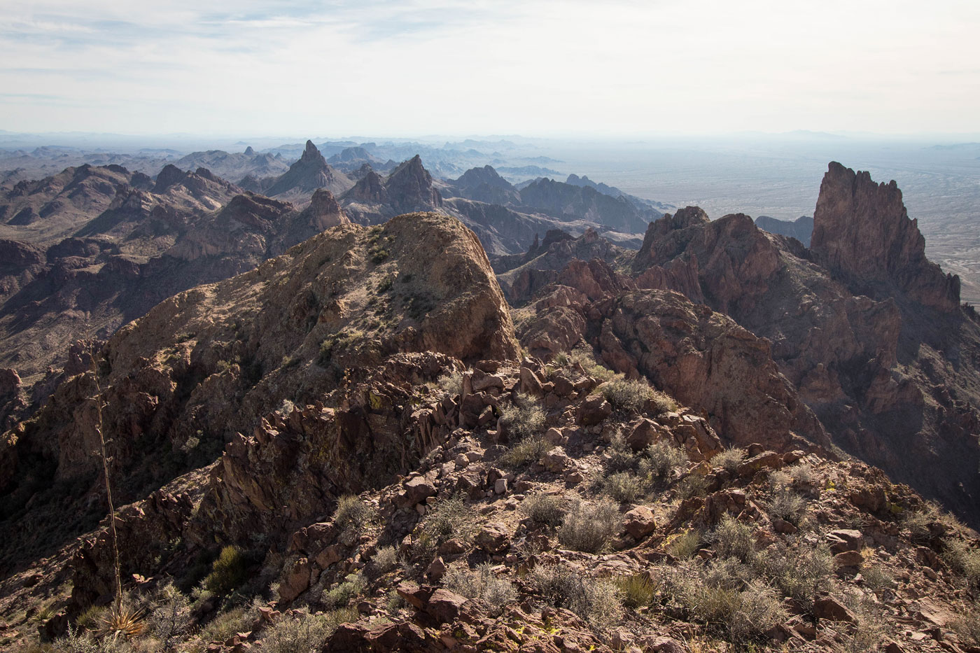
We started southwest into Ten Ewe Canyon, following cairns as they brought us up a progressively steepening slope. The trail leads around some cliffs at the base of Ten Ewe Mountain and there are some great views to the northeast into Ten Ewe Canyon. The trail led to a small saddle, where the route continued west along a small grassy slope/basin of sorts before ascending more steeply up a gully, mostly staying out of the drainage. From the top of this steep and heavily human-eroded section, we noted Ten Ewe Mountain to the left, but stayed on the trail as it continued toward Signal Peak. There were a few sections of beautiful colorful slickrock, and a Class 2 section brought us out of the drainage and onto a grassy slope. The slope wrapped along the south side of Signal Peak's false summits. Great views from Signal Peak, and I was happy to revisit the summit.
We made good time getting up the trail to Signal Peak and were looking forward to a little bit of scrambling, so we dropped back down to the top of the first steep gully and headed south through a side-drainage that had some brush. We were able to avoid most of it by staying out of the drainage itself, and then headed east along a grassy ridge to the base of Ten Ewe Mountain. There were a few breaks in the cliff face we could try ascending, but the only one that appeared reasonable from below was the first one on the left. It ascended diagonally from the ridge heading to the left. A short Class 3 section at the top of this weakness was the only real obstacle, and then a few Class 2 moves continued along the northwest slopes/ledges of Ten Ewe Mountain. A little bit of route-finding is required, but nothing particulary noteworthy. However, be sure you pay attention to where you emerged from the slopes/ledge system as not to get lost on the way down. Once above the cliffs, a grassy slope led to the summit of Ten Ewe Mountain.
Please consider helping me out if you find my site useful. I'm not sponsored, so all site fees are out-of-pocket and my time preparing these trip reports is unpaid. You can also hire me as a web developer. I really appreciate it!


If you find my site helpful, please help me replace my many broken cameras, fund my website fees (hosting, APIs, security), or just support my countless hours of work. I pay for all expenses myself, and all trip reports I post are unpaid and unsponsored, so any support is really appreciated!
If using PayPal, please select their option for "Sending to a friend" so they don't take out fees, thank you.
My site is free to use, but consider sending me a few bucks to help keep it running. Thanks in advance!