

Starting up the Ruby Crest Trail.
Snow Lake Peak seen on the right.
Passing Dollar Lakes.
Another of the Dollar Lakes.
View back at crazy wildflower and Dollar Lakes.
The trail ascends above Lamoille Lake, seen below.
Liberty Pass seen center.
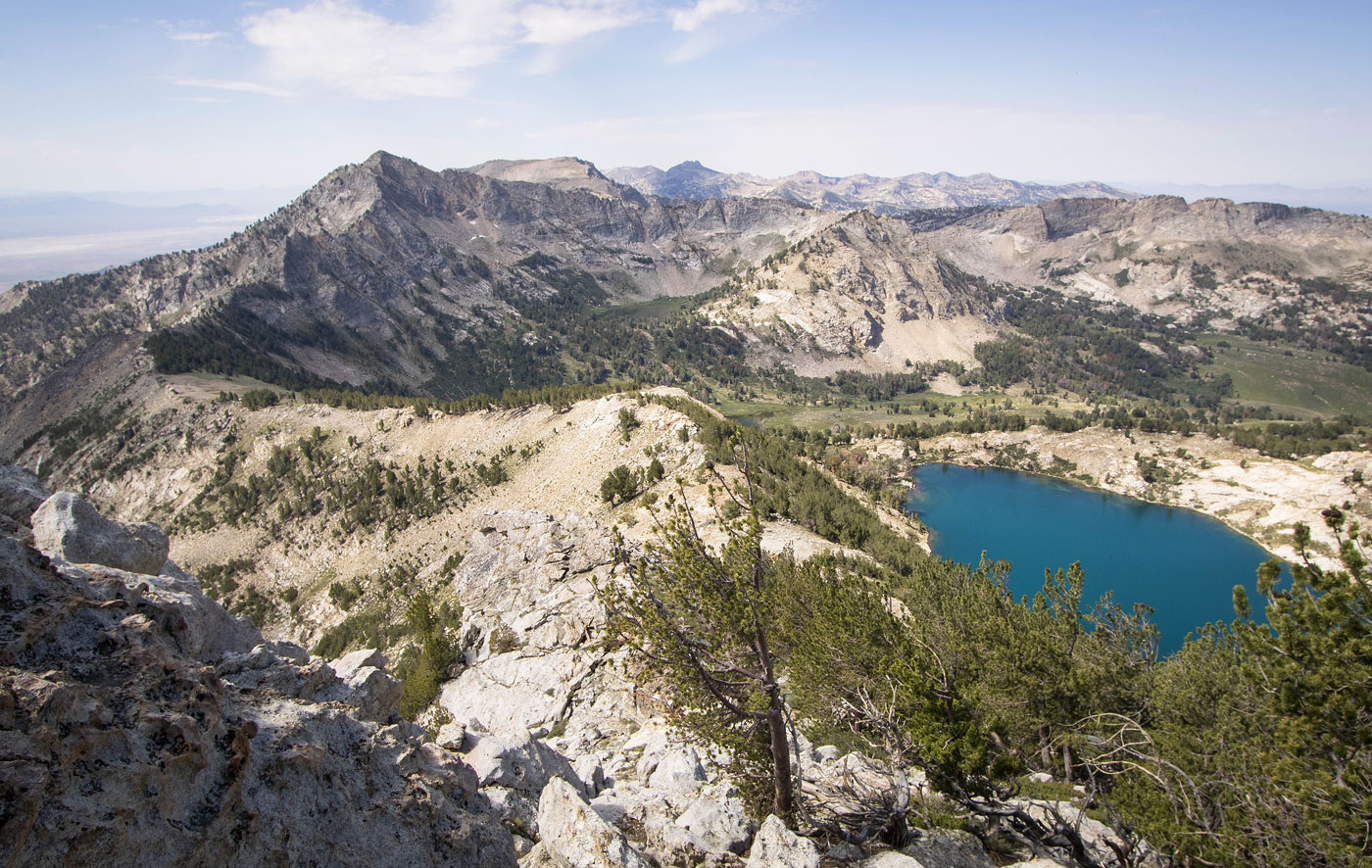
Near Liberty Pass, view back. Snow Lake Peak and Lamoille Lake seen left, the trailhead below on the right.
At Liberty Pass. we headed to the right to go up Liberty Peak.
Class 2 to Liberty Peak.
View back toward Liberty Pass, Tri-Lakes Peak seen left of center. Liberty Lake seen right.
Liberty Peak, view toward Snow Lake Peak and Mount Fitzgerald.
Liberty Peak, view toward Favre Lake and Lake Peak. Wines Peak seen on the right.
View back toward Liberty Peak as we head up Class 2 talus toward Tri-Lakes Peak.
False summit of Tri-Lakes Peak ahead. Mostly a pretty chill ridge hike with some Class 2.
Tri-Lake Peak, view down into Lamoille Canyon. Dollar Lakes seen below.
On the way down from Tri-Lakes Peak, Liberty Lake seen right and Lake Peak seen left.
Along the ridgeline to Lake Peak.
I loved this area. Wildflowers, open ground, and the pinnacles of Lake Peak's north ridge picturesquely stationed ahead.
Class 2 beneath the start of the ridgeline scramble.
We kept left (east).
Still east.
View back at our progress.
Class 2/3 side-hilling ascending traverse.
Lake Peak ahead. We still kept to the east.
Progress along the ridgeline.
More side-hill ascending on sometimes loose rock and a random Class 3 move mixed in.
It really was actually fun, even though it looks tedious in these photos. Above Chris is where you could potentially get to the crest and continue on Class 4 terrain, but I wasn't liking it. Instead we stayed east here, dropping downa
little and heading toward the center left of this photo.
View back at our progress.
The Class 2/3 slope ascent to rejoin the ridge.
View back at the Class 2/3 slope.
Final Class 2/3 bit to gain the ridge.
Along the ridge, Class 2 to the summit of Lake Peak.
View back, almost to the summit.
Lake Peak ahead.
View back along the ridge crest, Favre Lake and Liberty Lake seen left.
View down toward Castle Lake.
Wines Peak ahead.
Some light side-hilling to avoid the rocky crest as we descend from Lake Peak.
View back toward Lake Peak.
We joined the RCT and headed up to Wines Peak, ahead.
A bunch of switchbacks. We're almost at Wines Peak's east ridge, where we briefly left the trail to get to the summit.
Wines Peak summit, view south. King Peak seen on the right in the distance.
Close-up to the north at the many peaks of the Rubies. North Furlong Lake below.
Wider shot of everything. On the right is Lake Peak. Left of center is the pass the RCT will take us too shortly. Ruby Dome and Mount Gilbert far left.
We backtracked of Wines Peak and followed the RCT.
View back toward Wines Peak.
We ascended to a pass and on the other side were these ridiculous switchbacks that we were tempted to cut, but didn't. Also, holy views.
Beautiful trail.
The RCT wound around through meadows and forest. The Ruby Dome group is visible in the distance.
Gah, I loved this area.
Junction with the Kleckner Creek Trail, finally some water!
View back, we came from the center of this photo.
Passing Favre Lake, Lake Peak seen center.
Liberty Lake.
View back as we continue along the RCT past Liberty Lake. Lake Peak seen top center.
Gorgeous lighting and wildflowers as we ascend to Liberty Pass.
Back at Liberty Pass, a shot down into Lamoille Canyon.
Hire me or show me some love!
Hire/refer me as a web developer or send me a few bucks if you find my site useful. I’m not sponsored, so all fees are out-of-pocket and my time preparing trip reports is unpaid. I really appreciate it!