I provide a free route map, but you can also download a hike/drive GPX to assist you and to help support my site. Before sharing my GPX tracks with others, please remember my site is a free resource and I'm charging nominal fees to offset my substantial costs.
GPX track added to your cart.
Apr 23, 2023 — Liebre Mountain is a nice peak at the northern tip of Angeles National Forest. The trailhead can be reached just off Pine Canyon Road at the end of a short dirt spur road that might be easy to miss from the paved road. Some might prefer walking the <0.1mile, but I saw a sedan at the trailhead. This hike follows the Pacific Crest Trail for its majority, leaving it briefly to attain the summit via a forest road. I started along the PCT along the lightly forested and shrubby slope, the views north toward Antelope Valley improving as I slowly gained elevation. I could see the poppies in the distance, a burst of color against the fairly dry landscape.
The PCT switchbacked a bunch of times before ascending directly south and through a more forested setting. I passed the Horse Trail Camp, a nice little campsite amongst a grove of pines. Past the camp the PCT continued ascending. The light was hitting just right and everything was bright green. It was extra nice that the floor was blanketed in grasses while trees hung overhead. The forest lasted longer than I thought it would, but I guess Liebre Mountain gets enough precipitation to support all these trees.
The landscape opened a bit into a meadowy portion of the hike where trees grow more sparsely, a biome I later learned is known as an oak savanna. The trail widened into a doubletrack that's clearly not seen vehicular use in a very long time, aside from maybe someone driving down this way illegally from the forest road above. I passed a few PCT thru-hikers here, most of them likely planning to camp at Horse Trail Camp for the night since it was already getting late in the day. The old dirt road/trail came to a head at the ridge, where I found a fence poorly attempting to prevent motorized vehicle access and a big sign that served as my cue to leave the PCT in order to reach Liebre Mountain. Until recently, the high point of Liebre Mountain was thought to be a knoll a few hundred feet off the trail. I hiked to it just to make sure I got this other high point in case purist high pointers changed their mind again, but excluded this from my attached map.
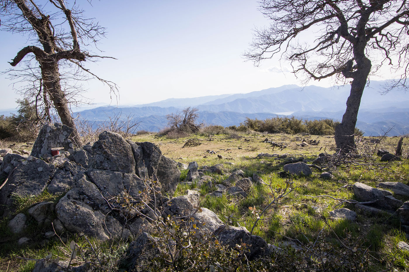
To reach the western peak, now claimed to be slightly higher, you can choose to head off-trail for a short time to reach the forest road. However, I instead followed a social trail with a clear mountain bike tire mark that paralled the fence. This trail totally avoided the road and actually provided a much more pleasant hike through the savanna, grasses stretching all around. The trail led back to the road ultimately and I was able to access Liebre Mountain from there. The views were minimal since the summit is pretty broad and prevents an expansive overlook, but I could see Pyramid Lake and the Sespe Wilderness in the distance. I hiked back along the dirt road rather than use the secret social trail, and returned to the PCT to head back down.
Please consider helping me out if you find my site useful. I'm not sponsored, so all site fees are out-of-pocket and my time preparing these trip reports is unpaid. You can also hire me as a web developer. I really appreciate it!


If you find my site helpful, please help me replace my many broken cameras, fund my website fees (hosting, APIs, security), or just support my countless hours of work. I pay for all expenses myself, and all trip reports I post are unpaid and unsponsored, so any support is really appreciated!
If using PayPal, please select their option for "Sending to a friend" so they don't take out fees, thank you.
My site is free to use, but consider sending me a few bucks to help keep it running. Thanks in advance!