

Along the Loy Canyon Trail, Loy Butte pictured center.
A view of the ruins (marked Ruins 1 on my map) in the center. This was taken from the Loy Canyon Trail, right before we left it.
A social trail leads up to the ruins.
Ruins 1 ahead.
The ruins are in a gorgeous area.
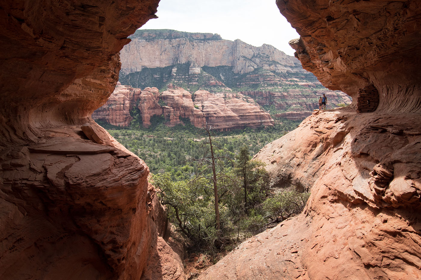
Great views from these dwellings.
There were more dwellings along the depression in the cliff.
After ruins 1, we continued along the social trail to higher ground.
Looking back along the social trail toward the Loy Canyon Trail is below.
Loy Butte on the left.
A short Class 3 notch to get higher up.
Loy Butte left. Ruins 3 (labeled on my map) are located below the dark water stains on the left. The notch we took to get to Ruins 2 is located in the center. The route goes around the canyon on the left.
Looking back along the social trail.
Working up to the notch toward Ruins 2.
Looking back the way we came from the top of the notch.
Ruins 2 ahead.
Ruins 2 weren't much to talk about.
Just a wall of piled rocks.
Back along the social trail headed toward Ruins 3. This is a view looking back toward the route we came from, on the other side of the canyon.
Social trail leads through some brush.
The ruins are located out of frame on the right. The route up to Loy butte zig-zags up the ledges on the right in this photo. Alternatively, the slope on the left could work as an easier way up.
Hugging manzanitas on the way to Ruins 3.
Ruins 3.
Ruins 3.
Old corn cob? How old?
Working up ledges to get to Loy Butte. You can see Josh in the center.
Zig-zagging up the ledges.
Bushwhack to the summit ridge.
More ledges to gain the ridge.
Ridge to Loy Butte's summit.
Just below the summit, we went to the right and found a Class 3 scramble up.
Class 3 scramble to the summit.
Looking down the Class 3 scramble.
Loy Butte summit, looking north, toward the way we came. We could trace our whole route: we came up the red ridge on the right.
Hire me or show me some love!
Hire/refer me as a web developer or send me a few bucks if you find my site useful. I’m not sponsored, so all fees are out-of-pocket and my time preparing trip reports is unpaid. I really appreciate it!