I provide a free route map, but you can also download a hike/drive GPX to assist you and to help support my site. Before sharing my GPX tracks with others, please remember my site is a free resource and I'm charging nominal fees to offset my substantial costs.
GPX track added to your cart.
Dec 20, 2020 — The Manganese Peaks have stayed on my backburner for years because the approach road, Boathouse Cove Road, is in quite poor condition. However after getting a Jeep, I was feeling all macho-like in my new ride (lolz) and headed out to attempt the drive with Jon Avery. This was Jon's 100th peak with 300 prominence - congrats, friend! The road ended up being in very good shape except for two key spots that would have shut me down in my previous Subaru Crosstrek. Not being able to get past this would add about 3 miles to the hike, which isn't really that much and I felt silly for putting the Manganese Peaks off for this long just because I'd have to hike a little more.
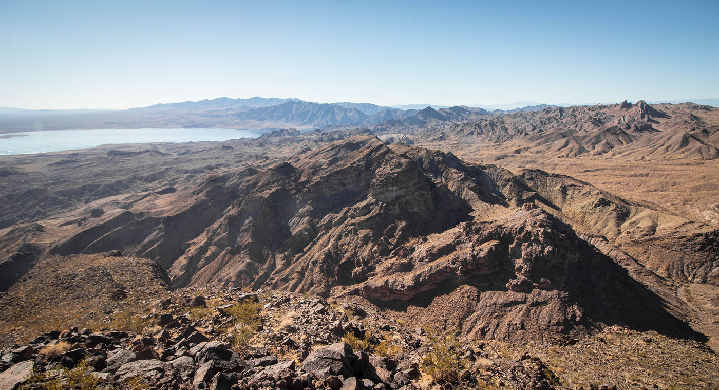
We headed into a canyon on the left from where we parked and followed it for only a short time, leaving it on the right at the first fork to enter a side-drainage. We followed this (Class 2) to the northwest ridge of Manganese Peak - Southwest. The ridgeline had some Class 2 and maybe a Class 2+ move, but mostly everything tricky can be avoided. The views of Lake Mead were amazing, as expected. Jon and I traced the surrounding peaks for a long time, sort of reflecting on our year's peaks surrounding Lake Mead. This would be my last hike for 2020, my most fruitful hiking year to date.
We headed back into the main canyon and followed it until we located a side-drainage on the left. We'd use this to access Manganese Peak, the taller of the two Manganese Peaks. We headed up this drainage, encountering some more Class 2 boulder-hopping and enjoying the views back toward Manganese Peak - Southwest. We left the drainage when the slope on the right was no longer cliffy and ascended the mostly mellow ridgeline to Manganese Peak. Yet again we enjoyed the views toward Lake Mead and fantasized about routes in the very remote Gold Butte area.
On our descent, we decided to stay along the ridgeline and drop down a somewhat loose Class 2 slope to get back to the car.
Please consider helping me out if you find my site useful. I'm not sponsored, so all site fees are out-of-pocket and my time preparing these trip reports is unpaid. You can also hire me as a web developer. I really appreciate it!


If you find my site helpful, please help me replace my many broken cameras, fund my website fees (hosting, APIs, security), or just support my countless hours of work. I pay for all expenses myself, and all trip reports I post are unpaid and unsponsored, so any support is really appreciated!
If using PayPal, please select their option for "Sending to a friend" so they don't take out fees, thank you.
My site is free to use, but consider sending me a few bucks to help keep it running. Thanks in advance!