

Starting up Golden Canyon.
Narrows within Golden Canyon.
Golden Canyon's well-traveled trail.
Continuing up Golden Canyon, Red Cathedral coming into view in the distance.
The Golden Canyon trail heads to the right out of the wash.
Looking back before we leave Golden Canyon.
Along the Golden Canyon Trail, Manly Beacon in view ahead. We would rap around the opposite side of the feature and approach from the left ridge in this photo.
Looking back as we continue along the Golden Canyon Trail.
Golden Canyon Trail.
The Golden Canyon Trail crests a minor ridge, then drops down the opposite side.
View back toward Manly Beacon.
Manly Beacon as we head toward Gower Gulch.
We headed left into a wash, away from Gower Gulch, in order to get to Manly Beacon. Red Cathedral visible ahead.
A social trail led up one of the dirty fingers. It was eroded enough to be obvious if paying attention.
Looking back down the finger as we ascended to Manly Beacon. Zabriskie Point in behind Matt somewhere.
Along the ridge leading to Manly Beacon.
Looking back as we ascend the ridge.
Wide shot of the ridge. Red Cathedral visible behind Matt.
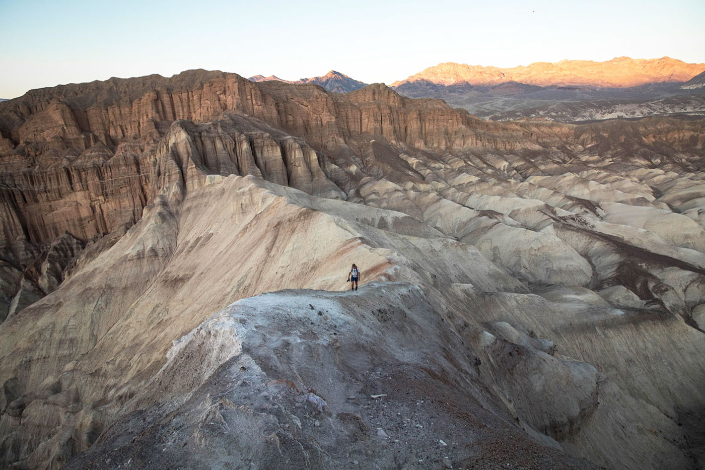
Manly Beacon summit, view toward the badlands leading to Death Valley.
View down at the trail system. We took that trail earlier when wrapping around Manly Beacon.
A shot of Matt coming down the crux of Manly Beacon (Class 3). I took this on the way down from the summit.
Within Gower Gulch.
Feb 2015: Some beautiful colors on the Gower Gulch Trail
Feb 2015: Gower Gulch Trail
Feb 2015: Gower Gulch Trail
Hire me or show me some love!
Hire/refer me as a web developer or send me a few bucks if you find my site useful. I’m not sponsored, so all fees are out-of-pocket and my time preparing trip reports is unpaid. I really appreciate it!