

From the Lupine Meadows Trailhead, follow the pleasantly graded Valley Trail.
Garnet Canyon Trail.
Garnet Canyon Trail officially ends at the boulder field ahead. A social trail leads through it.
Boulder field. You can see Middle Teton on the right there.
Looking back down the boulder field.
Across a small section of packed snow. Middle Teton right.
Looking back down Garnet Canyon.
Looking back down Garnet Canyon.
There's a social trail, but if you miss it, you get pretty water cascades and canyon. It might be a little easier to navigate while on the social trail, but as long as you're still headed up Garnet Canyon, you're fine.
Looking down Garnet Canyon.
Almost at the saddle of Middle Teton and South Teton.
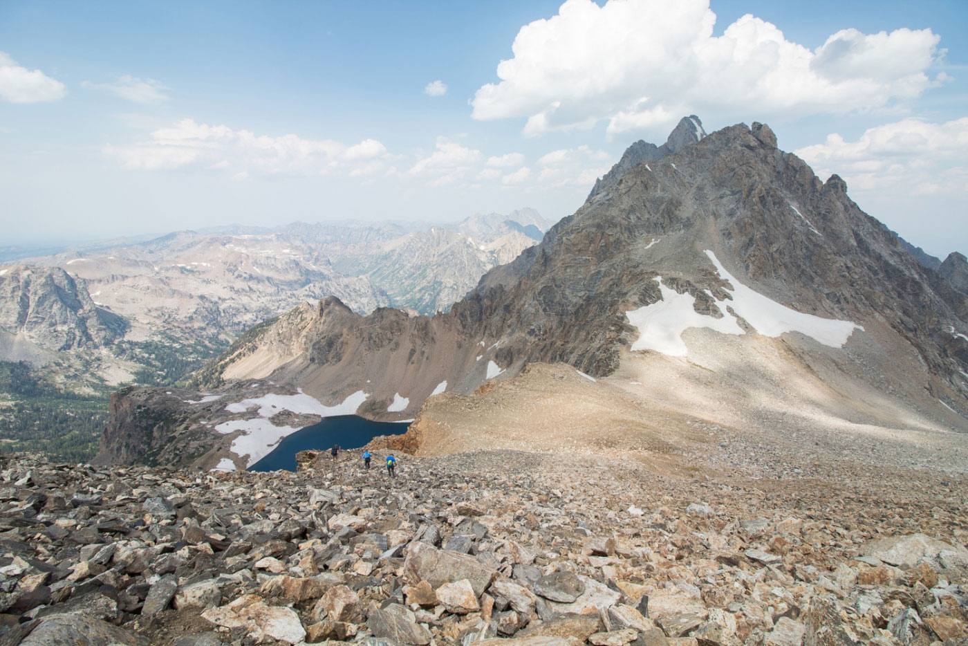
Saddle of Middle Teton and South Teton, looking down at Icefloe Lake to the northwest.
Starting up Middle Teton.
Starting up Middle Teton, looking back toward South Teton (left), and the saddle above Jordan's head.
Middle Teton ahead.
Close-up of the saddle (left), and Icefloe Lake (right).
Entering the gully. Lots of loose rock. And people. Therefore, a helmet is a good idea.
Looking back toward South Teton, some climbers coming down.
The South Couloir gets more narrow, and you can avoid a bit of the terrible loose rock by sticking to the solid rock walls on the left.
Looking down the Middle Teton South Couloir, Icefloe Lake slightly visible.
Last bit of scrambling.
Summit of Middle Teton, looking toward South Teton (left), and Icefloe Lake (right).
Summit of Middle Teton, looking toward Grand Teton, the obvious center one. Teewinot Mountain is obscured on the right there, still a formidable-looking mountain.
Close-up of Grand Teton.
Yep, I couldn't help myself.
Jordan chose to be less basic.
Close-up looking down into Garnet Canyon.
Back at the saddle, headed toward South Teton.
Along the ridge of South Teton, looking back toward Middle Teton (left) and Garnet Canyon.
South Teton ahead. There's a social trail that we kept losing.
Looking back toward Middle Teton (right) and Icefloe Lake (left).
Along the ridge of South Teton. Keep to the social trail here to make it easier. The rock is very loose. Be really careful. We watched a couple of pieces fall without anyone touching them.
Almost at the summit, looking back.
A gully before the summit.
South Teton summit, looking toward Middle Teton and Grand Teton.
South Teton summit, looking southwest toward Snowdrift Lake and Buck Mountain in the distance.
Hire me or show me some love!
Hire/refer me as a web developer or send me a few bucks if you find my site useful. I’m not sponsored, so all fees are out-of-pocket and my time preparing trip reports is unpaid. I really appreciate it!