I provide a free route map, but you can also download a hike/drive GPX to assist you and to help support my site. Before sharing my GPX tracks with others, please remember my site is a free resource and I'm charging nominal fees to offset my substantial costs.
GPX track added to your cart.
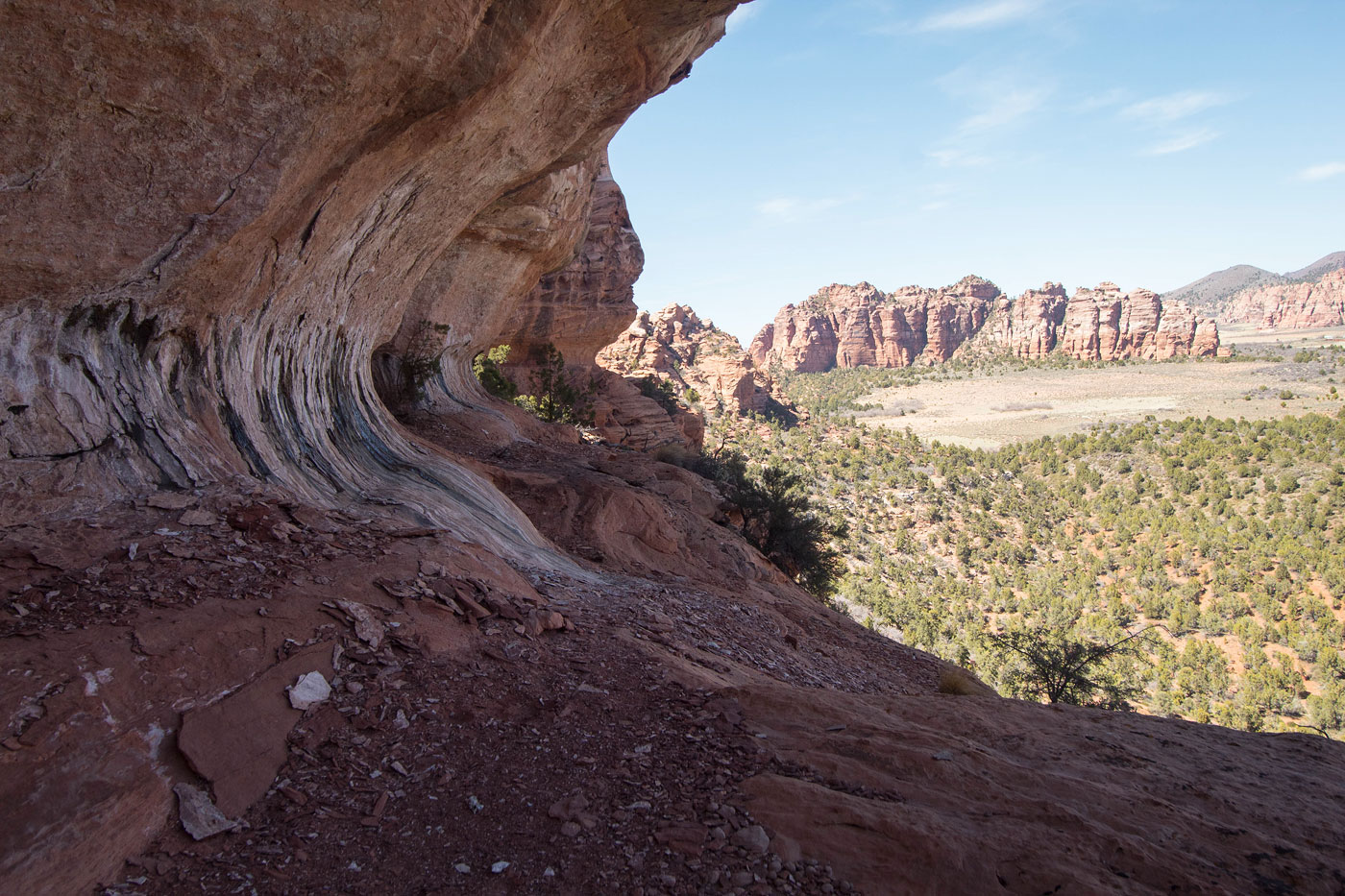
Apr 04, 2021 — Moqui Peak sits across Kolob Terrace Road from the more iconic Tabernacle Dome, but Moqui Peak offers just as much fun,with a bit more of a route-finding challenge. From a pull-off, we headed through the mostly open brush/forest terrain toward the northeast side of Moqui Peak.
Our short-term goal was to access a ledge outlined by Courtney Purcell that would bring us around to the south side of the peak, but this ledge would prove difficult to locate without knowing where it is. We began ascending the peak's steep slope and kept generally to the left, knowing we'd have to wrap around to the south side to locate the ledge. We did find some light Class 2+ on sandy/loose terrain as we ascended the slope. There are worse spots, and likely better ones as well. Initially we kept too high and too far to the right and were stopped by a treacherous cliff band that, while marked by a cairn and climbable, would defintiely be Class 5. I only included the route that worked on my attached map. It's not easy to find the proper ledge, but you'll know when you're on it since it remains relatively flat as it continues above one cliff band and below another. I'd say you can find it at around 5700 feet.
Once on this nice wide ledge, we followed an animal trail for a short time at the base of the peak's cliff bands until a weakness on our right marked a Class 2 slope that brought us up through the cliff band. The going was loose and became more so as we hugged the cliff on the right side and entered a Class 3 chute. The chute brought us to a short narrow ledge that ended with a tree. A Class 3 sandstone move ascended past the tree to a crack in the rock above, which we entered. The crack miraculously provided access to the north side of Moqui Peak, where a Sedona-like eroded ledge continued west. Another break in the cliff on our left brought us back to the south side. Here we hugged the cliff and ascended an easy Class 4 slab, leading us to a Class 2 slope that brought us to the base of Moqui Peak.
Courtney Purcell describes the final summit route as being a Class 5.2 climb. Going directly up the east face would result in such a feat, and we mistakenly did this on the ascent. The rock is brittle and a little scary, ending at an arch on which the summit block is perched. However, we were able to find an alternative route to reach the summit. Instead of heading up the face, keep left and descend a brushy gully for 50 feet, locating a slickrock slab on the right and ascending on the south side. This resulted in a Class 3 slab climb up to the arch. Class 2+ got us to the summit block.
Although the route was complex and it may seem like there just "has to be another way" up, we attempted a few different options on our descent and found none. Really interesting route.
Please consider helping me out if you find my site useful. I'm not sponsored, so all site fees are out-of-pocket and my time preparing these trip reports is unpaid. You can also hire me as a web developer. I really appreciate it!


If you find my site helpful, please help me replace my many broken cameras, fund my website fees (hosting, APIs, security), or just support my countless hours of work. I pay for all expenses myself, and all trip reports I post are unpaid and unsponsored, so any support is really appreciated!
If using PayPal, please select their option for "Sending to a friend" so they don't take out fees, thank you.
My site is free to use, but consider sending me a few bucks to help keep it running. Thanks in advance!