May 16, 2018 — Park in the slightly larger parking lot because it's in Cleveland National Forest. If you park in the smaller lot next to it, you have to pay Lake Morena County Park a few bucks.
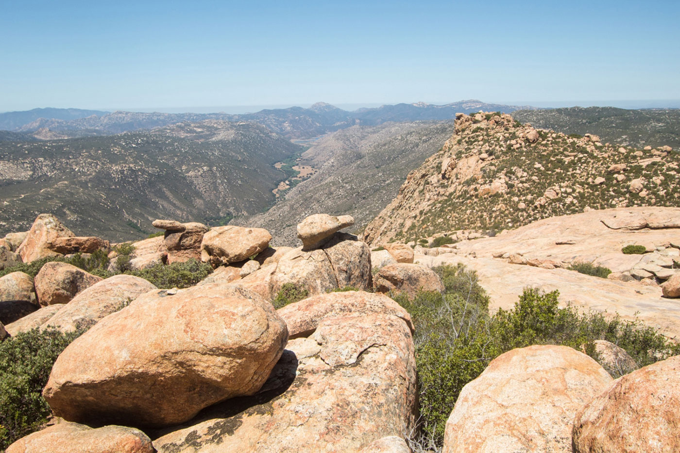
From the trailhead, follow the Pacific Crest Trail for a few miles, Lake Morena and Morena Butte visible for much of the hike, until you get to the southeast ridge of Morena Butte. A social trail leads up to the two high points of Morena Butte. There's a small section of Class 2 to gain the southern high point of Morena Butte. There are some really nice views, and the granite boulders and slickrock sections near the summit add some really unique exploring on this peak. Go back the way you came, or follow the dirt roads in Lake Morena County Park if you want a slightly shorter route.
Please consider helping me out if you find my site useful. I'm not sponsored, so all site fees are out-of-pocket and my time preparing these trip reports is unpaid. You can also hire me as a web developer. I really appreciate it!


If you find my site helpful, please help me replace my many broken cameras, fund my website fees (hosting, APIs, security), or just support my countless hours of work. I pay for all expenses myself, and all trip reports I post are unpaid and unsponsored, so any support is really appreciated!
If using PayPal, please select their option for "Sending to a friend" so they don't take out fees, thank you.
My site is free to use, but consider sending me a few bucks to help keep it running. Thanks in advance!