I provide a free route map, but you can also download a hike/drive GPX to assist you and to help support my site. Before sharing my GPX tracks with others, please remember my site is a free resource and I'm charging nominal fees to offset my substantial costs.
GPX track added to your cart.
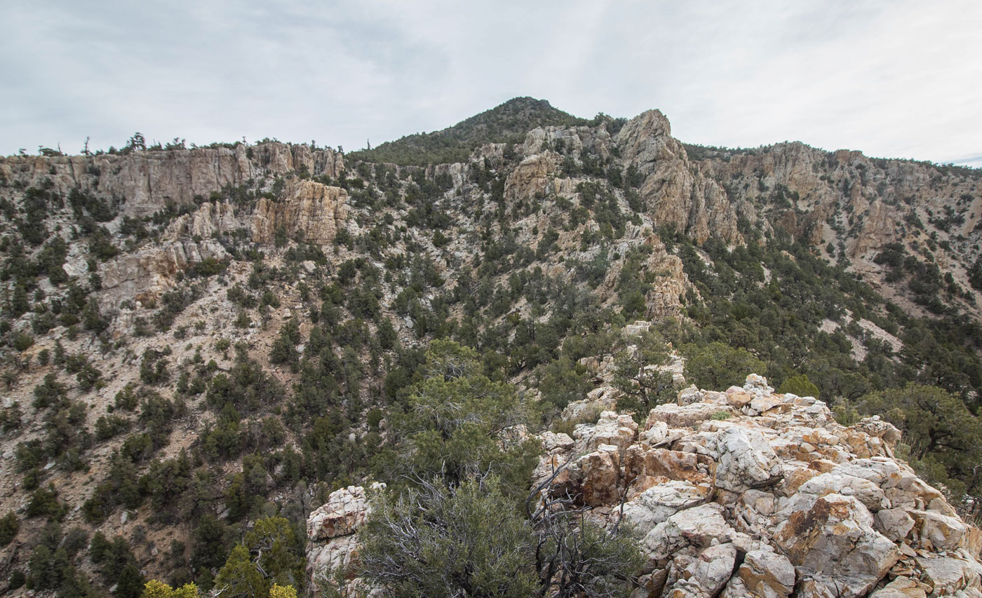
May 18, 2020 — I parked at Logan Pass (accessible by mid-clearance from either direction) and headed directly up the steep south ridge on a social trail for a few hundred feet before being confronted with an interesting-looking rocky ridgeline. I stayed on the ridgeline for some Class 2+ moves, but dropped off of it when there was an obviously easier option directly to the left, where I followed the base of the cliffs. Cairns funneled me through a small gully with a couple of interesting rock pinnacles on both sides and to a Class 2+ pull move to get over the rocky rim. I continued through lightly forested terrain, still heading generally north. There are lots of options around here, as nothing is difficult or misleading, but I recommend staying high so you can get views of Mount Irish ahead as a landmark. I wrapped around a sub-peak and made it to the southest ridge of Mount Irish. Some Class 2 and minor bushwhacking on steep terrain led to the summit, where the views were great.
Please consider helping me out if you find my site useful. I'm not sponsored, so all site fees are out-of-pocket and my time preparing these trip reports is unpaid. You can also hire me as a web developer. I really appreciate it!


If you find my site helpful, please help me replace my many broken cameras, fund my website fees (hosting, APIs, security), or just support my countless hours of work. I pay for all expenses myself, and all trip reports I post are unpaid and unsponsored, so any support is really appreciated!
If using PayPal, please select their option for "Sending to a friend" so they don't take out fees, thank you.
My site is free to use, but consider sending me a few bucks to help keep it running. Thanks in advance!