

Heading up the Pine Creek Trail.
Some cute rocky features within the canyon toward the start of the trail.
Entering the Toquima Wilderness. The trail was in amazing shape.
Along the Pine Creek Trail.
The trail alternates between pretty forest and meadows.
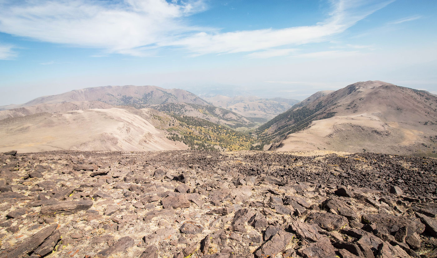
We came down the ridge on the top right later in the day, Mount Jefferson North Summit out of view up there somewhere.
Mount Jefferson East Summit visible top left. The Pine Creek Trail continues ahead. You can see the primary Mount Jefferson ridgeline in the distant center.
Looking back down the Pine Creek Trail at our progress.
The Pine Creek Trail enters this talus-filled cirque.
Looking back as we happily continue along the nice trail.
The trail continues up to the ridge above.
The trail avoids all talus and took us up to the ridge, Mount Jefferson East Summit visible ahead.
Along the ridge to Mount Jefferson East Summit.
Mount Jefferson East Summit out of sight along the ridge ahead.
Looking back at the ridge, Mount Jefferson visible top left.
Mount Jefferson East Summit ahead.
Mount Jefferson East Summit, view into Pine Creek Canyon, where we came up. You can see Mount Jefferson North summit on the left, and the ridge we would descend later to the low saddle visible in the center.
Back at the saddle of Mount Jefferson East Summit and Mount Jefferson, heading up Class 2 talus and steep tundra to the high point.
Looking back, Mount Jefferson East Summit on the right and Pine Creek Canyon on the left.
Another shot looking back. The terrain gets a little more rocky than this toward the summit, but it's never bad.
Mount Jefferson summit.
Mount Jefferson summit. Mount Jefferson East Summit on the right, Pine Creek center, the ridgeline to come and Mount Jefferson North Peak on the left.
Mount Jefferson summit, view toward the standard route, which comes up along the ridge seen here, starting from the center of this photo.
Heading down from Mount Jefferson, along the ridge. Keep right of the ridge and side-hill down on talus to avoid cliffs.
At the northern base of Mount Jefferson.
Looking aback toward Mount Jefferson as we traverse.
Class 2 move to gain Mount Jefferson Middle Summit.
Mount Jefferson North Summit ahead on the right. The views were lovely.
Mount Jefferson North Summit on the right.
Almost to Mount Jefferson North Summit, view back toward Mount Jefferson, left of center.
Mount Jefferson North Summit, view east along the ridgeline we decided to descend on. It started off nicely.
Along the east ridge, descending from Mount Jefferson North Summit. It pretty much stays like this for the majority of the route. Nice views, lots of talus.
Looking back at our progress down from Mount Jefferson North Summit.
The ridgeline descent we chose to make it to the low saddle in the center of this photo, where we hoped to join with the North Jefferson Summit Trail.
Looking back at the descent talus, Class 2.
Some minor bushwhacking down the steep slope, the low saddle visible ahead.
Looking back toward our descent ridge from Mount Jefferson North Summit from the low saddle. You can see the minor bushwhacking we dealt with in the center along the ridge.
At the low saddle, view of the North Jefferson Summit Trail before it disappeared when the trail left the meadow on the right. You can see the ridge we will head to instead once we left the trail, seen left of center.
We lost the trail. It was awful. We continued to the lighter-colored ridge in the center of this photo, leaving whatever remained of the trail.
Looking back toward the low saddle (far right) as we follow a social trail. The ridge we descended from is visible top left.
Wonderful stroll down into Pine Creek, visible center. We followed the ridge a bit before dropping in.
Pine Creek Trail on the left, Mount Jefferson ridgeline visible across the top.
Jon heading into Pine Creek. You can see the trail on the left.
Hire me or show me some love!
Hire/refer me as a web developer or send me a few bucks if you find my site useful. I’m not sponsored, so all fees are out-of-pocket and my time preparing trip reports is unpaid. I really appreciate it!