I provide a free route map, but you can also download a hike/drive GPX to assist you and to help support my site. Before sharing my GPX tracks with others, please remember my site is a free resource and I'm charging nominal fees to offset my substantial costs.
GPX track added to your cart.
Apr 28, 2023 — Mount Lukens is the high point within Los Angeles' limits, but it gets a lot less attention than many other hiking areas outside of the LA metro sprawl despite having a great trail system. Starting from Deukmejian Wilderness Park, Chris and I decided we wanted to hike the peak as a loop in a counter-clockwise direction. This would allow us to ascend on a trail and then descend the way that utilizes a service road for about half of it.
We followed the paved stairs along the Dunsmore Canyon Trail after passing the many amenities within the park, then located the start of the Crescenta View Trail. This crossed over a little dam before starting up a bunch of switchbacks. The views improved slightly on the way up Mount Lukens, but they were mostly just down toward the city sprawl. The summit ocassionally came into view as the trail switchbacked up toward Mount Lukens Road. Well-maintained and steep enough to be a solid workout, we hiked quickly to beat the quickly increasing temperature.
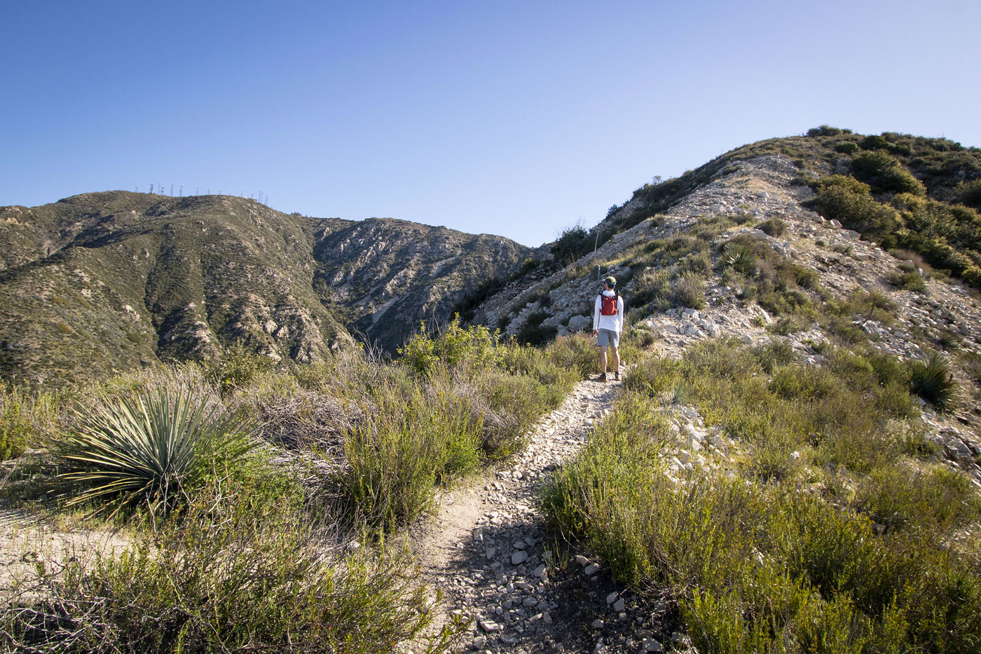
The Mount Lukens service road took us to the summit, where we found a nice view point of the San Gabriels and a bunch of radio towers. We took a social trail heading northwest along the ridge, which dropped us onto Haines Canyon Road. This road took us down for a couple of miles to a junction with the Rim of the Valley Trail. This was a much less well-maintained trail than the Crescenta View Trail. While easy to follow, it was eroded at points and brush encroached lightly.
The Rim of the Valley Trail descended into a drainage with a flowing creek. An easy creek crossing and a short hike through the canyon were nice additions to the otherwise pretty similar views we experienced on the hike. The trail climbed a few hundred vertical out of the canyon and we took the Le Mesnager Loop Trail at a junction. Rather than take the more direct eastern portion along the Le Mesnager Loop Trail back to the trailhead, we added a few unnecessary switchbacks through the wildflowers using the slightly longer western portion of the short loop trail.
Please consider helping me out if you find my site useful. I'm not sponsored, so all site fees are out-of-pocket and my time preparing these trip reports is unpaid. You can also hire me as a web developer. I really appreciate it!


If you find my site helpful, please help me replace my many broken cameras, fund my website fees (hosting, APIs, security), or just support my countless hours of work. I pay for all expenses myself, and all trip reports I post are unpaid and unsponsored, so any support is really appreciated!
If using PayPal, please select their option for "Sending to a friend" so they don't take out fees, thank you.
My site is free to use, but consider sending me a few bucks to help keep it running. Thanks in advance!