I provide a free route map, but you can also download a hike/drive GPX to assist you and to help support my site. Before sharing my GPX tracks with others, please remember my site is a free resource and I'm charging nominal fees to offset my substantial costs.
GPX track added to your cart.
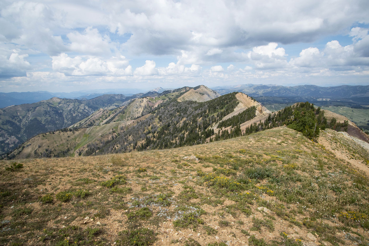
Aug 20, 2022 — Mount McDougal is a colorful mountain in the Wyoming Range just north of McDougal Gap. The trailhead can be reached either from the west via Alpine, WY or the east on good roads. Don't let Google choose your route or you may get to enjoy the thrills of primitive Wyoming roads, as I had the pleasure of doing. I was chatting with a NFS ranger at the trailhead while snacking on kale because I'm on some nonsensical fleeting health kick at the moment. She casually noted clouds building, so I decided to cut our chat and attempt Mount McDougal despite her completely reasonable warning of lightning, being the simple human I often am. I had to at least try. After all, when would I be way out here next?
I chugged an energy drink and many ibuprofen and began basically running north along the Wyoming Range National Recreation Trail, which gained elevation gradually until about 9000'. Here I left the trail since it continued north and away from Mount McDougal. I think you could continue north along the Wyoming Range National Recreation Trail and then ascend via the east ridge of a bump to the north of Mount McDougal here (42.86955, -110.58645), but I don't know of the quality of that route. I didn't want to attempt that anyway since I was concerned about the foreboding clouds and I already knew there was a chance I'd have to bail before reaching the summit.
I started west up the laughably steep slope, nonchalantly knocking burrs from knee-high mountain growth into my shoes. I was somehow making very quick time, driven by caffeine and stoke. Some small limestone cliff bands above were my initial landmark goal. Once I got beneath them, I curved slightly left and found a weakness that seemed to attract enough attention to form a thin social trail (from animals or people, I don't know). With just some light Class 2 I was over the cliff bands. I followed the social trail as it made an ascending traverse sort of away from the summit. I didn't know where it would ultimately lead me, so I veered away from it and headed northwest directly up the steep slope. Fortunately none of this was loose, so it was just a matter of keeping my quads from dying as I huffed to the ridgeline above. I did encounter a Class 2+ cliff band, but this can likely be avoided if you have more time to look around for the path of least resistance.
Once along the final ridgeline, a short Class 2+ section of fun scrambling on solid limestone brought me to a mostly tame final hundred feet to the grassy summit. The views were absolutely wonderful, definitely better than anticipated. I returned the way I came, now actually running to escape the very loud thunder.
Please consider helping me out if you find my site useful. I'm not sponsored, so all site fees are out-of-pocket and my time preparing these trip reports is unpaid. You can also hire me as a web developer. I really appreciate it!


If you find my site helpful, please help me replace my many broken cameras, fund my website fees (hosting, APIs, security), or just support my countless hours of work. I pay for all expenses myself, and all trip reports I post are unpaid and unsponsored, so any support is really appreciated!
If using PayPal, please select their option for "Sending to a friend" so they don't take out fees, thank you.
My site is free to use, but consider sending me a few bucks to help keep it running. Thanks in advance!